Transcription of Third 2014-15 Grade Social Studies and Science …
1 Third Grade Science / Social Studies Curriculum Plan Draft Updated 1/3/2015 Schwinn: 3nd Grade Science / Social Studies Curriculum 1 New Day 2014-15 3rd Grade Social Studies and Science Curriculum Plan Unit 2, 28 Days Unit 2: Maps, geography, and our world! Old-Unit 1: Maps, geography, and our world! A. The World in Spatial Terms 1. Explain the spatial concepts of location, distance and direction, including: . The location of school, home, neighborhood, community, state, and country; . The relative location of the community and places within it; and.
2 The location of continents and oceans. 2. Explain that the globe is a model of the Earth and maps are representations of local and distant places. 3. Demonstrate basic globe and map skills. BIG IDEA concept objectives: SWBAT understand how geography is vital to decisions and choices people have made in the past, present, and future. SWBAT understand how geography helps us to better organize our world and our surroundings. SWBAT understand the concepts of location, distance, and direction on maps and globes. Resources for planning: CORE knowledge 4th Grade Unit: Getting to the core of world and state geography Additional Notes: **additional ideas for daily instruction/lessons** *(from page 7 of CORE lesson) TW throw a world ball to S in the beginning of class.
3 When S receives the ball, they must recite their city, state, country, and continent. Another variation is to have ocean day and then when S catch the ball, they have to identify the ocean closest to their finger. This will reinforce geography review daily. 2012-2013 CHANGES Daily Topic Resource/Read Aloud Book Vocabulary Objectives Assessment/Experiment Unit 2, Day 1 Vocabulary Preview geography physical geography SWBAT use their schema to develop a preliminary understanding of Students will predict meaning of new vocabulary words based off of their Third Grade Science / Social Studies Curriculum Plan Draft Updated 1/3/2015 Schwinn.
4 3nd Grade Science / Social Studies Curriculum 2 cultural geography perspective compass rose cardinal directions intermediate directions map key map scale globe hemisphere absolute location relative location natural features cultural features vocabulary words. SWBAT organize concepts and vocabulary based on similarities of their characteristics. SWBAT differentiate between the physical and cultural geography and natural and cultural features. schema and using pictures to assist. Students will organize new vocabulary words based on their characteristics and similarities. Students will complete a worksheet in which they analyze the various vocabulary words that were introduced in this lesson.
5 Students will use context clues to come to a fuller understanding of some of these words. Unit 2, Day 2 Physical Geography- what is it? **Lesson Needs to be split in 2 Lessons 2 & 3 Resource: Page 2. Lesson 1- CORE Read Aloud: The Everything Kids Geography Book Page: 2 Geography Physical Geography SWBAT identify that geography is made up of two parts: physical geography and cultural geography. SWBAT identify that studying geography helps us to better understand and organize our world and our surroundings. SW identify one of two parts of geography focusing specifically on physical geography Unit 2, Day 3 Cultural Geography- what is it?
6 Geography Cultural Geography SWBAT identify that geography is made up of two parts: physical geography and cultural geography. SWBAT identify that studying geography helps us to better understand and organize our world and our surroundings. SW identify one of two parts of geography focusing specifically on cultural geography. SW identify and write about why studying geography helps us to better understand and organize our world and our surroundings. Unit 2, Day 4 What do we use to study geography? Resource: Page 4- lesson 2 Compass rose north, south, east, west northeast, northwest, SWBAT identify the 4 cardinal directions and the 4 intermediate directions.
7 SW label a compass rose on a map with cardinal directions and intermediate directions. Third Grade Science / Social Studies Curriculum Plan Draft Updated 1/3/2015 Schwinn: 3nd Grade Science / Social Studies Curriculum 3 Read Aloud: Up North and Down South: Using Map Directions by: Doreen Gonzales southeast, southwest SWBAT place the cardinal directions and intermediate directions on a compass rose. SW create their own compass rose. SW locate different places using the cardinal and intermediate directions.
8 Unit 2, Day Day 5 2 days needed on map scales- more application *read aloud needs to be revised Map Scales and Measuring Distance Read Aloud: Are We There Yet? Using Map Scales This lesson needs to be revised to focus on modeling the process of using a map scale. More of a direct instruction lesson in order to set the student s up for the next day s lesson **Read aloud needs to be revised Map scale distance SWBAT identify that distance is the space between 2 objects or places. SWBAT identify that maps have map scales to determine distance. SWBAT identify that different maps have different scales. SW identify what distance is.
9 SW chant, use the bar to find out how far to help them remember what a map scale is. SW identify that because of different distances, different maps have different map scales. Unit 2, Day 6 Continuation of Map Scales and Measuring Distance This lesson should be the application piece where students are doing hands on activity of measuring distances on a map using the scale. Map scale distance SWBAT identify that distance is the space between 2 objects or places. SWBAT identify that maps have map scales to determine distance. SWBAT identify that different maps have different scales. SWBAT apply their skills and understanding of a map scale in order to accurately measure the distances between different locations on a map.
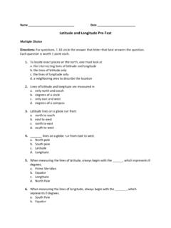
10 SW review the process of using a map scale in order to accurately measure the distance from one location on a map to another. SW use a map scale to determine distance. Unit 2, Day 7 How do we study geography? Read Aloud: Maps and Mapping by: Deborah Globe Sphere hemisphere SWBAT identify and label latitude and longitude on maps. SWBAT identify that the earth is SW differentiate between latitude and longitude : fat lat (waist, horizontal) and long longitude (vertical, up and down). Third Grade Science / Social Studies Curriculum Plan Draft Updated 1/3/2015 Schwinn: 3nd Grade Science / Social Studies Curriculum 4 Chancellor Pages 18-19, 20-21, 34-35 Read Aloud needs to be revised Equator Latitude longitude divided into hemispheres by the equator and the Prime Meridian.