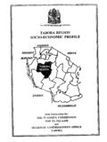
Transcription of Tsawwassen First Nation
1 Tsawwassen First NationLand Use PlanJanuary 12, 2009 ForewardIt is with great excitement that I am bringing forward an introduction to our long awaited TFN Land Use Plan. It is long awaited because it represen ts another major step and decision along the long and arduous journey Tsawwassen members have taken towards being a self-governing rst Nation . This plan sets the direction for the next years and decades for the Tsawwassen people. It is important for meeting obligations and opportunities that arise from the treaty, including activities such a s infrastructure planning and economic development planning purposes. Change is a scary pro spect to so me people, but this document re ects a balance of economy and environment that will bene t the collective community as well as individuals within it.
2 It provides for certainty to TFN members, leaseholders, investors and neighbours. We have had dozens of consultation meetings before our community voted on this plan. Consultation has been the foundation of our success, for the treaty, this TFN Land Use Plan, or various other initiatives that TFN members have decided to move forward on. Continued consultation will remain the priority as we move forward in implementing this plan whether it be for economic development projects, infrastructure projects such as our road networks, or our community facilities and housing. Much work lies ahead for Tsawwassen First Nation but it is exciting work, as we rebuild and strengthen our community.
3 Chief Kim Baird Foreward | iTsawwassen First Nation LAND USE P LAN Chapter 1. Introduction 1 Purpose of the Plan 2 A Brief History of Tsawwassen 3 Planning Process 6 Chapter 2. Vision & Guiding Principles 7 Chapter 3. Role of the TFN Land Use Plan 9 Chapter 4. Land Use 11 TFN Community 12 Commercial Enterprise / Residential Area 13 Single Family and Multiple Family Housing 14 Industrial 15 Mixed Use 16 Agriculture & Managed Forest 17 Blu Area 18 Tidal Marsh / Water Lot 19 Development Permit Areas 20 Chapter 5. Heritage Conservation 21 Chapter 6.
4 Park, Trail Network, & Amenities 22 Chapter 7. Sustainable Design Elements 23 Chapter 8. Transportation 25 Chapter 9. Community Services 26 Chapter 10. TFN Public Input 27 Chapter 11. Livable Region Strategic Plan Statement 28 SchedulesSchedule 1. Land Use PlanSchedule 2. Servicing MapSchedule 3. Development Permit AreasContents Table of Contents | iiTsawwassen First Nation LAND USE P LAN Introduction | 1 Tsawwassen First Nation LAND USE PLAN The Tsawwassen First Nation Final Agreement (Treaty) provides Tsawwassen First Nation (TFN) with important self government powers including responsibility for the management of lands and resources under the ownership of TFN.
5 Under the Treaty, TFN s land base will total 724 hectares. As well as owning the land, TFN will have significant law making powers, including municipal-like powers to plan and regulate its own lands in order to realize its goals. Chapter 1. Introduction The treaty represents a new day for the Tsawwassen residents 2 | Introduction Tsawwassen First Nation LAND USE PLAN The creation of a Land Use Plan (or the plan) that must be in place before the Treaty comes into effect. The plan provides a long-term vision for TFN lands and provides certainty for the development of the community. It forms a general statement of the broad objectives and policies of TFN respecting the character of existing and proposed land use and servicing requirements.
6 The Land Use Plan serves as a foundation for all policies, regulations, and decisions pertaining to land use and development at TFN. Purpose of the Plan The Lands The Tsawwassen Treaty Lands (the Lands), as defined in the Treaty, are located adjacent to the Municipality of the Corporation of Delta, approximately 25 km from downtown Vancou-ver. The Lands face the Strait of Georgia and are bisected by the Roberts Bank causeway to the north, and the BC Ferries Tsawwassen Terminal to the south. The Tsawwassen First Na-tion Final Agreement identifies two distinctive classes of land that will be owned by TFN referred to as the Tsawwassen Lands and Other Lands.
7 Tsawwassen Lands Under the Treaty, 662 hectares of land will be identified as the Tsawwassen lands. This in-cludes approximately 290 hectares of former reserves and 372 hectares of former provincial Crown land. TFN will have law-making authority over this land and will also own the subsurface re-sources. Federal and provincial laws will apply to all lands owned by TFN. The Treaty identifies 157 hectares which will remain within the Agricultural Land Reserve (ALR). In the future, if TFN wish to remove land from the ALR it can apply to the Agricultural Land Commission through the process set out in the Agricultural Land Commission Act. These lands are the subject of this Land Use Plan.
8 Other Lands TFN will also own in fee simple an additional 62 hectares of other land comprised of the Boundary Bay and Fraser River parcels. This land will remain under the municipal regulatory authority of the Corporation of Delta. Existing Delta Official Community Plan and Zoning Bylaws apply to these parcels. TFN may, at a later date, undertake a separate land use plan-ning exercise for these other lands. Brunswick Point (Rights of Refusal Lands) The Treaty also identifies Rights of Refusal for 80 years after the Treaty takes effect to pur-chase approximately 278 hectares of lands north of Tsawwassen Lands (Brunswick Point lands) if the people currently leasing these lands choose not to buy them or decide to sell them later.
9 The Treaty also states that if TFN purchases land within the Brunswick Point lands within 50 years after the effective date of the Treaty, TFN may add these lands to its treaty settlement lands. Following this 50-year period, TFN can add lands to treaty settlement lands if it pur-chases the land from willing sellers, but the federal, provincial and municipal governments must consent to the addition. TFN have identified the Rights of Refusal Lands as a potential area of growth to serve the future needs of the TFN community. As such the following policy applies: An aerial view of the Tsawwassen lands Introduction | 3 Tsawwassen First Nation LAND USE PLAN Tsawwassen First Nation (TFN) members are Coast Salish people who belong to the Hun qum i num linguistic group.
10 In their language, Tsawwassen means the land facing the sea. Historically, they have traveled and fished the waterways of the southern Strait of Georgia and the lower Fraser River. Traditional Territory The traditional Tsawwassen territory was bordered to the northeast by the watersheds that feed into Pitt Lake, down Pitt River to Pitt Meadows, where they empty into the Fraser River. It includes Burns Bog and part of New Westminster, following the outflow of the river just south of Sea Island. From Sea Island it cut across the Strait to Galiano Island and includes all of Saltspring, Pender and Saturna islands. From there the territory continued northeast to include the Point Roberts peninsula, and the watersheds of the Serpentine and Nicomekl rivers.