Transcription of Unit 13 Nelchina–Upper Susitna
1 State restricted areas: 6 Tangle Lakes Archaeological District: BLM & DNR restrict off-road ve- hicles to designated trails between MP 16 and MP 37. BLM designated trails 1 Denali State Park: in Unit 13E within Denali State Park, hunting of include: Swede Lake Trail (MP 16) miles paralleling district boundary and bears over bait prohibited. leads into Dickey Lake Trail, Landmark Gap Trail South branches to west for miles, and Osar Lake (MP 37) miles to Osar Lake. DNR desig- 2 Clearwater Creek Controlled Use nated trails include: Landmark Gap Trail North (MP ) miles area : north of Denali Hwy, west of a to Landmark Gap Lake, Glacier Gap to Sevenmile Lake boundary 100 feet east of the length (MP ) 3 miles to Glacier Gap Lake continu- of the Maclaren Summit trail ing miles to Sevenmile Lake, & Maclaren Summit Trail (MP 37) miles, that starts from the Denali this authorization does not Highway and heads north, apply to hunting in the and including the Maclaren Clearwater Creek Con- River drainage, east of and trolled Use area .
2 Contact including the eastern bank BLM (907) 822-3217 or DNR. drainages of the Susitna (907) 269-8503. River downstream from and including the Susitna Glacier, 7 Delta Controlled Use area : and the eastern bank of the Susitna that portion in 13B north of a line from the head of River, is closed to the use of any Canwell Glacier down the north side of glacier and Miller motorized vehicle for hunting, Creek, along the divide separating the south side drainages including the transportation of of Black Rapids Glacier, including Augustana Creek. The area hunters, their hunting gear, or parts is closed to motorized vehicles or pack animals for of game, except for brown/grizzly bears, wolves, and small big game hunting, including the transportation of big game from Mar 15 through June 30; however, this provision does not prohibit game hunters, their hunting gear, and/or parts of big motorized access, or transportation of game, on the Denali Hwy and adjacent highway game, from Aug 5- Aug 25.
3 However, this does not prohibit vehicle parking areas. motorized access to the area for hunting or transportation of game on 3 Sheep Mountain Closed area : bounded by a line from Caribou Creek the Richardson Hwy (See Unit 20 for complete area description.). (Mi 107 Glenn Hwy) then easterly along the Glenn Hwy to Mile 123, then north to Squaw Creek, then downstream to Caribou Creek, then down Caribou Creek to the point 8 Tok Management area : that portion in 13C west of the Tok- of beginning, is closed to taking sheep or goats. Slana cutoff (Glenn Hwy) north of the north bank of the Slana River to its confluence with Lost Creek, east of a line up 4 Paxson Closed area : the eastern drainage of the Gulkana River lying west of the north side of Lost Creek to the divide between Lost Creek and Jack Creek to the Unit 12 boundary, the the Richardson Hwy (between MP 182 and MP ) and the western drainage of the area is open to sheep hunting by permit.
4 Gulkana River between the Denali Hwy (between MP 0 and MP ) and the north end of (See Unit 12 map for complete area description.). Paxson Lake where the Gulkana River enters Paxson Lake is closed to taking any big game. 9 Tonsina Controlled Use area : bounded on the west by the Richardson Hwy from the Tiekel River to 5 Sourdough Controlled Use area : bounded by a line beginning at the confluence of Sourdough the Tonsina River at Tonsina, on the north along the south Creek and the Gulkana River then northerly along Sourdough Creek to the Richardson Hwy at approx. bank of the Tonsina River to where the Edgerton Hwy crosses Mile 148, then northerly along the Richardson Highway to the Middle Fork Trail at approx. Mile 170, then westerly the Tonsina River, then along Edgerton Hwy to Chitina, on 2019-2020 Alaska Hunting Regulations along the trail to the Gulkana River, then southerly along the east bank of the Gulkana River to its confluence with the east by the Copper River from Chitina to the Tiekel Sourdough Creek, the point of beginning, is closed to using motorized vehicles for hunting, including transportation of hunters, their hunting gear, River, and on the south by the north bank of the Tiekel and/or parts of game.
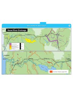
5 This does not prohibit motorized access or transportation of game on the Richardson Hwy, Gulkana River, Sourdough Creek River, is closed to using motorized vehicles Campground or boat launch, Sourdough and Haggard Creeks, Middle Fork, and Haggard Creek trails, or other trails designated by the department. The or pack animals for hunting,including the pipeline access road is not a designated trail. transportation of hunters,hunting gear, and/or parts of game, from July 26 - Unit may include National Park Service lands and federal regulations may also apply. See page 8. Sept 30. Unit 13 23. 26. 25. Game Management Units / Special Management Areas Closed Areas National Parks Military Boundary Nelchina-Upper Susitna 24. 22. 20 Controlled National Preserves Military Closure Use Areas 21. 12 & Other Tangle Lakes 13. Federal Lands . Management Areas 19 16 14.
6 11. Archaeological District 18 14 6. Region 4. 5. 15 7. 17 1. State Refuges, Unit Boundary 9. 4. 3. Sanctuaries, & Roads 8 2. Critical Habitat Areas Subunit Boundary Railroads 0 15 30 60. Miles 10 Other State Lands City Boundary Trails 75. U:\wc\regbook_MPS\MXD_2019\ 4/29/2019 skt Unit 13 Nelchina Upper Susitna See map on page 75 for state restricted areas in Unit 13. Unit 13: That area westerly of the easternmost bank of the Copper River from Miles Glacier north to the confluence with the Slana River, then along the east bank of the Slana River to Suslota Creek, and that area of the Slana River drainage north of the south bank of Suslota Creek; the drainages into the Delta River upstream from Falls Creek and Black Rapids Glacier; the drainages into the Nenana River upstream from the southeast corner of Denali National Park at Windy; the drainage into the Susitna River upstream from its junction with the Chulitna River; the drainage into the east bank of the Chulitna River upstream to its confluence with Tokositna River; the drainages of the Chulitna River (south of Denali National Park) upstream from its confluence with the Tokositna River.
7 The drainages into the north bank of the Tokositna River upstream to the base of the Tokositna Glacier; the drainages into the Tokositna Glacier; the drainages into the east bank of the Susitna River between its confluence with the Talkeetna and Chulitna Rivers; the drainages into the north and east bank of the Talkeetna River and including the Talkeetna River, to its confluence with Clear Creek, the eastside drainages of a line going up the south bank of Clear Creek to the first unnamed creek on the south, then up that unnamed creek to lake 4408, along the northeast shore of lake 4408, then southeast in a straight line to the northernmost fork of the Chickaloon River; the drainages into the east bank of the Chickaloon River below the line from lake 4408; the drainages of the Matanuska River above its confluence with the Chickaloon River;. Unit 13A.
8 Bounded by a line beginning at the Chickaloon River bridge at Mile on the Glenn Highway, then along the Glenn Highway to its junction with the Richardson Highway, then east to the east bank of the Copper River, then northerly along the east bank of the Copper River to its junction with the Gulkana River, then northerly along the west bank of the Gulkana River to its junction with the West Fork of the Gulkana River, then westerly along the west bank of the West Fork of the Gulkana River to its source, an unnamed lake, then across the divide into the Tyone River drainage, down an unnamed stream into the Tyone River, then down the Tyone River to the Susitna River, then down the southern bank of the Susitna River to the mouth of Kosina Creek, then up Kosina Creek to its headwaters, then across the divide and down Aspen Creek to the Talkeetna River, then southerly along the boundary of Unit 13 to the Chickaloon River bridge, the point of beginning.
9 Unit 13B: bounded by a line beginning at the confluence of the Copper River and the Gulkana River, then up the east bank of the Copper River to the Gakona River, then up the east bank of the Gakona River and Gakona Glacier to the boundary of Unit 13, then westerly along the boundary of Unit 13 to the Susitna Glacier, then southerly along the west bank of the Susitna Glacier and the Susitna River to the Tyone River, then up the Tyone River and across the divide to the headwaters of the West Fork of the Gulkana River, then down the West Fork of the Gulkana River to the confluence of the Gulkana River and the Copper River, the point of beginning;. Unit 13C: Unit 13 east of the east bank of the Gakona River and Gakona Glacier; Unit 13D: Unit 13 south of Unit 13A; Unit 13E: the remainder of Unit 13. OPEN TO: R = RESIDENTS ONLY B = RESIDENTS AND NONRESIDENTS N = NONRESIDENTS ONLY.
10 OPEN UNIT/ PERMIT/. BAG LIMIT AND SPECIAL INSTRUCTIONS OPEN SEASON. TO: area HUNT #*. Black Bear See pages 24-28 for bear information and salvage requirements. B 13 Three bears HT no closed season No resident locking-tag required. Brown/Grizzly Nonresident hunters must be accompanied by a guide, see page 10. See pages 24-28 for additional bear hunting information. Bear Evidence of sex must remain naturally attached to the hide. B 13E within Denali State Park One bear every regulatory year Aug 10-June 15. B 13 remainder One bear every regulatory year no closed season Bison Nonresidents can only be awarded one bison permit per lifetime. R east of the One bison by permit every ten regulatory years 13D DI454 Sept 1-Mar 31. N Edgerton Highway One bison by permit, per lifetime In bag limit, caribou means an animal of either sex. Proxy hunting restrictions apply, see page 12.