Transcription of User Guide, National Commodity Crop Productivity Index …
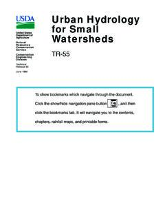
1 User Guide United States Department of Agriculture National Commodity Crop Natural Resources Productivity Index (NCCPI). Conservation Service Version , 2008. Cover Pictures Top. Harvesting wheat in an area of Washington State. Photo by usda , NRCS. Middle. A field of cotton in New Madrid County, Mississippi. Photo by Lynn Betts, usda , NRCS. Bottom. Contour stripcropping in an area of York County, Pennsylvania. Photo by Ron Nichols, usda , NRCS. Nondiscrimination Statement The Department of Agriculture ( usda ) prohibits discrimination in all its programs and activities on the basis of race, color, National origin, age, disability, and where applicable, sex, marital status, familial status, parental status, religion, sexual orientation, genetic information, political beliefs, reprisal, or because all or a part of an individual's income is derived from any public assistance program.
2 (Not all prohibited bases apply to all programs.) Persons with disabilities who require alternative means for communication of program information (Braille, large print, audiotape, etc.) should contact usda 's TARGET Center at (202) 720-2600 (voice and TDD). To file a complaint of discrimination, write to usda , Director, Office of Civil Rights, 1400. Independence Avenue, , Washington, 20250-9410 or call (800) 795-3272. (voice) or (202) 720-6382 (TDD). usda is an equal opportunity provider and employer. Contents Preface .. iii User Guide .. 1. The Corn and Soybeans Submodel .. 2. The Small Grains Submodel .. 7. The Cotton Submodel .. 11. Discussion .. 16. Appendices .. 17. Appendix 1.
3 Data Elements and Reports .. 18. Appendix 2. Evaluations .. 21. Appendix 3. Properties With a Possible Result of Null Not Rated .. 54. Appendix 4. Root-Limiting Layers in NCCPI .. 55. Appendix 5. Calculations Used To Manipulate Data .. 56. References .. 67. Glossary .. 69. i Preface Introduction The National Commodity Crop Productivity Index (NCCPI) model is a National soil interpretation that is not intended to replace other crop production models developed by individual states. At present, NCCPI is used in the National Soil Information System (NASIS) environment and is not available through the Soil Data Mart. It presently deals only with nonirrigated crops, but at a later date it will be expanded to include irrigated crops, rangeland, and forestland Productivity .
4 The user guide for NCCPI, version , arrays soils according to their inherent capacity to produce dryland (nonirrigated) Commodity crops. Most of the NCCPI. criteria relate directly to the ability of soils, landscapes, and climates to foster crop Productivity . A few criteria relate to factors that can limit use of the land ( , surface boulders). All criteria used in the Index affect crop culture and production and are referred to as factors affecting inherent Productivity . The rating indices can be obtained through a computer program in NASIS. Inherent Productivity is considered nearly invariant over time. Temporary fluctuations in Productivity caused by good or bad management and year-to-year variations in weather are not addressed.
5 More permanent changes in soil properties that cause significant changes in Productivity can affect the NCCPI Index when current NASIS information is used. Extreme erosion, compaction, land leveling, and salinization are examples that could cause such changes. Traditional steps in creating soil survey interpretations are: 1. Studying an array of soils having known, documented performance. 2. Constructing conceptual and mathematical relationships that predict soil performance. 3. Using the National Cooperative Soil Survey (NCSS) soil database (NASIS) to generate predictions on a wider array of soils. 4. Testing predictions against the soil survey knowledge base, that is, known local relationships that are accumulated from personal experience; field observations by soil scientists (soil surveyors) and NCSS cooperators and collaborators; and the scientific literature.
6 Why the NCCPI Was Developed The Conservation Reserve Program (CRP) of usda provided one stimulus to develop the NCCPI. The inherent capacity of soil to produce Commodity crops is one factor needed to adjust average rental payments. A soil model that is consistent across political boundaries and over time is required for many uses. Crop varieties, management scenarios, and yields vary from place to place and over time, reflecting choices made by farmers and ranchers. These factors partially mask inherent soil quality. Except for the extreme circumstances mentioned above, inherent soil quality or inherent soil Productivity varies little over time or from place to place for a specific soil (map unit component) identified by the NCSS.
7 Iii NCCPI User Guide, Version Staff of the National Soil Survey Center in Lincoln, Nebraska, developed the NCCPI to use soil survey information that is accessible in every county where Commodity crops are grown. The system arrays soils according to their relative Productivity for Commodity crops and avoids the inequities that are possible when yield data alone are used to rate soils. Although the immediate NCCPI focus is on Commodity crops, Productivity for certain other crops was considered in those areas where other crops dominate. Why the NCCPI Uses the NASIS Database The NCCPI uses soil data stored in NASIS. It rates all soils that are used for the production of Commodity crops.
8 The NCCPI model data parameters are items that are (1) uniformly available across the Nation, (2) calculated and/or produced by the same standards throughout the Nation, (3) accessible electronically throughout the Nation, (4) capable of producing results through a system that uses routinely maintained data and information, and (5) detailed enough to accurately represent a few acres in highly variable soils. The NASIS database meets these criteria. Some other attributes important to plant growth do not occur in the NASIS database. These attributes include such information as day length and photosynthetically active radiation. The United States was therefore divided into areas that commonly produce specific Commodity crops.
9 These areas have climatic factors that remain fairly constant. In some cases criteria from Soil Taxonomy (Soil Survey Staff, 1999) are used as effective surrogates for specific climatic variables. The NASIS database provides information and soil data for nearly all of the Nation's farmland. After soils and their properties in a specific field have been identified, recorded, stored in a database, and published, the database can be queried to obtain data about soil properties and accessory information about landscape features, soil climate, parent material, and taxonomic classes. As NCCPI development continues and is expanded to include other land uses, the expert knowledge of soil scientists that collected the data and populated the database will be used to calibrate the NCCPI indices across the Nation.
10 As known relative productivities and geographic relationships of soils and crop growth become more clearly understood, new information will be added and used to refine aspects of the model. Each database entity used in the calculation of NCCPI ratings is called a map unit component. A map unit component is a phase or type of a soil series or higher taxonomic unit. Numerical values for each soil property of each component stored in the database are typical values for each map unit component of the soil series or higher taxa within a soil survey area. Thus, the Index for a soil series may differ from place to place because of the geographic variability of the soils in the series.
