Transcription of Virginia Department of Transportation History of …
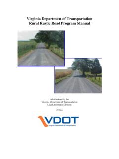
1 THE MOST CONVENIENT WAYES A History OF ROADS IN VIRGINIAA History OF ROADS IN Virginia THE MOST CONVENIENT WAYES Amherst County road todayAn 850-gallon basin water fountain was installed at the Amherst traffic circle at the intersection of Route 60 and Route 29 Business in June 2006. It is the oldest traffic circle in Virginia . The exact location of the 1910 cover photo showing removal of wet subgrade in Amherst County is unknown, but it is believed to be Route 60. Produced by the Virginia Department of Transportation Office of Public Affairs 1401 E. Broad Street Richmond, VA 2006, Commonwealth of Virginia 5m/October 2006 SPECIAL CENTENNIAL EDITIONP roduced by the Virginia Department of Transportation Office of Public Affairs 1401 E.
2 Broad Street Richmond, VA 23219(804) 786-2802 (TTY users, call 2006, Commonwealth of Virginia , 2006A History OF ROADS IN Virginia THE MOST CONVENIENT WAYES 3A History OF ROADS IN VIRGINIAThe Virginia settlers, who arrived at Jamestown Island aboard three small ships on May 13, 1607, had little need for a road more than 100 in number, their first concerns were disease, hunger, shelter, and protection from the often hostile Indians who had lived on the land for generations. In those first rigorous years, survival demanded the full energy of the colonists in the waterways were there for Transportation the great rivers that emptied into the Chesapeake Bay and that were to become known as the James, the York, the Rappahannock, and the the colonists hunted for food and cautiously began exploring the forest, they discovered a crude network of paths made long before by Indians and wild animals.)
3 The colonists used these, and many of the paths were to shape the Virginia road pattern for years to settlers also found roughly built bridges made of tree trunks and limbs, which they at first believed to be Indian-planted traps rather than bridges. By 1610, with new arrivals from England, the colony numbered road along the River Bank, probably a former Indian path, was used to haul supplies from the ships to the Jamestown Greate Road appears to have been Jamestown s main street, and it was of early commercial importance. It crossed the isthmus connecting the island with the mainland at Glass House Point, where in 1608 glass was manufactured for export. Faint traces of the road are evident today at Glass House History OF ROADS IN Virginia THE MOST CONVENIENT WAYES Early colonists considered waterways to be the most important Transportation links.
4 4A History OF ROADS IN VIRGINIAE ventually, the Greate Road extended on the mainland to Middle Plantation, a settlement to become known as Williamsburg and destined to be the capital of the Virginia colony and the hub of the colonial road first bridge recorded as having been built by the English settlers was constructed in 1611 at Jamestown Island. It wasn t really a bridge, but a wharf about 200 feet long from the bank of the James to the river channel, where the settlers docked their ships. The colony s first agricultural crops raised for export were rolled to these Rolfe had begun experimenting with the cultivation of tobacco in 1612 and two years later exported a shipment to England. In less than 20 years, tobacco exports had reached 500,000 pounds annually; tobacco would remain the foundation for the Virginia economy throughout the colonial , the success of the tobacco crop was to influence the colony s Transportation needs as tobacco fields spread on the mainland, and a number of the old Indian paths became tobacco rolling roads.
5 The name came from the practice of packing the harvested tobacco in barrels called hogsheads and rolling them to the wharves, frequently a distance of miles. The rollers ordinarily tried to follow the high ground and avoid the fords, or shallow stream crossings, because water leaking through the barrels would damage the tobacco. The practice of following the old paths and branching off from time to time on higher ground accounts for many of the early meandering country two decades, the colony s population was near 5,000 and growing. The frontier had been pushed well beyond its original boundaries, and while much of the settlers travel was still by boat, an increasing proportion was on History OF ROADS IN VIRGINIAThe need for improving roads to better serve the social and economic life of the colony was among the matters facing members of the House of Burgesses as they met in Jamestown in September adjournment, they had passed the first highway legislation in American History , an act providing, in the language of the day, that, Highwayes shall be layd in such convenient places as are requisite accordinge as the Gov.
6 And Counsell or the commissioners for the monthlie corts shall appoynt, or accordinge as the parishioners of every parish shall agree. The first legislation also required each man in the colony to work on the roads a given number of days each year, a custom dating at least from the feudal period of the Middle Ages in England, or to pay another to work in his place. This labor law, to remain in effect for more than 250 years, provided the main source of workers for road and bridge years later, probably in March 1657, the colony s basic road law was broadened to provide that surveyors of highwaise and maintenance for bridges be yearly kept and appointed in each countie cort In 1661, the surveyors were empowered to select locations for roads, choosing the most convenient wayes to Church, to the Court, to James Towne, and from County to County.
7 By the end of the 17th century, many miles of primitive roads threaded throughout Tidewater Virginia . The colony s population had reached 70,000. While horseback AMERICA S FIRST ROAD LAW Much manual labor was the requirement for building and maintaining early roads. 6A History OF ROADS IN VIRGINIAwas the most frequent means of overland travel, horse-drawn carts became more numerous, and some carriages and coaches gradually 1705, the legislature passed a new road act providing for making, clearing, and repairing the highways and for clearing the rivers and for the more convenient traveling and carriage, by land, of tobaccos merchandise, or other things within this The new road act provided for further extension of the road system and required that the roads be kept well cleared from woods and bushes, and the roots well grubbed up, at least thirty feet broad.
8 The new law also provided for skilled labor to erect bridges larger than could be built by the local surveyors, and when such a bridge was to cross a county line, its cost would be divided proportionable to the number of tithables in each county. Other road laws came quickly in the early years of the 18th century. Owners of mill dams were required to provide a 10-foot passage on dams and spillways; it became mandatory for a county in which an iron furnace was operated to provide good roads to be laid out and made from such works to the nearest place upon some navigable river or creek. Establishment of public ferries was authorized by the 1716, Alexander Spotswood, regarded by many as perhaps the best of the colonial governors, led his Knights of The Golden Horseshoe up the summits of the Great Mountains, the Blue Ridge, and looked down in amazement at the splendor of the Shenandoah Valley.
9 Spotswood, a former soldier, recognized that settlement of the valley could help protect eastern Virginia from hostile was in the next quarter-century that the valley and much of the Piedmont, the rolling country between the mountains and Tidewater, were settled by pioneers moving inland and by many others who came down into the valley from Pennsylvania and New north and south through the valley was a relatively good Indian path, called by various names including the Appalachian Warriors Path and the Shenandoah Hunting Path. By the mid-18th century, it had been developed into the Great Wagon Road, which eventually led from Pennsylvania southward through the valley and on to the southern end of the valley, the Great Wagon Road separated into two branches near Big Lick, later to become Roanoke.
10 While one branch left the valley and went due south, the other continued west and crossed Cumberland Gap through the Allegheny Mountains at what now is the junction of the Virginia , Kentucky, and Tennessee borders. After Daniel Boone and a band of frontiersmen cleared a path into Kentucky about 1775, the western branch became known as the Wilderness Road, and it was to become the main pioneer route along which traveled the first waves of the great migration to the of the mountains, two principal routes led from where Richmond stands today deep into the interior. One was a path to the settlements that were to become Lynchburg and Roanoke, a course now followed approximately by Routes 60 and 460. The other was the Three-Chopt Road or Three-Notched Road to Albemarle, where it connected with another path leading across the mountains at Afton and into the valley.
