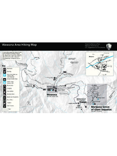
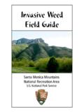
Transcription of Yosemite Fall Yosemite Valley Visitor Center
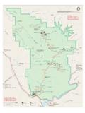
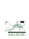
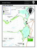
1 EmeraldPoolRoyal ArchCascadeSilverApronStaircaseFallsYose mite Creek Sentinel Creek Tenaya Creek Royal Arch Creek LowerYosemiteFallVernal FallIndian Canyon Creek UpperYosemiteFallSentinelFallsMerced River NevadaFallIllilouetteFallMerced River BridalveilFallBridalveil Creek RibbonFallRibbon Creek Horse TailFall5907ft1801m5044ft1538mROYALARCHE SILLILOUETTE RIDGE THREE BROTHERS CATHEDRAL ROCKS 7214 ft2199 m4035ft1230m6100 ft1859m4094ft1248mTaft Point7503ft2287mEl Capitan7569ft2307mMoranPointLeaningTower EaglePeak7779ft2371mMiddleBrotherLowerBr otherCathedralSpiresSentinelDome8122ft24 76mGrizzlyPeakWashingtonColumnNorth Dome7525ft2294mYosemite Point6936ft2114mLiberty Cap7076ft2157mHalf Dome8836ft2693mClarkPoint ColumbiaRockWashburnPointMt Broderick6706ft2044mJohn Muir Trail Southside Drive one-way Northside Drive Wawona Road EL Portal Road one-way Glacier Point Roadclosed November to MayTo El Portaland Hwy 140To Tioga Road, Tuolumne Meadowsand Hwy 120; and Hetch HetchyTo Glacier Point,Wawona andMariposa Grove.
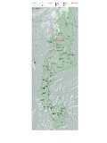
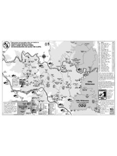
2 Hwy 41, Oakhurst, and FresnoStoneman BridgeSentinel BridgePohono BridgeEl CapitanBridgeVisitorParkingVisitor ParkingTrailheadParkinghorse trail only Sentinel Dome/Taft PointTrailheadTrailhead for VernalFall, Nevada Fall, andJohn Muir TrailTrailhead forFour Mile TrailRoad open ONLY to pedestrians, bicycles, and vehicles with wheelchair emblem placardsNorthPinesHousekeepingCampLowerP inesUpperPinesSentinelBeachSwinging BridgeCamp 4 CathedralBeachEl CapitanYosemite Valley Visitor CenterLittle Yosemite Valley (summer only)LeConte ClinicChapelYOSEMITEVILLAGEW ilderness CenterMuseumThe AhwahneeCurry VillageYosemite LodgeNature Centerat Happy IslesGlacier PointLower YosemiteFall TrailTunnel ViewMirrorLakeJohn Muir TrailPaved bikewayand foot trailPicnic areaHorseback ridingCampgroundWalk-in campgroundOther trailRestroomsFood service and lodgingWilderness permit stationPark and use the free Yosemite Valley ShuttleYosemite ValleyShuttle KilometerNorth