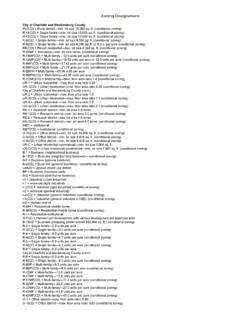
Transcription of Zoning Designations - Polaris 3G
1 Zoning Designations City of Charlotte and Mecklenburg county RU(CD) = Rural district min. lot size 15,000 sq. ft. (conditional Zoning ). R-15(CD) = Single family min. lot size 15,000 sq. ft. (conditional Zoning ). R-12(CD) = Single family min. lot size 12,000 sq. ft. (conditional Zoning ). R-9(CD) = Single family min. lot size 9,000 sq. ft. (conditional Zoning ). R-6(CD) = Single family min. lot size 6,000 sq. ft. or 6 per acre (conditional Zoning ). RR(CD) = Resort residential min. lot size 9,000 sq. ft. (conditional Zoning ). R-20MF = Innovative min. lot size varies (conditional Zoning ). R-15MF(CD) = Multi-family units per acre (conditional Zoning ). R-12MF(CD) = Multi-family units per acre or units per acre (conditional Zoning ). R-9MF(CD) = Multi-family units per acre (conditional Zoning ). R-6MF(CD) = Multi-family units per acre (conditional Zoning ). R-6 MFH = Multi-family units per acre R-6 MFH(CD) = Multi-family units per acre (conditional Zoning ).
2 R-1 OMF(CD) = Multi-family Max. floor area ratio (conditional Zoning ). UR-1 = Urban residential max. floor area ratio UR-1(CD) = Urban residential max. floor area ratio (conditional Zoning ). City of Charlotte and Mecklenburg county (cont.). UR-2 = Urban residential max. floor area ratio UR-2(CD) = Urban residential max. floor area ratio (conditional Zoning ). UR-3 = Urban residential max. floor area ratio UR-3(CD) = Urban residential max. floor area ratio (conditional Zoning ). RE-1 = Research district min. lot area acres RE-1(CD) = Research district min. lot area acres (conditional Zoning ). RE-2 = Research district min. lot area acres RE-2(CD) = Research district min. lot area acres (conditional Zoning ). INST = Institutional INST(CD) = Institutional (conditional Zoning ). O-15(CD) = Office district min. lot size 15,000 sq. ft. (conditional Zoning ). O-9(CD) = Office district min. lot size 9,000 sq. ft. (conditional Zoning ).
3 O-6(CD) = Office district min. lot size 6,000 sq. ft. (conditional Zoning ). UR-C = Urban residential commercial min. lot size 5,000 sq. ft. UR-C(CD) = Urban residential commercial min. lot size 5,000 sq. ft. (conditional Zoning ). B-1 = Business (neighborhood business). B-1(CD) = Business (neighborhood business) (conditional Zoning ). B-2 = Business (general business). B-2(CD) = Business (general business) (conditional Zoning ). UMUD = Uptown mixed use district BP = Business (business park). B-D = Business (distributive business). UI = Industrial (urban industrial). I-1 = Industrial (light industrial). I-1(CD) = Industrial (light industrial) (conditional Zoning ). I-2 = Industrial (general industrial). I-2(CD) = Industrial (general industrial) (conditional Zoning ). I-3(CD) = Industrial (general industrial in CBD) (conditional Zoning ). HD = Historic district R-MH = Residential mobile home R-MH(CD) = Residential mobile home (conditional Zoning ).
4 R-I = Residential institutional R-PUD = Planned unit development with various development per approved plan B-1 SCD = Business (shopping center w/over 100,000 sq. ft.) (conditional Zoning ). R-3 = Single family units per acre R-3(CD) = Single family units per acre (conditional Zoning ). R-4 = Single family units per acre R-4(CD) = Single family units per acre (conditional Zoning ). R-5 = Single family units per acre R-5(CD) = Single family units per acre (conditional Zoning ). R-6 = Single family units per acre City of Charlotte and Mecklenburg county (cont.). R-8 = Single family units per acre R-8(CD) = Single family units per acre (conditional Zoning ). R-8MF = Multi-family units per acre R-8MF(CD) = Multi-family units per acre (conditional Zoning ). R-12MF = Multi-family units per acre R-17MF = Multi-family units per acre R-17MF(CD) = Multi-family units per acre (conditional Zoning ). R-22MF = Multi-family units per acre R-22MF(CD) = Multi-family units per acre (conditional Zoning ).
5 R-43MF = Multi-family units per acre R-43MF(CD) = Multi-family units per acre (conditional Zoning ). O-1 = Office district max. floor area ratio: O-1(CD) = Office district max. floor area ratio: (conditional Zoning ). O-2 = Office district max. floor area ratio: O-2(CD) = Office district max. floor area ratio: (conditional Zoning ). O-3 = Office district max. floor area ratio: O-3(CD) = Office district max. floor area ratio: (conditional Zoning ). HD-O = Historic district (overlay). A-O = Airport district (overlay). MH-O = Manufactured house (overlay). MX-1 = Mixed use district min. of acres, max. floor area ratio MX-2 = Mixed use district min. of acres, max. floor area ratio MX-3 = Mixed use district min. acres, max. floor area ratio CC = Commercial center min. of five acres NS = Neighborhood service district max. floor area ratio HW = Hazardous waste district UNKNOWN = Unknown Cornelius RP - Rural Preservation - Single family residential, 1 unit per 5 acres.
6 GR - General Residential - Single family residential, typically 2 units per acre. Minimum lot size is 20,000 square feet. NR - Neighborhood Residential - Mixed residential development; projects greater than 3 acres may be permitted to incorporate multi-family by right provided single family residences comprise 70% of the total number of units. NMX - Neighborhood Mixed Use - Mixed use; high-density residential homes and limited scale commercial activities. VC - Village Center - Large scale mixed use districts. TC - Town Center - Mixed use, high density; commercial components may exceed 15000 square feet within a single building. HC - Highway Commercial - Commercial uses up to 30000 square feet; conditional use permit required for uses exceeding 30000 square feet. TN - Traditional Neighborhood - Minimum development size 80 acres. MHN - Manufactured Home Neighborhood - Minimum development size is 5 acres; maximum size is 40 acres.
7 IC - Industrial Campus - Light and heavy industrial campus. Minimum district size is 10 acres. Minimum lot size is 1 acre. Davidson VIP - Village Infill Planning Area VCP - Village Center Planning Area CCPA - College Campus Planning Area LPA - Lakeshore Planning Area RPA - Rural Planning Area CPA - Conditional Planning Area PUD. Town of Huntersville Rural District (R). The Rural District is provided to encourage the development of neighborhoods and rural compounds that set aside significant natural vistas and landscape features for permanent conservation. Density of development is regulated on a sliding scale; permitted densities rise with increased open space preservation. Development typologies associated with the Rural District are farms, the single house, the conservation subdivision, the farmhouse cluster, and the residential neighborhood. Transitional Residential District (TR). The Transitional Residential District serves as a bridge between rural zones and more urbanized development.
8 It is provided to encourage the development of neighborhoods and rural compounds that set aside significant natural vistas and landscape features for permanent conservation. Density of development is regulated on a sliding scale; permitted densities rise with increased open space preservation. Development typologies associated with the Transitional District are farms, the single house, the conservation subdivision, the farmhouse cluster, and the residential neighborhood. General Residential District (GR). The General Residential District is coded to permit the completion and conformity of conventional residential subdivisions already existing or approved in sketch plan form by the Huntersville Board of Commissioners prior to the effective date of these regulations or by the Charlotte- Mecklenburg Planning Commission under the prior jurisdiction of Mecklenburg county . The application of the General Residential District is not intended for development projects in the Huntersville jurisdiction which are initiated after the effective date of this ordinance.
9 Neighborhood Residential District (NR). The Neighborhood Residential District provides for residential infill development surrounding the traditional town center and its logical extensions. This district also provides for town-scaled residential development within walking distance (generally mile) of satellite village centers, identified on the Land Development Plan. Streets in the Neighborhood Residential District must be interconnected, according to Article 5, Streets, and Urban Open Space provided according to Article 7. A range of housing types is encouraged. Low-intensity business activity is permitted in mixed-use buildings at residential scale, according to locational criteria. The intensity to which permitted uses may be built is regulated by the building type which corresponds to the use. Neighborhood Center District (NC). The Neighborhood Center District is provided for the location of shops, services, small workplaces, and civic and residential buildings central to a neighborhood or grouping of neighborhoods and within walking distance of dwellings.
10 A neighborhood center shall be developed on an interconnected pattern of streets and is limited to approximately mile in radius. Uses in the neighborhood center will have a primary market area of 1 mile and buildings compatible with surrounding residences. If a Neighborhood Center is the focus of a planned transit stop, it should be designed to serve the neighborhood's residential base plus transit riders. The Huntersville Land Development Plan shows the general location of new neighborhood centers. Town Center District (TC). The Town Center District provides for revitalization, reuse, and infill development in Huntersville's traditional town center. A broad array of uses is expected in a pattern which integrates shops, restaurants, services, work places, civic, educational, and religious facilities, and higher density housing in a compact, pedestrian-oriented environment. The Town Center anchors the surrounding residential neighborhoods while also serving the broader community.


