
ASPRS ACCURACY STANDARDS FOR LARGE-SCALE …
ASPRS ACCURACY STANDARDS FOR LARGE-SCALE MAPS The American Society for Photogrammetry and Remote Sensing Approval by the ASPRS Professional Practicing Division, March, 1990
Download ASPRS ACCURACY STANDARDS FOR LARGE-SCALE …
Information
Domain:
Source:
Link to this page:
Documents from same domain

Mapping Matters Your Questions Answered The …
www.asprs.orgPHOTOGRAMMETRIC ENGINEERING & REMOTE SENSING June 2008 685 continued from page 683 defi ned points. The following table provides an example of the limiting vertical RMS for Class 1 at the most widely used contour intervals:
THE KINGDOM OF MOROCCO - ASPRS
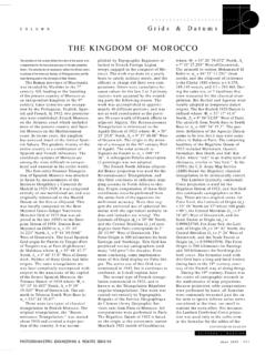
www.asprs.orgPHOTOGRAMMETRIC ENGINEERING & REMOTE SENSING June 1999 657 COLUMN aaaaaaaaaaaaaaa aaaaaaaaaa Grids & Datums THE KINGDOM OF MOROCCO The contents of this column reflect the views of the author, who

ASPRS Positional Accuracy Standards for Digital …
www.asprs.org3. REFERENCES American Society for Photogrammetry and Remote Sensing (ASPRS), 2013. ASPRS Accuracy Standards for Digital Geospatial Data (DRAFT), PE&RS, December 2013, pp 1073-1085.

Indiana Geospatial Coordinate System (InGCS) - …
www.asprs.orgThe Indiana Geospatial Coordinate System (InGCS) Bridging the data gap between Land Surveying and the larger geospatial community. …like having your cake,
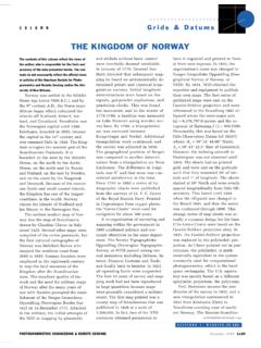
THE KINGDOM OF NORWAY - ASPRS
www.asprs.org1130 October 1999 PHOTOGRAMMETRIC ENGINEERING & REMOTE SENSING COLUMN a a aaaaaaaaaaaaaaaaaa CONTINUED FROM PAGE 1129 vian geodetic survey extended from Swedish Lapland to ...

R&D OF MOBILE LIDAR MAPPING AND FUTURE TRENDS …
www.asprs.orgASPRS 2009 Annual Conference Baltimore, Maryland March 9-13, 2009 R&D OF MOBILE LIDAR MAPPING AND FUTURE TRENDS Charles K. Toth, Senior Research Scientist The Ohio State University 470 Hitchcock Hall, 2070 Neil Ave, Columbus, OH 43212
LAS SPECIFICATION VERSION 1.4 – R13 15 July 2013
www.asprs.orgAmerican Society for Photogrammetry & Remote Sensing Page 6 of 28 LAS SPECIFICATION Version 1.4-R13 File Source ID: This field should be set to a value ranging from 1 to 65,535. If this file was derived from an original flight line, this is often the flight line number.
ASPRS Positional Accuracy Standards for Digital Geospatial ...
www.asprs.orgJan 22, 2015 · Applications Division, Primary Data Acquisition Division, and Lidar Division, which was formed for the purpose of reviewing and updating ASPRS map accuracy standards to reflect current technologies. A sub-committee of this group, consisting of Dr. Qassim Abdullah of Wool-pert, Inc., Dr. David Maune of Dewberry Consultants, Doug Smith of

The LAS file format contains a header block, variable ...
www.asprs.orgfloating point resolution. 1:15 . Reserved . Must be set to zero . Note that in the previous version of LAS (LAS 1.1), this was a reserved field that had to be set to zero. Thus LAS 1.2 files that use GPS Week Time and point record types 0 and 1 (the only types

LAS Specification 1.4 - R15 - ASPRS
www.asprs.orgLAS Specification v.1.4 - R15 American Society for Photogrammetry & Remote Sensing 1Introduction 1.1Purpose, Scope, and Applicability The LASer (LAS) file is intended to contain point cloud data records, including those derived
Related documents
ASPRS Positional Accuracy Standards for Digital …
www.asprs.org3. REFERENCES American Society for Photogrammetry and Remote Sensing (ASPRS), 2013. ASPRS Accuracy Standards for Digital Geospatial Data (DRAFT), PE&RS, December 2013, pp 1073-1085.

Standard on Digital Cadastral Maps and Parcel …
www.iaao.orgApproved January 2015 International Association of Assessing Officers This standard replaces the January 2012 Standard on Digital Cadastral Maps and Parcel Identifiers.IAAO assessment
4. HORIZONTAL AND VERTICAL CONTROL 4.01 …
www.ncpropertymappers.org4. HORIZONTAL AND VERTICAL CONTROL 4.01 General: Sufficient horizontal and, if applicable, vertical control surveys shall be established by
AZIMUTHS IN CONTROL SURVEYS - Terrasurv
www.terrasurv.comJohn Hamilton 1 [email protected] Geodetic Engineer 412-341-5620 AZIMUTHS IN CONTROL SURVEYS ABSTRACT With the advent of GPS for control surveying, a problem has arisen.

Chapter 13 Control Survey Procedures
www.wsdot.wa.govHighway Surveying Manual Page 13-1 January 2005 Chapter 13 Control Survey Procedures 13-01 General Control surveys establish a common, consistent network of physical points that are the
Accuracy Standards of Control Survey - Geodetic
www.geodetic.gov.hkAccuracy Standards of Control Survey (Version 2.0) September 2010 . Geodetic Survey Section . Survey and Mapping Office . Lands Department
1.0 Conversion Factors - michigan.gov
www.michigan.govSOM CSS Lidar Specifications, 2012 Derived from the USGS Lidar Base Specification Version 1.0 Page | 1 1.0 Conversion Factors Altitude and Elevation, as used in this report, refers to the distance above the geoid, unless specifically referenced to the
Related search queries
ASPRS Positional Accuracy Standards, Standards, Standard on Digital Cadastral Maps and Parcel, Standard on Digital Cadastral Maps and Parcel Identifiers, 4. HORIZONTAL AND VERTICAL CONTROL, Control, AZIMUTHS IN CONTROL SURVEYS, Geodetic, Chapter 13 Control Survey Procedures, Accuracy Standards of Control Survey, Specifications