
Chapter 13 Control Survey Procedures
survey results will be submitted to NGS for inclusion in the National Spatial Reference System (NSRS). Accuracy Surveys must be referenced and adjusted to HPGN stations and meet WSDOT first-order survey standards with a distance accuracy standard of 1:500,000. See Section 5, “Classification and Accuracy Standards” (See Figure 5-1, Note 10).
Download Chapter 13 Control Survey Procedures

Information
Domain:
Source:
Link to this page:
Documents from same domain
Chapter 6 Seismic Design
www.wsdot.wa.govChapter 6 Seismic Design 6.1 Seismic Design Responsibility and Policy 6.1.1 Responsibility of the Geotechnical Designer The geotechnical designer is responsible for providing geotechnical/seismic input

Project Management Manual - wsdot.wa.gov
www.wsdot.wa.govCommunication Management Plan [Output/Input] The document that describes: the communications needs and expectations for the project; how and in what format information will be

Project Risk Management Guide
www.wsdot.wa.govProject Management Online Guide in the Risk Management Plan spreadsheet. Larger, more complex projects may wish to use more robust analysis techniques via Monte Carlo simulation models.
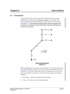
Chapter 6 Storm Drains - Washington State …
www.wsdot.wa.govWSDOT Hydraulics Manual M 23-03.03 Page 6-1 June 2010 Chapter 6 Storm Drains 6-1 Introduction A storm drain (storm sewer) is a network of pipes that conveys surface

Cost Estimating Manual for Projects
www.wsdot.wa.govWSDOT Cost Estimating Manual for Projects M 3034.03 Page i April 2015 Foreword WSDOT’s vision is to be the best at providing a sustainable and

Maintenance Manual - Washington State …
www.wsdot.wa.govForeword Reliable, well-maintained highway transportation facilities are essential to the well being of the state, its citizens, and its commerce.
Chapter 4 Soil and Rock Classification and Logging
www.wsdot.wa.govChapter 4 Soil and Rock Classification and Logging 4.1 Overview The detailed description and classification of soil and rock are an essential part of the

Chapter 1310 Intersections
www.wsdot.wa.govIntersections Chapter 1310 Page 1310-2 WSDOT Design Manual M 22-01.14 July 2017 1310.02 Design Considerations Consider all potential …
Chapter 25 Right of Way - Washington State …
www.wsdot.wa.govRight of Way Chapter 25 Page 25-2 WSDOT Local Agency Guidelines M 36-63.36 June 2018.11 WSDOT Services – At the earliest possible date, the local agency should notify
Chapter 1510 Pedestrian Facilities
www.wsdot.wa.govWSDOT Design Manual M 22-01.10 Page 1510-1 July 2013 Chapter 1510 Pedestrian Facilities 1510.01 General. 1510.02 References. 1510.03 Definitions
Related documents

5 Classifications of Accuracy and Standards
dot.ca.gov5 Classifications of Accuracy and Standards . 5.1 Introduction . Survey standards may be defined as the minimum accuracies deemed necessary to meet specific objectives. Specifications are the procedural requirements that will achieve the required accuracy, proving that the survey results weren't a matter of chance, but an

201 KAR 18:150 Standards Of Practice - Kentucky
kyboels.ky.gov(a) The standards for accuracy and precision established by the provisions of this section; or (b) Standards for accuracy and precision that exceed the standards established by the provisions of this section but are: 1. Requested by the client; 2. Required by contract; 3. Required by the agency or entity to which the plat of survey is to be
Map Accuracy Standards - USGS
pubs.usgs.govand procedures the Survey uses are pro-ducing maps that meet the U.S. National Map Accuracy Standards. How the Survey Maintains Map Accuracy In 1958, the USGS began systematically testing the accuracy of its maps. Presently, accuracy testing is performed on 10 percent of the mapping projects at each contour interval as a method of

ASPRS Positional Accuracy Standards for Digital Geospatial ...
www.asprs.orgJan 22, 2015 · U.S. Geological Survey, was responsible for drafting the document. ASPRS POSITIONAL ACCURACY STANDARDS FOR DIGITAL GEOSPATIAL DATA 1. PURPOSE The objective of the ASPRS Positional Accuracy Standards for Digital Geospatial Data is to replace the existing ASPRS Accuracy Standards for Large-Scale Maps (1990), and the ASPRS …

Chapter 4 - Photogrammetry
www.codot.govsurvey data is combined with field survey data to produce high precision mapping and meet the accuracy standards described in this Chapter. 4.1.4 Aerial Photogrammetry

RICS professional guidance, global Measured surveys of ...
www.rics.org2.6 Survey control network..... 15 2.7 Survey control network plan accuracy..... 15 2.8 Survey control height accuracy..... 16 2.9 Survey control outputs..... 16 Measured surveys of land, buildings and utilities ii RICS guidance note, global Effective date 8 December 2014

CHAPTER 3 - SURVEYING PROCEDURES AND PRACTICES …
www.tn.govaccording to the publication “Geometric Geodetic Accuracy Standards and Specifications for Using GPS Relative Positioning Techniques”, Version 5.0, May 1988, distributed by the Federal Geodetic Control Committee. GNSS Surveys shall meet First Order (1:100000) accuracy standards as an absolute minimum.