
Chapter 13 Control Survey Procedures
projects and facilities. Corridor control surveys ensure that adjacent projects have compatible control. Project control surveys provide consistent and accurate horizontal and vertical control for all subsequent project surveys — photogrammetric, mapping, planning, design, construction, and …
Download Chapter 13 Control Survey Procedures

Information
Domain:
Source:
Link to this page:
Documents from same domain
Chapter 6 Seismic Design
www.wsdot.wa.govChapter 6 Seismic Design 6.1 Seismic Design Responsibility and Policy 6.1.1 Responsibility of the Geotechnical Designer The geotechnical designer is responsible for providing geotechnical/seismic input
Project Management Manual - wsdot.wa.gov
www.wsdot.wa.govCommunication Management Plan [Output/Input] The document that describes: the communications needs and expectations for the project; how and in what format information will be
Project Risk Management Guide
www.wsdot.wa.govProject Management Online Guide in the Risk Management Plan spreadsheet. Larger, more complex projects may wish to use more robust analysis techniques via Monte Carlo simulation models.
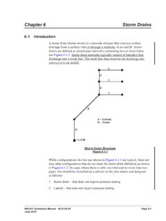
Chapter 6 Storm Drains - Washington State …
www.wsdot.wa.govWSDOT Hydraulics Manual M 23-03.03 Page 6-1 June 2010 Chapter 6 Storm Drains 6-1 Introduction A storm drain (storm sewer) is a network of pipes that conveys surface

Cost Estimating Manual for Projects
www.wsdot.wa.govWSDOT Cost Estimating Manual for Projects M 3034.03 Page i April 2015 Foreword WSDOT’s vision is to be the best at providing a sustainable and
Maintenance Manual - Washington State …
www.wsdot.wa.govForeword Reliable, well-maintained highway transportation facilities are essential to the well being of the state, its citizens, and its commerce.
Chapter 4 Soil and Rock Classification and Logging
www.wsdot.wa.govChapter 4 Soil and Rock Classification and Logging 4.1 Overview The detailed description and classification of soil and rock are an essential part of the

Chapter 1310 Intersections
www.wsdot.wa.govIntersections Chapter 1310 Page 1310-2 WSDOT Design Manual M 22-01.14 July 2017 1310.02 Design Considerations Consider all potential …
Chapter 25 Right of Way - Washington State …
www.wsdot.wa.govRight of Way Chapter 25 Page 25-2 WSDOT Local Agency Guidelines M 36-63.36 June 2018.11 WSDOT Services – At the earliest possible date, the local agency should notify
Chapter 1510 Pedestrian Facilities
www.wsdot.wa.govWSDOT Design Manual M 22-01.10 Page 1510-1 July 2013 Chapter 1510 Pedestrian Facilities 1510.01 General. 1510.02 References. 1510.03 Definitions
Related documents
Recommended Marking Guidelines For Underground Utilities
www2.apwa.netcompletion and mapping of underground installations as well as emerging ... (Corridor Markings) Even though this has the potential for abuse, this was a compromise ... EMS = Electronic Marking System device CON = Concrete and etc. "Marking Offsets" direction (N,S,E,and W) should be included. ...

DJI TERRA - dl.djicdn.com
dl.djicdn.comSep 17, 2021 · Corridor DJI Terra automatically generates corridor flight area and several independent flight paths after the user has set the corridor points, expansion distance, and flight band cutting distance. After the mission is complete, users can import the original images into DJI Terra for 2D map or 3D model reconstruction.

ZONAL DEVELOPMENT PLAN FOR ZONE ‘F’ (SOUTH DELHI-I)
mcdonline.nic.inMajor Transport Corridor, a network of Recreational and Sports facilities to be suitably incorporated while preparing the detailed Schemes. Mapping of the Zone shall be done using remote sensing and GIS tools and shall also be updated from time to time to have valuable data as regards ground situation and

BRIEF HISTORY OF GEOGRAPHICAL INFORMATION SYSTEMS
web.mst.eduIan McHarg (1920-2001) is credited with being the father of map overlays, which had a major impact on Geographical Information Systems He was a Professor of Landscape Architecture and Regional Planning at the University of Pennsylvania from

Chapter 4 - Photogrammetry
www.codot.govmapping that has been historically referred to as 1”=50’ scale mapping with 1’ contours. The vast majority of aerial mapping contracted by CDOT calls for mapping standards associated with this scale. Where requirements differ from this scale, the necessary equipment, ground control, flight planning and other key
In the Senate of the United States,
www.congress.govIn the Senate of the United States, August 10, 2021. Resolved, That the bill from the House of Representa- tives (H.R. 3684) entitled ‘‘An Act to authorize funds for Federal-aid highways, highway safety programs, and transit

List of Public International Organizations
www.usaid.govUnited Nations System Considerations Note that entities and bodies included in the UN System are considered Public International Organizations for the purposes of ADS 308. Any entity or body of the UN System that is not listed below should be considered as a Category 2 PIO.