
Chapter 13 Control Survey Procedures
• Global Positioning System (GPS) survey methods. • Today’s multiorganizational transportation project development efforts. • Surveys required to accurately locate transportation improvements and rights of way. • Geographic Information Systems (GIS). This network is called the Washington High-Precision Geodetic Network (HPGN). In
Download Chapter 13 Control Survey Procedures

Information
Domain:
Source:
Link to this page:
Documents from same domain
Chapter 6 Seismic Design
www.wsdot.wa.govChapter 6 Seismic Design 6.1 Seismic Design Responsibility and Policy 6.1.1 Responsibility of the Geotechnical Designer The geotechnical designer is responsible for providing geotechnical/seismic input
Project Management Manual - wsdot.wa.gov
www.wsdot.wa.govCommunication Management Plan [Output/Input] The document that describes: the communications needs and expectations for the project; how and in what format information will be

Project Risk Management Guide
www.wsdot.wa.govProject Management Online Guide in the Risk Management Plan spreadsheet. Larger, more complex projects may wish to use more robust analysis techniques via Monte Carlo simulation models.
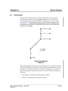
Chapter 6 Storm Drains - Washington State …
www.wsdot.wa.govWSDOT Hydraulics Manual M 23-03.03 Page 6-1 June 2010 Chapter 6 Storm Drains 6-1 Introduction A storm drain (storm sewer) is a network of pipes that conveys surface

Cost Estimating Manual for Projects
www.wsdot.wa.govWSDOT Cost Estimating Manual for Projects M 3034.03 Page i April 2015 Foreword WSDOT’s vision is to be the best at providing a sustainable and

Maintenance Manual - Washington State …
www.wsdot.wa.govForeword Reliable, well-maintained highway transportation facilities are essential to the well being of the state, its citizens, and its commerce.
Chapter 4 Soil and Rock Classification and Logging
www.wsdot.wa.govChapter 4 Soil and Rock Classification and Logging 4.1 Overview The detailed description and classification of soil and rock are an essential part of the
Chapter 1310 Intersections
www.wsdot.wa.govIntersections Chapter 1310 Page 1310-2 WSDOT Design Manual M 22-01.14 July 2017 1310.02 Design Considerations Consider all potential …
Chapter 25 Right of Way - Washington State …
www.wsdot.wa.govRight of Way Chapter 25 Page 25-2 WSDOT Local Agency Guidelines M 36-63.36 June 2018.11 WSDOT Services – At the earliest possible date, the local agency should notify
Chapter 1510 Pedestrian Facilities
www.wsdot.wa.govWSDOT Design Manual M 22-01.10 Page 1510-1 July 2013 Chapter 1510 Pedestrian Facilities 1510.01 General. 1510.02 References. 1510.03 Definitions
Related documents

Lecture 2 Introduction to GIS (Based on lecture notes of ...
sites.bsyse.wsu.eduA Geographic Information System (GIS) is a computer system for capturing, storing, querying, analyzing, and displaying geographic data. Like any other information technology, GIS can be divided into the ... calculations and positioning. Therefore, accuracy in a feature’s absolute position and its relative position to

Why is Geography Important - Virginia Tech
geography.vt.eduThe information revolution expands our geographic horizons from local to global. Today, use of the Internet, Geographic Information Systems (GIS), Global Positioning Systems (GPS), and other mapping technologies give Americans access to a world of spatial (geographic) information. Whether obtaining and mapping geographic data, finding our way from

National Geographic Geography Handbook - Boone County …
www.boone.kyschools.usgrams called geographic information systems (GIS). This software layers map data from satellite images, printed text, and statistics. A Global Positioning System (GPS)helps con-sumers and mapmakers locate places based on coordinates broadcast by satellites. 60°N 30°N 30°S 0° 120°E 180° 120°W PACIFIC OCEAN Map A Los Tokyo Angeles W E N S ...

THE GLOBAL POSITIONING SYSTEM - IIT Bombay
www.civil.iitb.ac.inTHE GLOBAL POSITIONING SYSTEM AND ITS APPLICATIONS 1. INTRODUCTION The Global Positioning System (GPS) is a satellite-based navigation and surveying system for determination of precise position and time, using radio signals from the satellites, in real-time or in post-processing mode. GPS is being used all over the world for numerous navigational
Introduction to Global Positioning Systems (GPS) - USDA
www.nrcs.usda.govGPS is a positioning system based on a network of satellites that continuously transmit coded information. The information transmitted from the satellites can be ... resources, physical infrastructure or any other geographic features. In the slide the field is an area defined by 4 corner points, the road is a line, the lake is and area defined ...

Strategic Brand Management - Pearson
www.pearsonhighered.comPART I Opening Perspectives 1 CHAPTER 1 Brands and Brand Management 1 PART II Developing a Brand Strategy 37 CHAPTER 2 Customer-Based Brand Equity and Brand Positioning 37 CHAPTER 3 Brand Resonance and the Brand Value Chain 76 PART III Designing and Implementing Brand Marketing Programs 111 CHAPTER 4 Choosing Brand …
AP Human Geography Outline - Springfield Public Schools
www.sps186.orgGeographic Information System- (GIS) a computer that can capture, store, query, analyze, and display geographic date. Remote Sensing- the acquisition of data about Earth’s surface for a satellite. Global Positioning System- (GPS) a system …

Market Segmentation Targeting and Positioning
www.um.edu.mtmarketing, including; market segmentation (ii) market targeting and (iii) market positioning. 4.1 Introduction Target marketing involves the identification of the most profitable market segments. Therefore, businesses may decide to focus on just one or a few of these segments. They may develop products or services to satisfy each selected segment.