
Chapter 4 - Photogrammetry
4.1.2 Purpose of this Chapter The purpose of this chapter is to define the specifications that shall be followed while performing aerial surveys, photogrammetry and geospatial data processing for CDOT. CDOT contracts out all aerial surveys as the aerial photography and mapping equipment is not available in the department.
Download Chapter 4 - Photogrammetry

Information
Domain:
Source:
Link to this page:
Documents from same domain
Basic Highway Plan Reading - index html
www.codot.govBasic Highway Plan Reading Inspector ... The Standard Specifications, ... standard design and construction practices which are utilized on all projects.
COLORADO DEPARTMENT OF TRANSPORTATION …
www.codot.govcolorado department of transportation staff bridge bridge rating ... – reinforced concrete structures ... 8-4 rating concrete bridges with unknown reinforcing ...
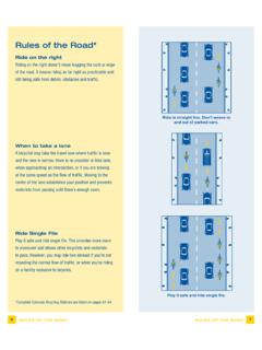
Rules of the Road* - CDOT
www.codot.govRules of the Road* Ride on the right Riding on the right doesn’t mean hugging the curb or edge of the road. It means riding as far right as practicable and
for Road and Bridge Construction - CDOT
www.codot.govi Colorado Department of Transportation Standard Specifications for Road and Bridge Construction 2011
Work Zone Safety and Mobility Rule - CDOT
www.codot.govPage 4 of 58 Traffic Control Plan (TCP) Construction phasing greatly affects the safety and mobility of work zone users. It is important that designers and construction engineers who …

STUDIES OF ENVIRONMENTAL EFFECTS OF MAGNESIUM …
www.codot.govEven very close to the roadway, the potential of magnesium chloride deicer to cause environmental damage is probably much smaller than that of other factors related to road use and maintenance, including pollution of highway surfaces by
Associated Press Style - CDOT
www.codot.govAssociated Press Style Quick Reference Guide To subscribe to The Associated Press Stylebook online, or to find out about purchasing hard copies of the book, start here. To find out about StyleGuard for Word, start here. For slide presentations of AP Style basics, go here.
15 Load and Resistance Factor Rating LRFR - index html
www.codot.govThe Notional Rating Load (NRL) and Lane Type Legal truck for spans greater than 200 feet as specified in the AASHTO Bridge Evaluation Manual shall be included in the posting analysis.
00 Introduction Final - CDOT
www.codot.govApril 1, 2011 Introduction Page 4 of 4 The HL-93 load rating for the Load and Resistance Factor Rating (LRFR) method is reported as a rating factor. All other ratings are reported as a rating ... Bridge Rating Manual (see AASHTO LRFD 4.6.3.1, modified here as …

COLORADO DEPARTMENT OF PUBLIC HEALTH AND …
www.codot.govColorado Department of Transportation Compliance Order on Consent Page 1 of 28 COLORADO DEPARTMENT OF PUBLIC HEALTH AND ENVIRONMENT WATER QUALITY CONTROL DIVISION
Related documents
Understanding VNA Calibration - UMD
anlage.umd.eduWhile these choices will be discussed in detail later in this chapter, they can be categorized according to two distinctions: calibration type (e.g., which ports are being corrected and to what level they are being corrected) and calibration algorithm (e.g., how the correction is
Chapter 5: Errors in Chemical Analyses
web.iyte.edu.trinterfere with the measurement process. Errors inherent in a method are often difficult to detect and hence, these errors are usually the most difficult to identify and correct.

SAFE FOOD AUSTRALIA
www.foodstandards.gov.auSAFE FOOD AUSTRALIA A Guide to the Food Safety Standards Chapter 3 of the Australia New Zealand Food Standards Code (Australia only) Standard 3.1.1 – Interpretation and Application Standard 3.2.2 – Food Safety Practices and General Requirements

WHO laboratory manual for the Examination and processing ...
www.who.intChapter 4 Research procedures 142 4.1 Reactive oxygen species 142 4.1.1 Introduction 142 4.1.2 Measurement of reactive oxygen species generated by sperm suspensions 143 4.2 Human sperm–oocyte interaction tests 146 4.3 Human zona pellucida binding tests 146 4.4 Assessment of the acrosome reaction 147