
FEATURES SHOWN ON TOPOGRAPHIC MAPS - USGS
topographic maps of the Survey. b. Planimetric map. --A planimetric map is similar to a topographic map, except that it does not portray relief in a measurable form. The Survey publishes some planimetric maps for use until they can be replaced by topographic maps. 1 The number 1 B 3 signifies Book 1, Part B, Chapter 3 of the
Download FEATURES SHOWN ON TOPOGRAPHIC MAPS - USGS

Information
Domain:
Source:
Link to this page:
Documents from same domain

Status of Groundwater Levels and Storage Volume …
pubs.usgs.govvolume in the Equus Beds aquifer near Wichita, south-central Kansas, predevelopment to winter 2014 ...

Groundwater-Level and Storage-Volume Changes in …
pubs.usgs.govGroundwater-Level and Storage-Volume Changes in the Equus Beds Aquifer near Wichita, Kansas, Predevelopment through January 2015 By Joshua A. Whisnant, Cristi V. Hansen, and Patrick J. Eslick

Student Guide Tracking Change Over …
pubs.usgs.govWhat is remote sensing? Remote sensing means observing something from a distance. ... Student Guide Tracking Change Over Time—Understanding Remote Sensing

Weak-Field Magnetic Susceptibility Anisotropy and …
pubs.usgs.govWEAK-FIELD MAGNETIC SUSCEPTIBILITY ANISOTROPY AND ITS DYNAMIC MEASUREMENT By WILLIAM F. HANNA ABSTRACT The apparent magnetic susceptibility, KA, …

U.S DEPARTMENT OF THE INTERIOR U. S. …
pubs.usgs.govu.s department of the interior u. s. geological survey magnetic susceptibility measurements and sample locations of granitic rocks from along a transect of the coast mountains near

Porosity and Bulk Density of Sedimentary Rocks
pubs.usgs.govPOROSITY AND BULK DENSITY OF SEDIMENTARY ROCKS ... the average and range of porosity, ... Total porosity is a measure of all the void space of porous material.

GEOLOGICAL SURVEY - USGS
pubs.usgs.govunited states geological survey charles d. walcott, director oil and gas fields of the bias coal and of the upper cretaceous and tertiary of the

Gem Stones of the United States
pubs.usgs.govGems are named for their color, type locality, outstanding physical property, or persons. The most popular gem cuts are the cabochon, rose, brilliant, step, and mixed. The carat, one-fifth of a gram or 200 milligrams, is the unit of weight measure ... PRECIOUS GEMS. GEM STONES OF THE UNITED STATES. GEM STONES OF THE UNITED STATES. GEM STONES ...

U.S. Department of the Interior U.S. Geological Survey ...
pubs.usgs.govU.S. Department of the Interior U.S. Geological Survey Natural Gemstones Searching for gemstones in the United States is a popular recreational activity for collectors and hobbyists ... Gems, when present at all, tend to be scat tered sparsely throughout a large body of
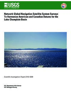
Network Global Navigation Satellite System Surveys to ...
pubs.usgs.govThe Global Navigation Satellite System surveys were completed from April 14 to 16, 2015, at locations ranging from southern Lake Champlain near Whitehall, New York, to the northern end of the Richelieu River in Sorel, Quebec, at its confluence with the St. Lawrence River in Canada.
Related documents

Chapter 2 Reading Topographic Maps and Making Calculations
www.honolulu.hawaii.eduTopographic maps do not show the latitude/longitude lines – just the tick marks. The numbers next to the tick marks indicate degrees (°), minutes (') and seconds ("). On 1:24,000 scale maps, latitude and longitude tick marks are indicated every 2.5 minutes.

TOPOGRAPHICAL SURVEY REPORT - PART OF L.R No. …
www.iucn.orgA topographic map or plat shall be prepared that shall be of a scale, size and accurately to clearly show the results of the survey. 7. DATA The surveyor shall locate and show on the topographic survey map or plat the following information:
Topographic Maps: The basics - NRCan
www.nrcan.gc.caTOPOGRAPHIC MAPS: The basics Topographic maps produced by Natural Resources Canada (NRCan) offer detailed information on a particular area and are used for several types of . activities such as emergency preparedness, urban planning, resource development and surveying to camping, canoeing, adventure racing, hunting and fishing.

How to Read a Topographical Map - USDA
www.nrcs.usda.govA topographic map illustrates the topography, or the shape of the land, at the surface of the Earth. The topography is represented by contour lines, which are imaginary lines. Every point on a particular contour line is at the same elevation. These lines are generally relative to mean sea level. The illustration above on the

How to Determine Latitude and Longitude from Topographic …
www.oregon.govTOPOGRAPHIC MAPS Latitude is the distance north or south of the equator. Longitude is the distance east or west of the prime meridian (Greenwich, England). Latitude and longitude are measured in seconds, minutes, and degrees: 60″ (seconds) = 1′ (minute) 60′ (minutes) = 1° (degree) To determine the latitude and longitude of your facility,

Topographic Surveying - PDH University
www.pdhuniversity.comTopographic surveying is performed to determine the planimetric location and topographic relief of features in three dimensions. Topographic surveys are performed for detailed large-scale site plan drawings or maps at scales equal to or larger than 1 inch = 100 feet (1:1,200).
Geological Maps 1: Horizontal and Inclined Strata
www.southalabama.edutopographic maps (Figure 1). Marine geologists who wish to investigate the floors of oceans would consult bathymetric maps (Figure 2). Both of these maps use contour lines in order to represent changes in altitude or water depth. Your instructor(s) may discuss these maps in more detail during one or more of your labs. There is also an

Six Maps FAQ - Spatial Services
www.spatial.nsw.gov.auQ11. How current is the cadastral and topographic data displayed in SIX Maps? The data displayed in SIX Maps is sourced from NSW Foundation Spatial Data Framework Data Themes. Information within these datasets is updated daily and automatically uploaded to SIX Maps to provide users with the most up to date information. Q12.