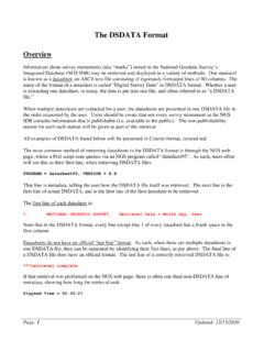
The DSDATA Format
Dec 15, 2020 · When Displayed Only when the horizontal datum being used has an epoch. Comments The attempt to regularize all data in a datum realization at one common epoch was not attempted until 2007. All datum realizations since then have a reference epoch. As such, if the latest datum realization for this mark is 2007 or later, it will be
Download The DSDATA Format

Information
Domain:
Source:
Link to this page:
Documents from same domain

Chapter 4 Supersedes Chapter 2 GLOBAL NAVIGATION …
www.ngs.noaa.govJun 06, 2016 · Global Navigation Satellite System Data . Survey Equipment Data . Control Point Data . Accuracy Data . Within these categories, the data have been grouped into one or more logical units called "records." A record is a string of characters containing data coded according to a specific format. Every record in a GNSS B-file consists of

NOAA Manages the National Spatial Reference System
www.ngs.noaa.govNational Spatial Reference System ... n Global Navigation Satellite System (GNSS) orbits; n orientation, scale, and offset information relating NAD 83 to international terrestrial reference systems; and n all necessary information to describe how these values change over time.

WORLD WAR II HISTORY OF THE DEPARTMENT OF …
www.ngs.noaa.govWORLD WAR II HISTORY OF THE DEPARTMENT OF COMMERCE . PART 5 US COAST AND GEODETIC SURVEY . UNITED STATES DEPARTMENT OF COMMERCE . CHARLES SAWYER, Secretary . COAST AND GEODETIC SURVEY . ROBERT F.A. STUDDS, Director . WORLD WAR II HISTORY . Of the . ... the installation of high-precision machine-tool equipment in war plants. …

Survey Monument Preservation - National Geodetic Survey
www.ngs.noaa.govResearch existing monuments and scout their condition. Select route to pass through, or install new, monuments. Install new monuments and take precise measurements.

Trimble Survey Controller User Guide
www.ngs.noaa.govSurvey Controller software: 6021376, 6016118, 5986604, 5969708, 5831573, 5614913 and other patents pending. Release Notice This is the July 2001 release (Revision A) of the Survey Controller User Guide, part number 44011-00-ENG. It applies to version 10.0 of the Trimble Survey Controller™ software. The following limited warranties give you ...

State Plane Coordinate System of 1983
www.ngs.noaa.govThe State Plane Coordinate System of 1927 was designed in the 1930s by the U.S. Coast and Geodetic Survey (predecessor of the National Ocean Service) to enable surveyors, mappers, and engineers to connect their land or engineering surveys to a common reference system, the North American Datum of 1927. The following
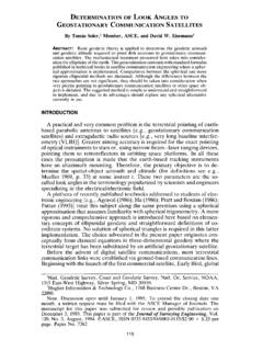
DETERMINATION OF LOOK ANGLES TO GEOSTATIONARY ...
www.ngs.noaa.govFrom Fig. 1 it is clear that the azimuth c,' of the satellite is a function of the angle f3. In this particular situation, as can be seen in the Fig. 1, eL' = 180 ~ _ 13. The angle 13 is computed using Napier's rules as 13 = cos-l(cot "y tan +') (6) Consequently, once the vertex angle 13 at P' is known, the value of the ...

Trimble R7/R8 GPS Receiver User Guide
www.ngs.noaa.govBluetooth wireless radio is far below the FCC radio frequency exposure limits. Nevertheless, the wireless radio shall be used in such a manner that this receiver is 2.0cm or further from the human body. The internal wireless radio operates within guidelines found in radio frequency safety standards and recommendations, which reflect the

Datums, Heights and Geodesy
www.ngs.noaa.govEach equipotential surface has one distinct potential quantity along its surface. Point on earth’s surface is the level surface parallel to the geoid achieved by adding or subtracting potential. Lines don’t appear parallel; they are based on the gravity field and are …

2022 is Coming – Will You Be Ready? (or NAD83 and NAVD88 ...
www.ngs.noaa.gov• NAD83 frame ≠ GPS navigation frame • NAD83 frame ≠ WAAS navigation frame • NAD83 frame ≠ satellite orbits frame • NAD83 frame ≠ satellite product frame • NAD83 frame ≠ international geodetic frame – International flights take off & land on different datums – Many geodetic tools assume ITRF as default
Related documents
What’s New in the ASME Y14.5 2009 Standard
www.qualitydigest.comDatum Reference Frame relative to a particular Datum Feature by specifying the behavior of its simulator. Whereas the RMB modifier “stabilizes” the Datum Reference Frame relative to the specified Datum Feature, the MMB modifier (M) “mobilizes” the frame, and the LMB modifier (L) “loosens” the frame relative to the
GD&T REFERENCE GUIDE
gdtseminars.comThe new standard allows a datum reference to be called out in a feature control frame with only certain degrees of freedom being constrained. The specific degrees of freedom are given after the datum letter by noting x, y, z, u, v, or w. See paragraphs 4.22 and 4.23.

MASTER CATALOG Switches - Mouser Electronics
www.mouser.comthe reference line to the top of the button or actuator. Reset Travel The distance the switch button (or actuator) travels back from reset point to rest position. Switch Characteristics Miniature Subminiature Rest Position Operating Position Pre-Travel Over-Travel Move Differential Actuating Line Horizontal Datum Vertical Datum

Dimensioning and Tolerancing Engineering Product ...
www.asme.orgDimensioning and Tolerancing Engineering Product Definition and Related Documentation Practices AN INTERNATIONAL STANDARD ASME Y14.5-2018 (Revision of ASME Y14.5-2009)

The C-- Language Reference Manual
www.microsoft.comThe C--Language Reference Manual Simon Peyton Jones Thomas Nordin Dino Oliva Pablo Nogueira Iglesias April 23, 1998 Contents 1 Introduction 3 2 Syntax definition 3
NMEA Reference Manual - SparkFun Electronics
www.sparkfun.comNMEA Reference Manual SiRF Technology, Inc. 217 Devcon Drive San Jose, CA 95112 U.S.A. Phone: +1 (408) 467-0410 Fax: +1 (408) 467-0420 www.SiRF.com Part Number: 1050-0042 Revision 2.1, December 2007 SiRF, SiRFstar, and SiRF plus orbit design are registered in the U.S. Patent and Trademark Office.

Dimensioning Standards - Intro to Engineering Design (IED)
iedjohnson.weebly.comDatum Dimensioning • Datum Dimensioning – Dimensioning from a single point of origin called a DATUM – Reduces dimensional deviations in manufactured parts because each size/ location dimension is referenced to a single point . ... Reference Dimensions “X ...

World Geodetic System 1984
www.unoosa.orgReference Epoch: 2005.0 Brief Description: WGS 84 is an Earth-centered, Earth-fixed terrestrial reference system and geodetic datum. WGS 84 is based on a consistent set of constants and model parameters that describe the Earth's size, shape, and gravity and geomagnetic fields. WGS 84 is the standard U.S.

EMPLOYEES TAX WERKNEMERSBELASTING EMP 123
www.sars.gov.zaDatum: UIF reference number: UIF verwysingsnommer: Trading or other name Handels- of ander naam I hereby apply for the cancellation of above-mentioned person and all separately registered enterprises / branches / divisions because: Hiermee doen ek aansoek om die kansellasie van registrasie van
Related search queries
Datum reference, Datum, Reference, MASTER CATALOG Switches, Mouser Electronics, Dimensioning and Tolerancing Engineering Product, Dimensioning and Tolerancing Engineering Product Definition and, The C-- Language Reference Manual, The C--Language Reference Manual, SparkFun Electronics, Dimensioning, Datum Dimensioning