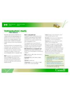
Topographic Maps: The basics - NRCan
TOPOGRAPHIC MAPS: The basics Topographic maps produced by Natural Resources Canada (NRCan) offer detailed information on a particular area and are used for several types of . activities such as emergency preparedness, urban planning, resource development and surveying to camping, canoeing, adventure racing, hunting and fishing.
Download Topographic Maps: The basics - NRCan

Information
Domain:
Source:
Link to this page:
Documents from same domain

Oil Sands - Aboriginal Peoples - Natural Resources Canada
www.nrcan.gc.caThe Joint Canada-Alberta Oil Sands Monitoring Plan is implementing scientifically rigorous, comprehensive, integrated ... sands development. The oil sands industry works closely with Indigenous peoples in support of economic security and well-being in their communities.

Oil Sands - Water Management - Natural Resources Canada
www.nrcan.gc.caannual flow is used by the oil sands The Athabasca River Water Management Framework ensures ... 4 Government of Alberta, November 2013 Oil Sands A strategic resource for Canada, North America and the global market. ... the oil sands industry accounts for only 8 percent.
Building Canada’s Energy Future Together - nrcan.gc.ca
www.nrcan.gc.caBuilding Canada’s Energy Future Together 1 WORKING TOGETHER TO BUILD CANADA’S ENERGY FUTURE Federal, provincial and territorial governments are working together through the Energy Mines and Ministers’ Conference

Impact of High PV Penetration on Voltage Profiles in ...
www.nrcan.gc.caecoENERGY Technology Initiative. Reinaldo Tonkoski was with Natural Resources Canada (NRCan) – ... Impact of High PV Penetration on Voltage Profiles in Residential Neighbourhoods R . ... impact on the network voltage profile with high PV penetration. Finally, Section IV presents the conclusion. II. …

Stakeholder Engagement Guide with Worksheets
www.nrcan.gc.caThis Engagement Guide was extracted from the report, Stakeholder Communications and Engagement Guide for District Energy Systems, developed by Sustainable Cities International for Natural Resources Canada’s

BENCHMARKING ENERGY USE IN CANADIAN PULP AND …
www.nrcan.gc.caThe information contained in Benchmarking Energy Use in Canadian Pulp and Paper Mills and the Energy Benchmarking Survey Tool on the CD-ROM is intended to be used solely as an educational tool to help companies determine approximately how their facility compares against industry averages. The information is not intended to
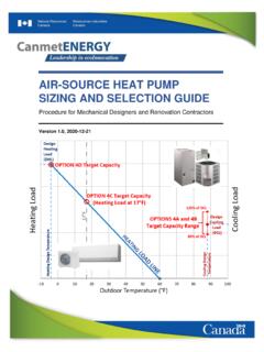
Air-source Heat Pump Sizing and Selection Guide
www.nrcan.gc.caReference in the report to any specific commercial product, process, ... Table 1: Typical Air-Source Heat Pump Options for Different Applications and Heating System Configurations 5 . ... An Example of defining Target Capacities for different ASHP Sizing Options21 . Figure 20: Comparing CC-ASHP Turn-down Ratios 27 .

Implementing an Energy Efficiency Awareness Program
www.nrcan.gc.caadvantage of the gains to be made by becoming more energy-efficient. Energy . efficiency practices and technologies are not being taken up in the sector at the 3 Energy Efficiency Trends in Canada, 1990 to 2008, Natural Resources Canada, September 2010. 4 Energy Efficiency Trends in Canada, 1990 to 2008, Natural Resources Canada, September 2010.

2019 Fuel Consumption Guide - NRCan
www.nrcan.gc.caThe 2019 Fuel Consumption Guide gives information about the fuel consumption of 2019 model year light-duty vehicles. You can use this information to compare vehicles as you shop for the most fuel-efficient vehicle that meets your everyday needs. Remember as you shop that fuel is an expense you will be paying for a long time.
Seizing the Opportunities for Hydrogen - NRCan
www.nrcan.gc.caHydrogen HD Heavy-Duty ICE Internal Combustion Engine ICT Innovative Clean Transit IEA International Energy Agency IMO IP International Maritime Organization Intellectual Property IRAP Industrial Research Assistance Program LD Light-Duty LNG Liquid Natural Gas MCH Methylcyclohexane MJ Megajoule NG Natural Gas NH 3 Ammonia NO x
Related documents

FEATURES SHOWN ON TOPOGRAPHIC MAPS - USGS
pubs.usgs.govtopographic maps of the Survey. b. Planimetric map. --A planimetric map is similar to a topographic map, except that it does not portray relief in a measurable form. The Survey publishes some planimetric maps for use until they can be replaced by topographic maps. 1 The number 1 B 3 signifies Book 1, Part B, Chapter 3 of the

Chapter 2 Reading Topographic Maps and Making Calculations
www.honolulu.hawaii.eduTopographic maps do not show the latitude/longitude lines – just the tick marks. The numbers next to the tick marks indicate degrees (°), minutes (') and seconds ("). On 1:24,000 scale maps, latitude and longitude tick marks are indicated every 2.5 minutes.

TOPOGRAPHICAL SURVEY REPORT - PART OF L.R No. …
www.iucn.orgA topographic map or plat shall be prepared that shall be of a scale, size and accurately to clearly show the results of the survey. 7. DATA The surveyor shall locate and show on the topographic survey map or plat the following information:

How to Read a Topographical Map - USDA
www.nrcs.usda.govA topographic map illustrates the topography, or the shape of the land, at the surface of the Earth. The topography is represented by contour lines, which are imaginary lines. Every point on a particular contour line is at the same elevation. These lines are generally relative to mean sea level. The illustration above on the

How to Determine Latitude and Longitude from Topographic …
www.oregon.govTOPOGRAPHIC MAPS Latitude is the distance north or south of the equator. Longitude is the distance east or west of the prime meridian (Greenwich, England). Latitude and longitude are measured in seconds, minutes, and degrees: 60″ (seconds) = 1′ (minute) 60′ (minutes) = 1° (degree) To determine the latitude and longitude of your facility,

Topographic Surveying - PDH University
www.pdhuniversity.comTopographic surveying is performed to determine the planimetric location and topographic relief of features in three dimensions. Topographic surveys are performed for detailed large-scale site plan drawings or maps at scales equal to or larger than 1 inch = 100 feet (1:1,200).
Geological Maps 1: Horizontal and Inclined Strata
www.southalabama.edutopographic maps (Figure 1). Marine geologists who wish to investigate the floors of oceans would consult bathymetric maps (Figure 2). Both of these maps use contour lines in order to represent changes in altitude or water depth. Your instructor(s) may discuss these maps in more detail during one or more of your labs. There is also an

Six Maps FAQ - Spatial Services
www.spatial.nsw.gov.auQ11. How current is the cadastral and topographic data displayed in SIX Maps? The data displayed in SIX Maps is sourced from NSW Foundation Spatial Data Framework Data Themes. Information within these datasets is updated daily and automatically uploaded to SIX Maps to provide users with the most up to date information. Q12.