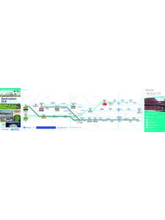
Transcription of Zion Hiking Map - National Park Maps | NPMaps.com
1 159999175915 Grafton(ghost town)RockvilleSpringdaleVirginLa VerkinToquervilleHurricaneTo Cedar City, Utah,Cedar Breaks NM, andSalt Lake City, UtahTo St. George,Utah and LasVegas, NevadaTo Pipe Spring National Monument andGrand Canyon National ParkTo at Mt. CarmelJunction, Utah, BryceCanyon NP, GrandCanyon NP, Kanab,Utah and Page, Arizona89To at Exit 16,St. George, Utah and Las Vegas,Nevada15 Exit40 Exit27 Exit42 Kolob Canyons Road Kolob Terrace Road West Rim Rd Zion Canyon Scenic Drive Zion-Mount Carmel Highway TunnelKolob Terrace Road Smithsonian Butte Scenic Backway Grafton Road BridgeRoadLava Point RdBeyond this point, the roadis not plowed in roads are impassable when roads are impassable when ButteScenic Backway maybe closed in pulling trailers are not recommended.
2 Narrow winding roadwith steep grades. The upper section is not plowed in March 24 through November 3, the Zion Canyon Scenic Drive is open to shuttle buses only. Private vehiclesare not permitted beyond Canyon longer than 19 meters are not allowed on Lava Point Road. Unpaved roads are impassable when bikes or pedestriansallowed. Large vehiclerestrictions on page WayChinleTrailheadLeft ForkTrailheadRight ForkTrailheadGrapevineTrailheadHop ValleyTrailheadWildcatCanyonTrailheadLee PassTrailheadWest RimTrailheadLa Verkin Creek Trail Hop Valley Trail Taylor Creek Trail Wildcat Canyon Trail Northgate Peaks Trail Connector Trail West Rim Trail West Rim Trail East Rim Trail Chinle Trail KolobArchTrailTimber CreekOverlookTrailRiversideWalkKolobArch AngelsLandingZION CANYON KOLOB CANYONSHURRICANE CLIFFS UPPER KOLOB PLATEAU HORSE PASTURE PLATEAU SMITH MESA LOWER KOLOB PLATEAU HURRICANE MESA PARUNUWEAP CANYON ORDERVILLE CANYON THE NARROWS East Fork Virgin River
3 North Fork Virgin River North Fork Virgin River Virgin River La Verkin Creek Taylor Creek PointLava PointOverlookTemple ofSinawavaEmerald PoolsTrailsCanyon JunctionThe GrottoWeepingRockZion LodgeCoalpits WashSpringdale / Zion Canyon Shuttleand Zion-Mount Carmel Highwayand tunnel informationSouthWatchmanEastEntranceSout hEntranceCourt of thePatriarchsZion Canyon detail oppositeKolob CanyonsVisitor CenterZion Canyon Visitor CenterZion Human History MuseumZIONNATIONALPARKP icnic areaRestroomsDrinking waterCampgroundPrimitivecampgroundRanger stationTrailUnpaved road(impassable when wet)Overlook / ParkingPaved road open toprivate vehiclesZion Canyon Shuttleand shuttle stopsSpringdale ShuttleShuttle InformationOther Visitor InformationFrom March 24 through November 3, the Zion Canyon Scenic Drive is open to shuttle buses only.
4 Private vehicles are not permitted beyond Canyon film012340 5 Miles5 Kilometers1234 NorthWildernessIn 2009, Congress protected nearly 84 percent of the park as wilderness under the 1964 Wilderness Act. Wilderness designation protects forever the land s wilderness character, natural conditions, opportunities for solitude, and scientific, educational, and historical National ParkThe GrottoZion LodgeKayenta TrailThe Grotto TrailUpperEmeraldPool TrailLowerEmeraldPool Pools TrailsZion Canyon9 SPRINGDALET unnelNo bikes or pedestrians allowed. Large vehicle restrictions on page March 24 through November 3, the Zion Canyon Scenic Drive is open to shuttle buses only. Private vehiclesare not permitted beyondCanyon lotWestboundparking areaTo at Mt.
5 CarmelJunction, Utah, BryceCanyon NP, GrandCanyon NP, Kanab,Utah, and Page, ArizonaTo , Kolob Canyons,Cedar City, Utah, St. George,Utah, and Las Vegas, Canyon Scenic Drive Zion-Mount Carmel Highway ObservationPointCable MountainAngelsLandingWaltersWigglesScout LookoutCOURT OF THE PATRIARCHS HIDDEN CANYON THENARROWSWest Rim Trail Cable Mountain Trail East Rim Trail Deertrap Mountain Trail Emerald Pools Trails detail oppositeSand Bench TrailPa rus TrailRiversideWalkCanyonOverlookTrailHid denCanyonTrailArcheology TrailWatchman TrailKayentaTrailGrotto TrailEmerald PoolsTrailsZion Nature CenterSouth CampgroundWatchmanCampgroundNorth Fork Virgin River JunctionBit & SpurZion park InnPizza & NoodleBumbleberry/Zions BankDesert Pearl/Post OfficeCanyon RanchFlanigan sCliffroseDriftwoodSilver BearMajesticViewCourt of
6 ThePatriarchsTemple of SinawavaWeepingRockBigBendThe GrottoZion LodgeZion CanyonTheatreZion HumanHistory MuseumZion Canyon Visitor CenterQuality InnRoad distance andindicatorZion Canyon shuttleroute and shuttle stopSpringdale Shuttle stopSpringdale shuttlerouteHiking trailTrails shown onHiking Guide at rightPaved road open toprivate vehiclesOverlook / ParkingRestroomsPicnic areaWheelchair accessibleCampgroundAmphitheaterRanger stationDrinking waterShuttle InformationOther Visitor InformationShuttle stops on requestor when people arewaiting (flag stop) park & RideRecycling KilometerHiking GuideStay on established trails and watch your footing, especially at overlooks and near drop-offs. Avoid cliff edges.
7 Watch children closely. People uncertain about heights should stop if they become uncomfortable. Never throw or roll rocks because there may be hikers rus TrailZion CanyonVisitor CenterArcheology TrailZion Canyon Visitor CenterLower Emerald Pool TrailZion LodgeThe Grotto TrailZion LodgeThe GrottoWeeping Rock TrailWeeping RockRiverside WalkTemple of SinawavaWatchman TrailZion Canyon Visitor CenterSand Bench TrailZion LodgeUpper Emerald Pool TrailZion LodgeKayenta TrailThe GrottoCanyon Overlook TrailZion-Mt. Carmel HwyTaylor Creek TrailKolob Canyons RoadTimber Creek Overlook TrailKolob Canyons RoadAngels Landingvia West Rim TrailThe GrottoHidden Canyon TrailWeeping RockObservation Point via East Rim TrailWeeping RockThe Narrowsvia Riverside WalkTemple of SinawavaKolob Arch via La Verkin Creek Trail Kolob Canyons RoadDescription Paved trail follows the Virgin River from the South Campground to Canyon Junction.
8 Wheelchairs may need , but steep. Starts across from the entrance to the visitor center parking lot. Climbs to the outlines of several prehistoric buildings. Trailside drop-offs. Paved trail leads to the Lower Emerald Pool and waterfalls. Connects to the Kayenta and Upper Emerald Pool trail connects the Zion Lodge to The Grotto. Can be combined with the Lower Emerald Pool and Kayenta Trails to create a , but steep. Minor drop-offs. Paved trail ends at a rock alcove with dripping springs. Trailside exhibits. Minor drop-offs. Paved trail follows the Virgin River along the bottom of a narrow canyon. Trailside exhibits. Wheelchairs may need drop-offs. Ends at viewpoint of the Towers of the Virgin, lower Zion Canyon, and Springdale.
9 Commercial horse trail from March to October. Hike atop a massive landslide under The Sentinel. Deep sand and little drop-offs. A sandy and rocky trail that climbs to the Upper Emerald Pool at the base of a cliff. Long drop-offs. An unpaved climb to the Emerald Pools. Connects The Grotto to the Emerald Pools drop-offs, mostly fenced. Rocky and uneven trail ends at viewpoint of Pine Creek Canyon and lower Zion Canyon. Parking lot is right turn to 12 people per group. Follows the Middle Fork of Taylor Creek past two homestead cabins to Double Arch a ridge to a small peak with views of Timber Creek, Kolob Terrace, and Pine Valley Mountains. Long drop-offs.
10 Not for young children or anyone fearful of heights. Last section is a route along a steep, narrow ridge to the summit. Long drop-offs. Not for anyone fearful of heights. Follows along a cliff face to the mouth of a narrow canyon. Long drop-offs. Climbs through Echo Canyon to viewpoint of Zion Canyon. Access to Cable Mountain, Deertrap Mountain, and East Mesa conditions at the visitor center before attempting. High water levels can prevent access to The to 12 people per group. Follows Timber and La Verkin Creeks. A side trail leads to Kolob Arch, one of the world s largest freestanding TripAverage timemi / km2 / / / / / / / / / / / / / / / / / / Changeft / m50 / 1580 / 2469 / 2135 / 1198 / 3057 / 17368 / 112466 / 142200 / 61150 / 46163 / 50450 / 137100 / 301488 / 453850 / 2592148 / 655334 / 1021037 / 316 EasyModerateStrenuous