Transcription of State Owned Real Property Inventory - Ohio
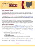
1 State Owned real Property Inventory OGRIP 77 S. High St 19th Floor Columbus ohio The ohio Geographically Referenced Information Program Council (OGRIP) serves as the authorized coordinating body for Geographic Information System (GIS) activity in the State of ohio . Created in response to the critical need for coordination in the development and use of digital spatial data the fifteen member OGRIP Council serves as a communication channel between State and local government concerning statewide geographic or location based initiatives. Supporting Asset Management Activities for the Highest and Best Use of Property In 2009 the Council s duties were expanded to include the production of a State - Owned real Property Management Report and the creation of an Inventory of State - Owned real Property assets (SORP). To accomplish these tasks OGRIP is engaging State agencies and local government in a collaborative effort to compile a statewide parcel database layer to better manage these assets.
2 In 2009-11 OGRIP collected real Property information from County Auditors and the Departments of Administrative Services (ODAS), Transportation (ODOT) and Natural Resources (ODNR). Fifty-nine counties provided parcel boundary files with information from Computer Assisted Mass Appraisal Systems (CAMA), 21 Counties provided only tabular CAMA parcel information. Most of the data provided included owner name and land use classification (LUC) values1, combining and reconciling these data resulted in the creation of a preliminary SORP database. The process is ongoing as additional information is made available. Selecting owner name State of ohio or an (LUC) value of 610 was determined to be insufficient for identifying SORP as the database contained 1,163 variations of the State or department name with records identified as belonging to 31 different agencies2, in all, 51,843 records were identified by the initial selection.
3 Removing university- Owned and forfeiture properties using information supplied in Auditor s CAMA data reduced the number to 38,721. While the LUC for State Owned Exempt Property is 610 , 2,434 records were identified having LUC values other than 610 ; 18,377 records had no LUC value available. A selection of all unknown parcels within 200 of State highways resulted in a subset of records which are likely under the control of ODOT. These along with records already identified as belonging to ODOT have been provided to the department for review and reconciliation. Approximately 2,933 unknown records are not in close proximity to the State highway system. A large number of these records have already been determined to be forfeiture Property or Property Owned by a university and will be removed from the final Inventory , after which any records remaining unknown will be provided to ODNR and ODAS for final verification.
4 1 ORC 5703-25-10 Classification of real Property and coding of records 2 ORC Section , Identification of agency for whose use and benefit interest in real Property is acquired