Example: tourism industry
2012 Remote Sensing - SPIE
Remote Sensing Technologies - -Atmospheric Sensing - -Sensors, Systems, and Next-Generation Satellites - Environmental Monitoring and Applications - Earth Surface Sensing Infrared Systems Optical Materials and Technologies - Unmanned/Unattended Sensors - Biological and Chemical Sensing
Tags:
Information
Domain:
Source:
Link to this page:
Documents from same domain

AND REMOTE SENSING• - SPIE - the international society ...
spie.orgConf . 9998: Remote Sensing for Agriculture, Ecosystems, and Hydrology (Neale, Maltese) p.48 Conf . 9999: Remote Sensing of the Ocean, Sea Ice, Coastal Waters, and Large Water Regions 2011

Chapter 1 Introduction to Radiometry - SPIE
spie.org1 Chapter 1 Introduction to Radiometry 1.1 Definitions Consider the following definitions a starting point for our study of radiometry: radio- [<L.radius] a combining form meaning ray, raylike -metry [Gr. -metria < metron] a terminal combining form meaning the process, art, or science of measuring

MARC TRAIN, AMTRAK & METRO SUBWAY ON METRORAIL …
spie.orgMARC is not the recommended method of transportation from Baltimore Washington Airport (BWI) to Baltimore Convention Center – Light Rail is recommended • The MARC …
Chapter 1 Infrared Detector Characterization
spie.orgdoes not include multiplexing functions in the infrared focal plane (IRFP). In the mid-1970s attention turned to the photodiodes for passive IR imaging applications. In contrast to photoconductors, photodiodes with their very low power dissipation, inherently high impedance, negligible 1/f noise, and easy

The Keynote Guide to Planning a Successful Conference
spie.orgAbout Conference Manager: Conference ManagerTM is an online application that will help you take care of the details as such as: usetting conference goals usetting up your registration process usending invitations ubooking transportation ucollecting abstracts and papers
Chapter 4 Airy Functions - SPIE
spie.orgChapter 4 Airy Functions 4.1 Introduction Airy functions are named after the English astronomer George Biddell Airy (1801–1892). Airy’s first mathematical work was on the diffraction phenom-enon, namely, the Airy disk—the image of a point object by a telescope— which is familiar to all of us in optics. The name Airy is connected with many
The concept of modes in optics and photonics
spie.orgThe shape of modes may be changed by passive optical elements (lenses, mirrors, filters), however, the number N of photons per mode cannot by increased. The energy throughput of an optical systems depends on the number of supported modes and the adaptation of the modes between the different sections of the system.

TRANSFER OF COPYRIGHT TO THE SOCIETY OF PHOTO …
spie.orgThis form must be signed by (1) at least one author who is not a U.S. Government employee and (2) the author's employer if the Paper was prepared within the scope of the author’s employment or was commissioned by the employer.

How to Write a Good Scientific Paper - SPIE
spie.orgin general, good science writing does not require creative writing. In particular, writing for a peer-reviewed science or engineering journal requires learning and executing a specific formula for presenting scientific work. This book is all about teaching the style and conventions of writing for a peer-reviewed science journal.
Flux and Irradiance flux irradiance intensity radiance
spie.orgare flux, irradiance, intensity, and radiance. Flux, Φ, is the optical power or rate of flow of radiant energy. Irradiance, E, is the flux per unit area striking a surface. Occasionally, the flux per unit area leaving a surface, called exitance, M, is important. However, the geometry is the same as for irradiance, so it will not be treated
Related documents
Chapter 15: Remote Sensing - GIS-Lab
gis-lab.infoCHAPTER 15 Remote Sensing 15.1 REMOTE SENSING Remote sensing is the science of gathering information from a location that is distant from the data source. Image analysis is the science of interpreting specific criteria from a remotely sensed image. An individual may visually, or with the

Handbook on remote sensing for agricultural statistics - GSARS
gsars.orgvi HANDBOOK ON REMOTE SENSING FOR AGRICULTURAL STATISTICS ChApTeR 7 mOniTORing fOResT COveR AnD DefOResTATiOn 185 7.1. Introduction and main objectives 185 7.2.The use of remote sensing to monitor forest cover – background information 186 7.2.1.Definition of forests, deforestation and degradation 187 7.2.2.Specifications for monitoring deforestation from remote sensing …
AND REMOTE SENSING• - SPIE - the international society ...
spie.orgConf . 9998: Remote Sensing for Agriculture, Ecosystems, and Hydrology (Neale, Maltese) p.48 Conf . 9999: Remote Sensing of the Ocean, Sea Ice, Coastal Waters, and Large Water Regions 2011
Introduction to RADAR Remote Sensing for Vegetation ...
whrc.orgIntroduction to RADAR Remote Sensing for . Vegetation Mapping and Monitoring. Wayne Walker, Ph.D. ... Remote Sensing of the Environment. Polarization Radar Scattering Intensity Short Wave. Long Wave C T T. C. T C T C. C = Crown T = Trunk.

Principles of active remote sensing: Radars.
irina.eas.gatech.edu• Radar is an active remote sensing system operating at the microwave wavelength. • Radar is a ranging instrument: (RAdio Detection And Ranging) Basic principles: The sensor transmits a microwave (radio) signal towards a target and detects the backscattered radiation. The …
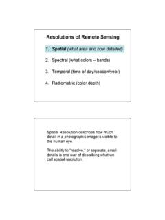
Resolutions of Remote Sensing - Data center
www.edc.uri.eduResolutions of Remote Sensing 1. Spatial (what area and how detailed) 2. Spectral (what colors – bands) 3. Temporal (time of day/season/year) 4. Radiometric (color depth) Spatial Resolution describes how much detail in a photographic image is visible to the human eye.

The Remote Sensing Process - knightlab.org
knightlab.orgThis*type*of*logic*is*at*the*center*of*remote*sensing*whenthe*focus* isimageinterpretation.**Likeour*everydaylearningexperiences,*a researcherusing*thislogic ...

Spectral Analysis for Earth Science: Investigations Using ...
www.geo.brown.eduInformation Content of Remote Sensing Doto 255 so on (e.g., Simonett et al., 1983).However, for simplicity, we adopt the definition based on the geometric properties of the imaging system. The smallest resolution cell in an image is defined by the IFOV and is typically quoted as the pixel size in meters

Use of Remote-Sensing Cameras in Wildlife Management
texnat.tamu.eduAbstract: Using remote-sensing cameras to count deer usually involves placing the cameras over baited areas or near feeders. However, this often leads to a high number of photographs of non-
Remote Sensing as a Tool for Monitoring Wetland Habitat …
www.fws.govThe use of remote sensing is an effective tool in this process. Gross physical alterations to wetlands such as drainage, filling, fl ooding, channelization or removal of
Related search queries
Chapter 15: Remote Sensing, CHAPTER 15 Remote Sensing, REMOTE SENSING Remote sensing, REMOTE SENSING FOR AGRICULTURAL STATISTICS, Remote sensing, Remote Sensing for . Vegetation Mapping and Monitoring, Remote*sensing, Analysis for Earth Science: Investigations, Remote-Sensing Cameras in Wildlife Management, Remote-sensing, Tool for Monitoring Wetland Habitat