Transcription of 52. GPS Based vehicle navigation system - IJCSIT
1 GPS Based vehicle navigation system Using Google Maps , , 1,2 Dept of CSE, GMRIT, RAJAM Andhra Pradesh, India 3 Dept of CSE, ANITS, Visakhapatnam Andhra Pradesh, India Abstract global positioning Systems (GPS) are being used for a wide variety of applications. This paper mainly focuses on developing an enhancement of GPS Based vehicle navigation system using Google Maps. Now a day, one of the main problems with respect to public transport is management of buses. Their management involves a lot of problems to the authorities. Moreover, while dealing with the management of public transport, one should also keep in mind the cost of operation. This paper gives a possible, efficient and low cost solution to the above problem. This system is helps to locate the routes in which buses are travelling and displaying the current position of vehicle on a displayed map so that it helps in tracking the bus timely and many applications like speed monitor, theft monitor etc.
2 Keywords GPS, GTO2, SMSLibX. I. INTRODUCTION Now a days, one of the main problems with respect to public transport is management of buses. Buses are the main means of transport. Their management involves a lot of problems to the authorities. To avoid this, one of the possible solutions is given here. Moreover, while dealing with the management of public transport, one should also keep in mind the cost of operation. This paper gives a possible, efficient and low cost solution to the above problem. In this paper, it is proposed to design an embedded application which is used for tracking and positioning of any vehicle by using global positioning system (GPS) and GSM/GPRS. The current embedded application will continuously monitor a moving vehicle and report the status of the vehicle on demand or automatically.
3 When the request by user is sent to the number at the modem, the system automatically sends a return reply to that mobile indicating the position of the vehicle in terms of latitude and longitude. This tracking can also be automatically done without the intervention of the user and the track report is updated using GPRS (General Packet Radio Services). GPS receiver interfaced with GSM module is used which gives the location of the object in which it is placed and also sends the message in the form of SMS to the registered owner. These GPS modules are placed in each bus and the messages from all buses are received at the bus station and also updated from time to time. At the station, with the help of a computer which is interfaced with these modules, these messages are then used to locate the routes in which buses are travelling and also a plot can be made using this information on a map.
4 This map is also updated timely. Fig. 1 Pictorial representation of entire process Apart from the prime objective of bus management, it is also advantageous in many other ways. This paper helps us in tracking the bus timely and many applications like speed monitor, theft monitor etc can be implemented. Finally, this paper helps the bus authorities in providing timely and reliable services to the public. II. GPS( global positioning system ) The global positioning system (GPS) is a space- Based satellite navigation system that provides location and time information in all weather conditions, anywhere on or near the Earth where there is an unobstructed line of sight to four or more GPS satellites. The system provides critical capabilities to military, civil and commercial users around the world.
5 It is maintained by the United States government and is freely accessible to anyone with a GPS receiver. The GPS project was developed in 1973 to overcome the limitations of previous navigation systems, integrating ideas from several predecessors, including a number of classified engineering design studies from the 1960s. GPS was created and realized by the Department of Defense (DoD) and was originally run with 24 satellites. It became fully operational in 1994. A. History The design of GPS is Based partly on similar ground- Based radio- navigation systems, such as LORAN and the Decca Navigator developed in the early 1940s, and used during World War II. Predecessors: In 1956, the German-American physicist Friedwardt Winterberg proposed a test of general relativity using accurate atomic clocks placed in orbit inside artificial satellites.
6 Additional inspiration for GPS came when the et al, / ( IJCSIT ) International Journal of Computer Science and Information Technologies, Vol. 4 (6) , 2013, Union launched the first man-made satellite, Sputnik in 1957. Precise navigation would enable United States submarines to get an accurate fix of their positions prior to launching their SLBMs. The USAF with two-thirds of the nuclear triad also had requirements for a more accurate and reliable navigation system . The Navy and Air Force were developing their own technologies in parallel to solve what was essentially the same problem. To increase the survivability of ICBMs, there was a proposal to use mobile launch platforms (such as Russian SS-24 and SS-25) and so the need to fix the launch position had similarity to the SLBM situation. Development: With these parallel developments in the 1960s, it was realized that a superior system could be developed by synthesizing the best technologies from 621B, Transit, Timation, and SECOR in a multi-service program.
7 With the individual satellites being associated with the name Navstar (as with the predecessors Transit and Timation), a more fully encompassing name was used to identify the constellation of Navstar satellites, Navstar-GPS, which was later shortened simply to GPS. The first satellite was launched in 1989, and the 24th satellite was launched in 1994. Roger L. Easton is widely credited as the primary inventor of GPS. GPS modernization has now become an ongoing initiative to upgrade the global positioning system with new capabilities to meet growing military, civil, and commercial needs. The program is being implemented through a series of satellite acquisitions, including GPS Block III and the Next Generation Operational Control system (OCX). The Government continues to improve the GPS space and ground segments to increase performance and accuracy.
8 B. Basic concepts of GPS A GPS receiver calculates its position by precisely timing the signals sent by GPS satellites high above the Earth. Each satellite continually transmits messages that include 1. The time the message was transmitted 2. Satellite position at time of message transmission The receiver uses the messages it receives to determine the transit time of each message and computes the distance to each satellite using the speed of light. Each of these distances and satellites' locations define a sphere. The receiver is on the surface of each of these spheres when the distances and the satellites' locations are correct. These distances and satellites' locations are used to compute the location of the receiver using the navigation equations. This location is then displayed, perhaps with a moving map display or latitude and longitude; elevation information may be included.
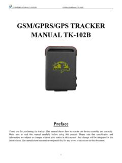
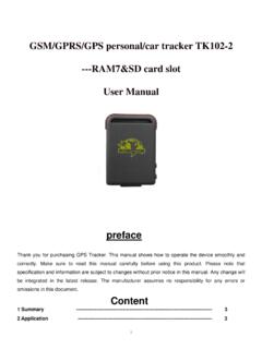
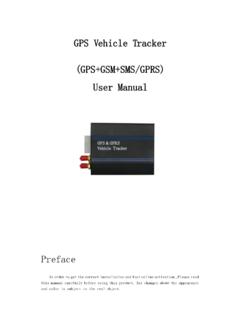
9 Many GPS units show derived information such as direction and speed, calculated from position changes. C. GPS message format A GPS contains a following message format: GPS message format Sub frames Description 1 Satellite clock, GPS time relationship 2 3 Ephemeris (precise satellite orbit) 4 5 Almanac component (satellite network synopsis, error correction) III. GT02 GT02 is a smart mini GPS vehicle tracker . The stylish design and high technology equipment make the device in high popularity. It is equipped with GSM wireless network and GPS. The performance of the device is outstanding because of the intelligent software mechanism and smart hardware design. Such as intelligent power-saving, static drift resistance, simple and reliable connector wide voltage input range etc. Fig. 2 Module- External view Fig.
10 3 Module- internal view et al, / ( IJCSIT ) International Journal of Computer Science and Information Technologies, Vol. 4 (6) , 2013, Features of GT02 1. Four-frequency system globally applicable. 2. High sensitivity of GPS receiver chip. 3. Smart open GPS locating. 4. Free press power button, working automatically after electrifying. 5. High integrated, mini size and easy to install. 6. GPS chipset with high sensitivity. 7. Built-in monitoring CPU, eliminating breakdown automatically. 8. Built-in ON/OFF power, wide voltage input range. 9. Built-in vibration sensor, smart power saving, avoid static drifting. 10. Dual build-in antenna. 11. Commands and location information received by SMS or platform. B. Process: Receives signals calculates Gives Sends message about longitudinal and latitude values IV.


