Transcription of APPENDIX F: FEMA FORMS
1 APPENDIX F: fema FORMS This APPENDIX includes copies of the following certificates that are mentioned in the Study Course and used in implementing your floodplain management ordinances: fema form 81-31, Elevation Certificate and Instructions fema form 81-65, Floodproofing Certificate The following fema FORMS may be of interest to local officials, but are not included in this APPENDIX : fema form 81-92, MT-EZ, Application form for Single Residential Lot or Structure Amendments to National flood insurance Program Maps; fema form 81-87, MT-1, Application FORMS for Conditional and Final Letters of Map Amendment and Letters of Map Revision Based on Fill; fema form 81-89, MT-2, Application FORMS for Conditional Letters of Map Revision and Letters of Map Revision; and Standard Flood Hazard Determination form .
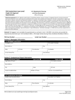
2 Current copies of all of these certificates and FORMS can be obtained from the following sources: They may be downloaded from fema s website at ; They are available on the CD-ROM version of the National flood insurance Program (NFIP) Floodplain Management Requirements: A Study Guide and Desk Reference for Local Officials; You may request the FORMS by calling the fema Map Assistance Center (FMAC) toll-free at 1-877- fema -MAP (1-877-336-2627); and You may request the FORMS electronically at While some of the FORMS may have passed their expiration dates, they are still current and should still be used. They may be reproduced for local use. fema FORMS F-1 fema FORMS F-2 fema FORMS F-3 FEDERAL EMERGENCY MANAGEMENT AGENCY NATIONAL flood insurance PROGRAM ELEVATION CERTIFICATE AND INSTRUCTIONS fema FORMS F-4 NATIONAL flood insurance PROGRAM ELEVATION CERTIFICATE PAPERWORK BURDEN DISCLOSURE NOTICE fema form 81-31 The public reporting burden for this form is estimated to be hours per response.
3 The burden estimate includes the time for reviewing instructions, searching existing data sources, gathering and maintaining the needed data, and completing, reviewing, and submitting the form . You are not required to respond to this collection of information unless a valid OMB control number appears in the upper right corner of this form . Send comments regarding the accuracy of the burden estimate and any suggestions for reducing this burden to: Information Collections Management, Federal Emergency Management Agency, 500 C Street, SW, Washington, DC 20472, Paperwork Reduction Project (3067-0077). NOTE: Please do not send your completed form to the above address. PURPOSE OF THE ELEVATION CERTIFICATE The Elevation Certificate is an important administrative tool of the National flood insurance Program (NFIP).
4 It is to be used to provide elevation information necessary to ensure compliance with community floodplain management ordinances, to determine the proper insurance premium rate, and to support a request for a Letter of Map Amendment or Revision (LOMA or LOMR-F). The Elevation Certificate is required in order to properly rate post-FIRM buildings, which are buildings constructed after publication of the flood insurance Rate Map (FIRM), for flood insurance Zones A1-A30, AE, AH, A (with BFE), VE, V1-V30, V (with BFE), AR, AR/A, AR/AE, AR/A1-A30, AR/AH, and AR/AO. The Elevation Certificate is not required for pre-FIRM buildings unless the building is being rated under the optional post-FIRM flood insurance rules. As part of the agreement for making flood insurance available in a community, the NFIP requires the community to adopt a floodplain management ordinance that specifies minimum requirements for reducing flood losses.
5 One such requirement is for the community to obtain the elevation of the lowest floor (including basement) of all new and substantially improved buildings and maintain a record of such information. The Elevation Certificate provides a way for a community to comply with this requirement. Use of this certificate does not provide a waiver of the flood insurance purchase requirement. Only a LOMA or LOMR-F from the Federal Emergency Management Agency ( fema ) can amend the FIRM and remove the Federal mandate for a lending institution to require the purchase of flood insurance . However, the lending institution has the option of requiring flood insurance even if a LOMA/LOMR-F has been issued by fema . The Elevation Certificate may be used to support a LOMA or LOMR-F request. Lowest floor and lowest adjacent grade elevations certified by a surveyor or engineer will be required if the certificate is used to support a LOMA or LOMR-F request.
6 This certificate is used only to certify building elevations. A separate certificate is required for floodproofing. Under the NFIP, non-residential buildings can be floodproofed up to or above the Base Flood Elevation (BFE). A floodproofed building is a building that has been designed and constructed to be watertight (substantially impermeable to floodwaters) below the BFE. Floodproofing of residential buildings is not permitted under the NFIP unless fema has granted the community an exception for fema FORMS F-5 residential floodproofed basements. The community must adopt standards for design and construction of floodproofed basements before fema will grant a basement exception. For both floodproofed non-residential buildings and residential floodproofed basements in communities that have been granted an exception by fema , a floodproofing certificate is required.
7 INSTRUCTIONS FOR COMPLETING THE ELEVATION CERTIFICATE The Elevation Certificate is to be completed by a land surveyor, engineer, or architect who is authorized by law to certify elevation information when elevation information is required for Zones A1-A30, AE, AH, A (with BFE), VE, V1-V30, V (with BFE), AR, AR/A, AR/AE, AR/A1-A30, AR/AH, or AR/AO. Community officials who are authorized by law or ordinance to provide floodplain management information may also complete this form . For Zones AO and A (without BFE), a community official, a property owner, or an owner s representative may provide information on this certificate, unless the elevations are intended for use in supporting a LOMA or LOMR-F. Certified elevations must be included if the purpose of completing the Elevation Certificate is to obtain a LOMA or LOMR-F.
8 In Puerto Rico only, elevations for building information and flood hazard information may be entered in meters. SECTION A - PROPERTY OWNER INFORMATION This section identifies the building, its location, and its owner. Enter the name(s) of the building owner(s), the building s complete street address, and the lot and block number. If the building s address is different from the owner s address, enter the address of the building being certified. If the address is a rural route or a Post Office box number, enter the lot and block numbers, the tax parcel number, the legal description, or an abbreviated location description based on distance and direction from a fixed point of reference. For the purposes of this certificate, building means both a building and a manufactured (mobile) home.
9 A map may be attached to this certificate to show the location of the building on the property. A tax map, FIRM, or detailed community map is appropriate. If no map is available, provide a sketch of the property location, and the location of the building on the property. Include appropriate landmarks such as nearby roads, intersections, and bodies of water. For building use, indicate whether the building is residential, non-residential, an addition to an existing residential or non-residential building, an accessory building ( , garage), or other type of structure. Use the Comments area of Section F if needed. If latitude and longitude data are available, enter them in degrees, minutes, and seconds, or in decimal degrees, taken at the center of the front of the building. Enter arc seconds to two decimal places.
10 Indicate the horizontal datum and the source of the measurement data (for example, taken with GPS, scaled from a USGS Quad Map, etc.). SECTION B - flood insurance RATE MAP (FIRM) INFORMATION Complete the Elevation Certificate on the basis of the FIRM in effect at the time of the certification. The information for Section B is obtained by reviewing the FIRM panel that includes the building s location. Information about the current FIRM and a pamphlet titled Guide to Flood Maps are available from the Federal Emergency Management Agency ( fema ) website at or by calling 1-800-427-4661. If a Letter of Map Amendment (LOMA) or Letter of Map Revision (LOMR-F) has been issued by fema , please provide the letter date and case number in the Comments area of Section D or Section G, as appropriate.