Transcription of CAPE TOWN EARTHQUAKES: AN ESSAY REVIEW
1 Draft Version: 030522:12h00 cape town EARTHQUAKES: REVIEW OF THE HISTORICAL RECORD Hartnady * Abstract The earthquake history of cape town , identified as a zone of seismic hazard on a mid-19th century global earthquake map, remains incomplete, vague, and often erroneous in the public memory. Before the Ceres-Tulbagh earthquake of 29 September 1969, the two largest historical earthquakes happened on 4 December 1809 and 2 June 1811. Detailed eyewitness descriptions establish that the common focus of these strong (magnitude ~6) events was only 20-30 km from the modern city centre, probably on a major shear structure identified, after Koeberg nuclear power-station investigations in the mid-1970s, as the Milnerton Fault.
2 Future recurrence of strong earthquakes along this seismogenic feature is a major natural hazard in the cape town area, but seismic emergency planning is neglected in the current Metropolitan Structural Development Framework. The southernmost part of the African continent is on the brink of a zone of very slow deformation (relative motions of ~2 mm/yr) between the Nubia (NB) and Somalia (SM) plates. The earthquake potential of this wide NB-SM plate boundary constitutes a grave natural threat to national security and socio-economic stability in Southern and Eastern Africa. earthquake anniversary commemoration and educational outreach programmes are means of raising public awareness of the danger and holding the relevant authorities accountable for its mitigation or provention.
3 _____ * Umvoto Africa (Pty) Ltd, PO Box 61 Muizenberg 7950, South Africa E-mail: Introduction Following recent media reports of a small earthquake that was felt on the 19th May 2003 in the coastal region on the northern boundary of the cape town metropolitan area, it is appropriate to REVIEW the significant events in the seismic history of the city, with a view to arousing public awareness of a substantial earthquake hazard in this area. Commentary on this latest event reveals that public memory of the cape town s seismic history is poor, and mainly dominated by the relatively distant Tulbagh-Ceres event of 29th September 1969.
4 There is almost no general recollection of much more proximate and dramatic events of 1809-1811, and of other earlier and later events that have been located close to the city, albeit erroneously in some cases. In part, this ignorance is due to a lack of access to and modern re-interpretation of original archived records or historical reports about cape town earthquakes, a few of which are of considerable seismological value even to the present day. Among the earlier examples is an earthquake that occurred on 4th September 1695, which in the official seismic catalogue 1 of the South African Council for Geoscience (CGS) is recorded as having occurred on "1695/10/4", a numerical mistranscription of the month.
5 There is even confusion about the time. The CGS catalogue, supported by the naturalist Von Buchenroder s account 2 in 1830, states that it occurred in the evening (circa 7 PM local time), whereas the historian Theal 3 says it happened during the morning. In the CGS catalogue, coordinates of the epicentre the surface point vertically above the earthquake focus - are given as 34,0 S 18,4 E, , the rough location of cape town , for want of any better alternative. The event description (loud thunderous noise and trembling of the earth, but no damage to any structures) corresponds to a level of about IV (Roman numeral 4) on the Modified Mercalli (MM) intensity scale.
6 This ordinal scale 4 is a standardised way of ranking, by values between I (one not felt, but evidenced by long-period effects, , swaying of doors or chandeliers, due to distant large magnitude earthquakes) and XII (twelve - nearly total destruction), the felt effects and types of damage experienced at a particular locality. Assuming that the earthquake focus was close to cape town , MM Intensity can be empirically translated into a modern instrumental ("Richter scale ) magnitude of about 1 Of particular seismological interest in historical accounts is the duration of the shaking. Theal (ref. 3, p. 374) remarks that shaking lasted only a "few seconds", whereas Von Buchenroder (ref.)
7 2, p. 25) notes that it seemed to go towards the interior of the colony, and to be of longer duration in some places than in others . An unsourced duration of 100 seconds is cited in some media accounts (cf. cape Argus Today in History column, 4th September 1996). Duration is important because it is 2related to the location and size of the earthquake . A nearby earthquake in the magnitude range 4-5 would produce shaking that lasts just a few seconds. A duration of "100 seconds" indicates an earthquake of greater magnitude at a large distance from cape town , or possibly but less likely a swarm of smaller events occurring in close temporal succession.
8 The " cape town " earthquake of 14th August 1857, which had a 25-30 second duration 5 and similar MM Intensities (IV-V) in places as widely spaced as cape town , Genadendal, Paleisheuwel and Citrusdal, is a good example of serious location error in the CGS catalogue. 1 The latter assigns it the same epicentre as the 1695 event and an identical calculated magnitude. Analysing contemporary reports in the foundation Volume (No. 1) of the " cape Argus", I established (1993 unpublished results) from the distribution of felt intensities that its epicentre was in the Ceres-Tulbagh area, and its magnitude was probably in the range ; not quite as large as the magnitude event on 29th September 1969 but definitely larger than the magnitude event on 2nd March 1977.
9 6 The 1857 earthquake is the first historical occurrence on the system of faults in the Ceres-Tulbagh area, a record previously held by an event on 9th October 1921 (reported in "The Argus" of 10 October 1921). 7 Whether or not a similar deduction about a distant epicentral location is possible for the 1695 event, is important to ascertain. If this earthquake did not have a distant focus, it provides useful information on the rate of recurrence of historical earthquakes that occurred on geological faults on the very doorstep of the Mother City. In 1855, the Irish naturalist Robert Mallet - of whom the American seismologist Charles Richter (ref.)
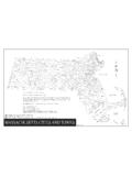
10 4, p. 30) writes that "no one man contributed more to the early organization of knowledge about earthquakes into a science" - published a global earthquake map under the auspices of the British Association for the Advancement of cape town is clearly shown as a zone of enhanced seismicity (Fig. 1), a reputation consequent on the strong events on 4 December 1809 and 2 June 1811. Accounts of the 1809 and 1811 earthquakes In 1830 von Buchenroder published a realistic eyewitness account 2 of the larger 1809 earthquake , for which the area of greatest structural damage - virtually complete destruction of the farmhouse - was on the farm Jan Biesjes Kraal, near modern Milnerton.