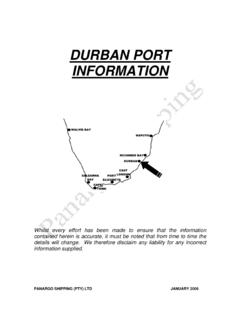
Transcription of CAPE TOWN PORT INFORMATION - Panargo
1 cape town PORT INFORMATION Whilst every effort has been made to ensure that the INFORMATION contained herein is accurate, it must be noted that from time to time the details will change. We therefore disclaim any liability for any incorrect INFORMATION supplied. Panargo SHIPPING (PTY) LTD JANUARY 2006 Table of Contents 1 UNCTAD 2 PORT GENERAL MAXIMUM 3 PRE ARRIVAL ETA CUSTOMS & STANDARD NOTICE OF REGULATIONS & GENERAL 4 PORT SEA BUOY, FAIRWAYS & DOCK NAVIGATION CHARTS AND TRAFFIC COAST BERTHING & 5 BERTHS AND BERTHS OPERATED BY BALLAST & CARGO GENERAL BERTHING 6 DOCKING SHIP REPAIR BUNKERS/ MEDICAL WORKING OFFICIALS AND 7 PORT WORKED EXAMPLE OF 3 cape town 1 PORT NAME cape town POSITION Latitude 33 54 ' S Longitude 18 26 ' E TIME GMT +2 hours UNCTAD LOCODE ZA CPT 2 PORT DESCRIPTION LOCATION At the south western extremity of the continent of Africa.
2 cape town is a large commercial port situated in Table Bay on the south west coast of South Africa and on the north side of cape Peninsula. The port consists of four main docks - Victoria Basin, Alfred Basin (used for recreation and fishing), Duncan Dock and Ben Schoeman Dock (used for cargo and containers), all protected by breakwaters. Good anchorage is found in the bay. GENERAL OVERVIEW Main imports: Chemical Timber Machinery Rice Soya Bean Meal/Pellets Various Grains Textiles and clothing Main exports: Deciduous fruit Prepared fruit (processed/canned) Citrus fruit Steel/Scrap Fresh fish Chemicals Prepared foods (processed/canned) Beverages (wine, fruit juices etc) Cement TOTAL CARGO HANDLED - 2005 cape town LANDED IMPORTS 1633362 COASTWISE 796717 TOTAL CARGO LANDED 2430079 SHIPPED EXPORTS 669037 COASTWISE 254422
3 TOTAL CARGO SHIPPED 923459 TRANSHIPMENT CARGO 155173 TOTAL CARGO HANDLED 3508711 * Total cargo includes coastal traffic and transhipments MAXIMUM SIZE Vessels up to 350m in length can be accommodated. Maximum draft permitted in the entrance to, and in Duncan Dock, is provided the level of the tide is at least above chart datum. 4 Large vessels up to 350 000 dwt in light condition displacing not more than 150 000t, with a draft max of m, may under normal conditions be berthed for bunkering or repairs. 3 PRE ARRIVAL INFORMATION ETA s 72 hours' advanced notice to agents. Vessels are not permitted to enter port unless agents have been appointed. ETAs to be given to agents every 24 hours thereafter, or sooner if change occurs, indicating time of arrival, last port of call, maximum draft, nationality, flag and any special requirements.
4 ISPS Requirements: Change from time to time thus it is important that Owners/Disponent Owners contact their agents for an up dated advice. ISPS must be submitted min of 4 days and max 7days prior arrival. DOCUMENTATION All documentation is arranged by the Agents Immigration Two Crew Lists Customs One Crew Lists Previous Port Clearance Nil List Port Call List One Ships' Store List List of Narcotics One Customs DA5 form One Declaration of crew's personal effects Port Health One Vaccinations List One Crew List One Maritime Declaration of Health Valid De-rat Certificate Ships agency Two Crew Lists Loadline Certificate Safety Radio Certificate Safety Equipment Certificate Safety Construction Certificate Tonnage Certificate IOPP Certificate RADIO cape town radio - ZSC. Operates 24 hours per day, 7 days per week. Inmarsat satellite not available.
5 Table Bay harbour control maintains permanent listening watch on VHF CH16. HEALTH Pratique obtained by radio 24 hours before ETA at first port of call in South Africa. Radio advice to be given between 24 and 48 hours prior to arrival, advising ETA, last port of call, date sailed, number of crew, state of health of crew and requesting radio pratique. If radio pratique is not granted, quarantine signals must be shown until ship has been cleared. Excellent medical facilities available. CUSTOMS & IMMIGRATION cape town is a port of entry. Penalties are imposed for non-compliance with prescribed regulations Drugs, non-declaration sealable and dutiable items etc. No other restrictions on crew or passengers. Crew/passengers may only travel within 100km range of cape town area. STANDARD MESSAGES Through cape town radio FLAGS Two flags, South African and Nationality, to be flown upon entry.
6 Also Pilot flag-H when pilot is on board and "I" flag until Immigration clearance. NOTICE OF READINESS To vessel's agent or cargo agent as per charter party. REGULATIONS & GENERAL NOTICES Harbour Regulations available on request from the agent or pilot. AGENCY No special arrangements but sometimes written into a charter party. 4 NAVIGATION PORT LIMITS Depth at entrance channel m Entrance depth at chart datum : Victoria Basin m Duncan Dock m Ben Schoeman Dock m Permissible vessel dimensions : Maximum length m Maximum beam m Maximum draft m (provided the level of the tide is at least m above chart datum) Large vessels up to 350 000 dwt in light condition displacing not more than 150000t, with a draft maximum of may under normal conditions be berthed for bunkering or repairs. Position of seaward boundaries: Line between Mouille Point Lighthouse and Robin Island Lighthouse and a line from Robin Island Lighthouse due east to the mainland.
7 SEA BUOY, FAIRWAYS & CHANNELS Fairway Buoy - position : Breakwater bearing 170 deg T x miles RACON NW. - The SE corner of the dredged channel is marked by a Light Buoy - A pair of light buoys, numbered 1 and 2, mark the outer end of the channel. - The Fairway Buoy A 2 000m long entrance channel from buoys, dredged to over a width of 450m, leads from the roads to the SSE to the harbour entrance. PILOT Pilots board vessels in the 1 mile north west off Fairway Buoy, positioned 2 miles north and west of the breakwater end. Pilotage compulsory - one hour notice to be given to Port Control on VHF 16. Pilot launch black and white, with pilots on the side of the vessel. Helicopter rendezvous for pilot transfer by special arrangements. 1 pilot available/required per vessel. Minimum drafts by arrangement, dependent upon weather conditions.
8 ANCHORAGES Vessels may enter anywhere within the port limits. There are no special anchorages. Anchorage is prohibited in the dredged channel and approaches up to 2 miles NNW of the breakwater light. Its SE corner is marked by a Light Buoy. The holding ground is not good in strong winds. In winter months there is no safe anchorage during westerly gales. Vessels should have main engines available and be prepared to get underway and steam seaward when these conditions prevail. TIDES 1,6 m springs. Tidal height : MHWS , MHWN AND MLWN There is no significant tidal current but heavy range action is sometimes experienced at berths particularly during the winter months as a result of westerly gales. Tides Low Water Rise High Water (m) (m) (m) (m) Spring Neap DOCK DENSITY 1025 WEATHER During the summer months from October to February, it is dry with little rain; the prevailing wind is south easterly, at times rising to gale force.
9 North westerly gales backing to south westerly are common in winter particularly during June, July and August. During winter gales moderate scend can be experienced in the docks. Fog occurs during winter at the change of seasons. VHF Table Bay Port Control can be contacted on VHF CH 16 (calling) and CH 12 (working). Agents are not permitted to use VHF to contact the vessel. They must work through cape town radio. NAVIGATION AIDS 3 lighthouses - Mouille Point, Robben Island and Milnerton 3 channel buoys and 1 shallow water buoy There are no leading lights in anchorage. Areas to avoid: Buoy at Whale Rock - 33 S, 18 E - Flash 6 short, 1 long, every 10 seconds Prominent landmarks: Table Mountain CHARTS AND PUBLICATIONS Charts : 1846, 1920, 2091, 1014, 1013 (All SAN) ( ports and approaches) TRAFFIC SCHEMES Vessel Traffic Management Schemes in operation at the port or its approaches - implementation September 1995 - report 4 miles off port limits to Port Control.
10 Radar coverage is supplied by Port Control for whole anchorage. RESTRICTIONS Vessels with hazardous cargo in tanker basin - daylight only. TUGS Ordered at pilot's discretion. 3 x Voigt Schneider-type diesel tugs of 3 900HP each, with a bollard pull of 41-42t. In addition 1 x 10t bollard tug and 3 modern diesel launchers of 10 knot speeds with bollard pull. Tug lines. The employment of fire fighting tugs or similar for tankers during loading/discharging are not compulsory. Berths are equipped with fire-fighting connections - dependent on Municipality. Dock fire brigade is a fire guard. COAST GUARD Sea Rescue services are co-ordinated from Port Control in conjunction with the National Sea Rescue Institute and the Maritime Rescue Co-ordination Centre.


