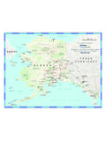
Transcription of Delaware County
1 Open Recreation Areas and Use Designations by CountyLast Update: 1/5/2018 NaturalResourcesDivisionNaturalResources DivisionDelaware County ** Hunting by Bow OnlyRECREATION AREAACRESTRAPHUNTFISHHIKEWMULOCATIONTOWN DUA21 PAA4 PYYYYY 520 Alpaca RidgeThompson Hollow 136 Archie Elliott RoadArchie Elliot 365 ArenaReservoir 481 Bagley BrookCounty Highway 2 NDelhi4 PYYNYY 198 Bagley Brook HeadwatersCounty Route 2 & Herr RoadNAndes4 OYYYYY 421 Barbour BrookBarbour Brook 141 BarkaboomBarkaboom 213 Basin CloveBasin Clove & Robinson 9 Baxter BrookHarvard 262 Bear SpringNYS Route 206 NWalton4 WYYYYY 11 Beaverkill WestCounty Route 7 NColchester4 WYYYYY 245 Beech HillBeech Hill 851 BeerstonNYS Route 10 NWalton4 OYYYYY 332 Bell HillPeakes Brook & Bell Hill 103 Betty Brook RoadBetty Brook
2 +YYYYY 351 BloomvilleNYS Route 10, County Route 18, & Bramley Mountain 59 Bobs BrookBobs Brook 78 Boulder HillCounty Route 36 NRoxbury4 PYYNYY 202 Bragg HollowBragg Hollow 1,243 Bramley MountainBramley Mountain 70 Brook RoadBrook 226 Brush RidgeKoop 278 Bryants BrookNYS Route 28 NAndes4 RYYNYY 346 Buffalo HollowGeorge Lawrence 190 Bullet HoleBullet Hole \\kngdsgis01\WaLIS\Reports\Server\Land Use Permits\LUP Report by - Public Access AreaDUA - Day Use AreaPage 1 of 1401/05/201812 Open Rec Areas and Allowed Uses by County (cont.)** Hunting by Bow OnlyRECREATION AREAACRESTRAPHUNTFISHHIKEWMULOCATIONTOWN DUA21 PAA4 PYYYYY 247 Bussey HollowBussey Hollow 143 Canada HollowCanada Hollow 254 Cape HornCape Horn RoadNBovina4 PYYYYY 248 Carey RoadNYS Route 28 NDelhi4 PYYYYY 170 Carman RoadCarman 175 Cat HollowNYS Route 30 NColchester4 OYYYYY 174 Chambers HollowChambers Hollow 102 Chipmunk HollowChipmunk Hollow 189 Churchill MountainMcGregor & Tower Mountain 55 CleaverFINCH HOLLOW RDNT ompkins4 PYYYYY 482 Cole HillSwart 362 Coulter BrookCoulter Brook 101 Couse HillCounty Route 27 NMasonville4 PYYYYY 22 Covered BridgeNYS Route 10 NDelhi4 OYYYYY 432 Covert HollowCovert Hollow 55 CovesvilleHog Mountain 237 Crescent ValleyBoggs RdNBovina4 OYYYYY
3 95 Cross RoadDryden Brook & Cross 47 Crystal CreekDunk Hill & Fish Hollow 95 Davis Hollow **Davis Hollow RoadNAndes4 PYYNYY 649 Delaware HeadwatersNYS Route 30 NRoxbury4 RYYYYY 470 DenverRoute 36 NMiddletown4 PYYNYY 91 Dingle HillLower Dingle Hill RoadNAndes4 OYYYYY 58 Dry BrookDry Brook 87 Dryden BrookDryden Brook 189 Duggan HillDuggan Hill 430 Dunraven NorthCounty Route 6 NMiddletown4 PYYYYY 246 East Bramley MountainEast Bramley Mountain 59 East Branch DelawareNYS Route 30, County Route 41, & Briggs 72 East BrookEast Brook \\kngdsgis01\WaLIS\Reports\Server\Land Use Permits\LUP Report by - Public Access AreaDUA - Day Use AreaPage 2 of 1401/05/201812 Open Rec Areas and Allowed Uses by County (cont.)** Hunting by Bow OnlyRECREATION AREAACRESTRAPHUNTFISHHIKEWMULOCATIONTOWN DUA21 PAA4 OYYNYY 138 East MasonvilleCounty Route 27 NMasonville4 OYYYYY 445 East Platner BrookCounty Route 16 NFranklin4 PNYYNN 20 East River RoadCounty Route 26 NHamden4 OYYYYY 151 Elk CreekElk Creek RdNMeredith4 PYYYYY 387 Fall Clove RoadFall Clove 138 Fall Clove SouthFall Clove RdNAndes4 OYYNYY 49 Finch HollowFinch Hollow 844 Fish BrookFish Brook 398 Fish HollowFish Hollow 403 Fletcher HollowFletcher 69 Floyd Finch RoadFloyd Finch 2,146 Flynn BrookNYCBWS Road 6 NAndes4 OYYNYY 82 Freer HollowFreer Hollow 319 Gladstone HollowGladstone Hollow 47 Glen BurnieGlen Burnie RdNDelhi4 OYYYYY 200 Gregory HillCrowe Rd.
4 & County Route 33 NKortright4 PYYNYY 143 Griffin HillCounty Hwy 18 NStamford4 RYYNYY 109 Grinch HouseJohnson 184 Gun House HillGun House Hill 47 Hardscrabble RoadHardscrabble 43 Hawk HollowHawk Hollow Rd (Howard Green Rd.)NRoxbury4 PYYNYY 169 Hemlock KnollsCounty Highway 2 NAndes4 OYYNYY 216 Herrick HillHerrick Hollow and Lake Cecil RoadsNMasonville4 PYYNYY 85 HinkleyCarroll Hinkley 57 Hollister HillHollister Hill 232 Holmes HollowHolmes Hollow RdNDelhi4 OYYNYY 79 Honest BrookHonest Brook RdNDelhi4 WYYYYY 7 Horton BrookHorton Brook 96 Huckleberry BrookHuckleberry Brook 30 Hughes BrookFederal Hill Rd 2 NDelhi\\kngdsgis01\WaLIS\Reports\Server\ Land Use Permits\LUP Report by - Public Access AreaDUA - Day Use AreaPage 3 of 1401/05/201812 Open Rec Areas and Allowed Uses by County (cont.)
5 ** Hunting by Bow OnlyRECREATION AREAACRESTRAPHUNTFISHHIKEWMULOCATIONTOWN DUA21 PAA4 OYYYYY 152 Irish HillIrish Hill 282 Irish MountainNYS Route 30 NRoxbury4 ONNNYN 3,804 Johnny BrookBarbour Brook 28 Johnny Cake LaneCounty Route 6 NMiddletown4 PYYYYY 490 Kettle HillSearles 345 Kiff BrookShaw 56 Kortright PatentShaw 58 Launt HollowLaunt Hollow 100 Little DelawareBob Hall 171 Little Dingle HillDingle Hill RoadNAndes4 RYYYYY 35 Little Red KillLittle Red Kill RdNMiddletown4 OYYNYY 99 LoomisJenkinsNWalton4 PYYNBOWY 33 Lower Dingle Hill **Dingle Hill RdNAndes4 PYYYYY 30 MacDonald RoadMacDonald 36 Mallory BrookCounty Route 26 NHamden4 OYYNYY 126 McArthur HillKiff Brook & McArthur Hill 116 Meekers HillClose Hollow 133 Mill MountainMountain Brook & New Kingston RdsNBovina4 WYYNYY 23 Miller HollowMiller Hollow 341 Miller RoadMiller 132 More ParkMurphy Hill RoadNWalton4 RYYNYY
6 369 Morris HillState Route 30 NMiddletown4 OYYNYY 39 Mountain TopFish Brook 38 MundaleEast Brook 514 Murphy HillNYCBWS Rd. 6 & Murphy Hill 173 Narrow NotchNarrow Notch & Town Brook 457 New Kingston MountainNew Kingston Mountain 369 New RoadNew 44 North Walton **Palmer Hill RoadNWalton4 OYYYYY 44 Odell Lake RoadO'Dell Lake \\kngdsgis01\WaLIS\Reports\Server\Land Use Permits\LUP Report by - Public Access AreaDUA - Day Use AreaPage 4 of 1401/05/201812 Open Rec Areas and Allowed Uses by County (cont.)** Hunting by Bow OnlyRECREATION AREAACRESTRAPHUNTFISHHIKEWMULOCATIONTOWN DUA21 PAA4 PYYNYY 235 Palmer HillFinkle Rd. & NYS Route 28 NAndes4 OYYYYY 197 Peakes BrookPeakes Brook & Frank Hafele 291 Pepacton LedgesNYS Route 30 NAndes4 PYYNYY 567 Pepacton PlateauShaver Hollow RoadNAndes4 PYYNYY 233 Perch LakePerch Lake 925 Pine MountainNYS Route 30 & Intake 87 Pines BrookPines Brook 1,202 Pink StreetScutt Mountain RdNStamford4 OYYYYY 132 Platner BrookCounty Route 16 NDelhi4 PYYYYY 625 Plattekill MountainLower Meeker Hollow 75 PlymouthCounty Route 21 NFranklin4 PYYYYY 360 Raynor BrookNYCBWS Rd.
7 1 NColchester4 WYYYYY 13 Read CreekHorton Brook 82 Red KillBig Red Kill 196 Rehor RoadBarkaboom & Rehor 123 Reuben Todd RoadReuben Todd 51 River RoadRiver 339 Roods CreekSands Creek Rd. & NYS Route10 NTompkins4 PYYNYY 81 Roses BrookRoses Brook 150 Roses Brook FarmRoses Brook RdNStamford4 PYYNYY 121 Roxbury RunCounty Hwy 8 NRoxbury4 OYYNYY 44 Russell RoadRussell RdNWalton4 RYYYYY 584 Sallys AlleySally's Alley & George Lawrence 1,610 Sands CreekNYCBWS Road 6 NTompkins4 PYYNYY 318 Scotch MountainScotch Mountain 33 Shaver HollowShaver Hollow 399 Shavertown Bridge NYCBWS Road 4 NAndes4 PNYYNN 71 Shaw RoadNYS Route 10 NKortright4 PYYNYY 89 South DunravenBen Meeker 38 South Finch HollowFinch Hollow RdNTompkins\\kngdsgis01\WaLIS\Reports\Se rver\Land Use Permits\LUP Report by - Public Access AreaDUA - Day Use AreaPage 5 of 1401/05/201812 Open Rec Areas and Allowed Uses by County (cont.)
8 ** Hunting by Bow OnlyRECREATION AREAACRESTRAPHUNTFISHHIKEWMULOCATIONTOWN DUA21 PAA4 WYYNYY 70 South River RoadSouth River 35 South RoxburyRed Kill RoadNRoxbury4 OYYNYY 3,708 Speedwell MountainNYS Route 10 NTompkins4 PYYNYY 36 Sprague RoadSprague 586 Spring ValleyWaterman 277 State Road Hollow1565 State 35 Steele BrookCounty Hwy 14 NDelhi4 OYYNYY 36 Sutherland RoadPeakes Brook 70 Thompson HollowThompson Hollow 107 Tower MountainFish Brook 29 Town BrookTown Brook 127 Township ValleyDavis 191 Tremper KillCounty Route 1 NAndes4 PNYYNN 41 Twin PondCemetery & Searles 47 Van Aken RoadNYS Route 23 NRoxbury4 RYYYBOWY 23 Van Aken Road North **Van Aken 61 Vega MountainVega Mountain 85 Vinci BrookNYS Route 30 NColchester4 OYYNYY 71 Wagon WheelWagon Wheel 828 Weaver HollowWeaver Hollow 109 West HalcottRed Kill 199 West MasonvilleState Route 206 NMasonville4 OYYYYY 83 West
9 Platner BrookPlatner Brook 382 West SchoharieWillium Lutz 2,489 West SettlementBurroughs Memorial, & Andrew Gray 34 Whiskey HollowWhiskey Hollow 120 Whiskey TowerCounty Route 18 NStamford4 OYYNYY 135 Windfall RoadWindfall 142 Wolf HollowCoss RdNAndes4 PYYYYY 22 Wolf Hollow SouthWolf Hollow \\kngdsgis01\WaLIS\Reports\Server\Land Use Permits\LUP Report by - Public Access AreaDUA - Day Use AreaPage 6 of 1401/05/201812 Open Rec Areas and Allowed Uses by County (cont.)** Hunting by Bow OnlyRECREATION AREAACRESTRAPHUNTFISHHIKEWMULOCATIONTOWN DUA21 PAA4 OYYYYY 190 Wright BrookCounty Route 33 NKortrightDutchess CountyRECREATION AREAACRESTRAPHUNTFISHHIKEWMULOCATIONTOWN DUA21 PAA3 NNYYNN 96 AlamarNYS Route 52 & White Pond Fishkill3 NNYYYN 803 East FishkillNYS Route 52 & Leetown FishkillGreene County ** Hunting by Bow OnlyRECREATION AREAACRESTRAPHUNTFISHHIKEWMULOCATIONTOWN DUA21 PAA3 AYYYYY 853 Balsam MountainSpruceton 53 Barnum RoadBarnum 481 BataviaNYS Route 23 & County Route 17 NAshland4 RYYYYY 656 Beech RidgeBeech Ridge 243 Black Dome ValleyCounty Route 56 NWindham4 RYYYYY 77 BrooksburgState Route 23 NWindham4 RNYYNN 95 Brownell CreekKaftas & West Settlement 221 Bump Mountain Mill
10 30 Camp MeadowbrookMaple AvenueNHunter4 RYYYYY 225 Campbell RoadCampbell 317 Case RoadCase Rd & County Route 10 NAshland4 RYYYYY 370 Cave MountainGoshen 227 Center JewettNYS Route 23 ANJewett4 RYYNYY 337 Cozy HollowCounty Route 10 & Cozy Hollow 120 Deer RunDeer Run 189 DevasegoNYS Route 23 & County Route 7 NPrattsville4 RNNNNN 53 Devasego Park Day Use AreaCounty Route 7 YPrattsville3 AYYNYY 86 Diamond NotchDiamond Notch 665 Dog HillGilboa 104 East WindhamNYS Route 23 & High Peak \\kngdsgis01\WaLIS\Reports\Server\Land Use Permits\LUP Report by - Public Access AreaDUA - Day Use AreaPage 7 of 1401/05/201812 Open Rec Areas and Allowed Uses by County (cont.)** Hunting by Bow OnlyRECREATION AREAACRESTRAPHUNTFISHHIKEWMULOCATIONTOWN DUA21 PAA4 RYYYYY 247 Four CornersCounty Route 11 & Albert Slater 115 HalcottWest Settlement 506 Halcott CenterElk Creek 31 Halcott Center North **NHalcott3 AYYYYY 105 High PeakHigh Peak 393 Huntersfield CreekCounty Route 10 & Stanley Slater 301 Jennie NotchJennie Notch 95 John Chase BrookRT 13 NLexington3 AYYYYY 143 Katydid CreekShad 325 Lake HeloiseNauvoo RoadNWindham3 AYYNYY 131 Lanes BrookBEECHER RDNH unter4 RYYYYY 46 Lewis CreekMail Rte Rd - County Route 5 NAshland4 RYYYYY 315 Little WestkillTruesdell 253 Maben HillNYS Route 23 ANLexington4 RYYNYY 146 Macumber RoadMacumber Rd.