Transcription of FIELD MANUAL - USDA
1 ENGINEERING FIELD MANUAL for Conservation Practices PREFACE L The objective of this MANUAL is to provide guidance in the use of basic engineering principles, techniques, and procedures for the planning, design, installation, and maintenance of soil and water conservation prac- tices. The material presented is limited to the types of conservation practices which are used most often. more complex practices are included in the various sections of the SCS National Engineering Handbook. Engineering procedures and data for The MANUAL is intended primarily for use at the FIELD office level. Basic principles of planning, design, construction, and maintenance of engineering measures are essentially the same regardless of the job loca- tion. But, to assure the applicability of the MANUAL nationally, it was necessary to treat certain portions of the text in a more general manner than would have been the case had it been prepared for a specific region or area. It is expected that State or regional additions may need to be made to certain sections of the text to conform to local or regional standard practices or to provide more detail.
2 Most chapters contain a limited number of tables, charts, curves, and forms used in solving planning and design problems. The training of per- sonnel in the use of this MANUAL may be facilitated if the states insert their approved design aids in the applicable chapters. Design aids which are added should give results consistent with similar ones in the MANUAL . Except in the chapter on Structures, design aids are labeled as Ex- hibits and placed at the end of the appropriate chapter. Once the user has become familiar with the techniques and procedures in the MANUAL he may wish to remove the exhibits and bind them in a reference book for FIELD use without destroying the continuity of the text. The MANUAL is not intended to supersede national or state engineer - ing standards and specification of the Soil Conservation Service as they pertain to various conservation practices. Development of this MANUAL was guided by the following committee, as- signed by C. J. Francis, Director, Engineering Division, SCS, Washington, (Retired) Harold M.
3 Kautz, Chairman, Head, Engineering and Watershed Planning Unit, Northeast Region (Retired) (Retired) James A. Aull, State Conservation engineer , South Carolina R. C. Barnes Keith H. Beauchamp, T. B. Chambers, Roy I,. Fox, J. W. Haas, Agricultural engineer , Engineering Division, SCS, Washington, (Retired) Irrigation engineer , Engineering and Water- shed Planning Unit, Midwest Region. (Retired) Former Head, Engineering and Watershed Plan- ning Unit, Southeast. (Retired) State Conservation engineer , Oregon. (Retired) Presently Deputy Chief, Natural Resource Projects, SCS, Washington, I SECOND PRINTING The supply of the 1969 Edition is exhausted. All changes made since that time have been incorporated in this printing. vances in technology and materials make it difficult to keep this handbook up to date. Further revisions, corrections, or additions will be made in the handbooks used by SCS employees as new information becomes avail- able Rapid ad- Soil Conservation Service Washington, '.
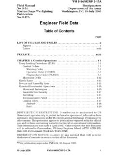
4 April 1975 THIRD PRINTING June 1979 FOURTH PRINTING July 1984 ENGINEERING FIELD MANUAL CONTENTS .- CHAPTER 1 .. 2 .. 3 .. <' 4 .. 5 .. 6 .. 7 .. 8 .. 9 .. 10 .. 11 .. 12 .. ENGINEERING SURVEYS EST I MAT1 NG RUN0 FF HYDRAULICS ELEMENTARY SOILS ENGINEERING PREPARATION OF ENGINEERING PLANS STRUCTURES GRASSED WATERWAYS AND OUTLETS TERRACES DIVERSIONS GULLY TREATMENT PONDS AND RESERVOIRS SPRINGS AND WELLS 13 .. DIKES AND LEVEES - WILDLIFE WETLAND DEVELOPMENT 14 .. DRAINAGE 15 .. IRRIGATION 16 .. STREAMBANK PROTECTION 17 .. CONSTRUCTION AND CONSTRUCTION MATERIALS 18 .. SOIL BIOENGINEERING FOR UPLAND SLOPE PROTECTION AND EROSION REDUCTION 19 .. HYDROLOGY TOOLS FOR WETLAND DETERMINATION Chapter 1 Engineering Surveys Contents Page Introduction 1-1 Fundamentalsofsurveying .. 1-2 Measurement of dimensions .. 1-2 Determining horizontal position .. 1-3 Determining vertical position .. 1-4 Surveyingequipment .. 1-5 Tapes 1-5 Levels 1-5 engineer s levels .. 1-5 Laser levels 1-5 engineer stransit.
5 1-8 Electronic surveying systems .. 1-8 Electronic distance-measuring equipment .. 1-9 Level rods and accessories .. 1-9 Fieldbooksandspecial forms .. 1-9 Programmable calculators .. 1-16 1-16 Maintainingtapesandchains .. 1-16 Transportingsurveyinginstrumentsandacces eories .. 1-16 Mounting instruments on tripod .. 1-16 Cleaning and storing equipment .. 1-16 Checkingandadjustinginstruments .. 1-18 Handlevels 1-18 Dumpylevel 1-18 Transitortheodolite .. 1-19 Planetable and telescopic alidade .. 1-19 Electronic and self-leveling survey equipment .. 1-22 Handsignals 1-23 Survey notes and symbols .. 1-23 Measurement of horizontal distances .. 1-28 Pacing 1-28 Taping 1-28 Stadia 1-30 Electronic equipment .. 1-30 Differentialleveling .. 1-31 Common terms used in leveling .. 1-31 Settingupthelevel .. 1-31 Bench level circuit .. 1-33 Profiles and cross sections .. 1-34 Use of grade rod 1-40 Setting up slope stakes .. 1-41 Topographic and control surveys .. 1-58 engineer s transit (primary instrument).
6 1-58 Setting up the transit .. 1-58 Measuring horizontal angles .. 1-59 Measuring vertical angles .. 1-59 1-60 .. Handlevels .. 1-5 .. Planetableandalidade .. 1-9 Care and handling of surveying instruments .. L .. Aerialphotographs .. 1-30 .. Transit traverse by deflection angles .. i Transit-stadiatraverse .. 1-61 Horizontal control only .. 1-62 Horizontal and vertical control .. 1-64 Gridsurveys .. 1-65 Topographic surveys with planetable and alidade .. 1-71 Setting up the planetable .. 1-71 Mappingprocedures .. 1-73 Beamanstadiaarc .. 1-74 Topographic surveys by aerial photos. ground control surveys. and stereoplotter .. Circularcurves .. 1-82 Bytransit .. 1-82 By tangent offsets .. 1-86 .. 11 Figures page 1-1 Horizontal angles .. 1-3 1-2 Azimuths and bearings .. 1-4 L 1-3 Locke hand level .. 1-6 1-4 Abney hand level .. 1-6 1-5 Clinometer .. 1-7 1-6 engineer 's dumpy level .. 1-7 1-7 Self-leveling level .. 1-8 1-8 Laser level transmitter and receiver .. 1-10 1-9 engineer 's transit.
7 1-12 1-10 Electronic theodolite .. 1-13 1-11 Electronic distance-measuring instrument .. 1-14 1-13 Self-indexing alidade .. 1-15 1-14 Range pole and surveying rods .. 1-16 1-15 Adjustment of level (two-peg method) .. 1-20 1-16 Code of hand signals (instructions) .. 1-24 1-17 Code of hand signals (numbers) .. 1-25 1-18 Symbols for soil and water conservation engineering maps and drawings .. 1-26 1-19 Soil symbols for soil and water conservation engineering maps and drawinga .. 1-27 1-20 Breakingchain .. 1-29 1-21 Method of differential leveling (metric) .. 1-32 1-21(a) Method of differential leveling (English) .. 1-32 1-22 Survey notes-bench level circuit (metric) .. 1-34 1-22(a) Survey notes-bench level circuit (English) .. 1-36 1-23 Survey notes-profile and cross section (metric) .. 1-37 1-23(a) Survey notes-profile and cross section (English) .. 1-41 1-24 Determining cut and fill with grade rod (metric) .. 145 1-24(a) Determining cut and fill with grade rod (English).
8 1-45 1-25 Survey notes-ditch survey using grade rod (metric) .. 146 1-25(a) Survey notes-ditch survey using grade rod (English) .. 1-49 1-26 Location of slope stakes (metric) .. 1-52 1-26(a) Location of slope stakes (English) .. 1-53 1-27 Survey notes-slope stakes for dam (metric) .. 1-54 1-27(a) Survey notes-slope stakes for dam (English) .. 1-56 1-28 One-minute vernier set at 0" .. 1-59 1-29 One-minute vernier set for measurement .. 1-59 1-30 Offset ties to traverse station (metric) .. 1-60 1-30(a) Offset ties to traverse station (English) .. 1-60 1-31 Deflectionangles .. 1-60 1-32 Survey notes-deflection angle traverse (metric) .. 1-61 1-32(a) Survey notes-deflection angle traverse (English) .. 1-63 1-33 Azimuths from north .. 1-64 1-34 Survey notes-stadia traverse survey for horizontal control (metric) .. 1-65 1-34(a) Survey notes-stadia traverse survey for horizontal control (English) .. 1-66 1-35 Method 3,4, and 5 of laying out a right angle.
9 1-67 1-36 Method of topographic survey by gridding (metric) .. 1-68 1-36(a) Method of topographic survey by gridding (English) .. 1-69 1-37 Survey notes-grid survey (metric) .. 1-70 1-37(a) Survey notes-grid survey (English) .. 1-71 1-38 Location of a point on planetable .. 1-72 1-39 Triangle of error and geometric relationship to point sought (planetable) .. 1-73 1-40 Survey notes-planetable topography (metric) .. 1-76 1-12 Telescopic alidade and planetable tripod .. 1-15 iii 1-4Ma) Survey notes-planetable topography (English) .. 1-78 1-41 Examples-identification of ground control points for stereoplotter (metric) .. 1-80 1-41(a) Examples-identification of ground control points for stereoplotter (English) .. 1-81 1-42 Circular curves in traverse survey .. 1-82 1-43 Elements of circular curve .. 1-82 1-44 Layout of circular curve (metric) 1-83 1-44(a) Layout of circular curve (English) .. 1-83 1-45 Survey notes-circular curve (metric).
10 1-85 1-45(a) Survey notes-circular curve (English) .. 1-87 1-46 Curve layout by tangent offsets .. 1-88 .. 4 ChaDter 1 Engineering Surveys Introduction Surveying is the science or art by which lines, distances, angles, and elevations are established and measured on or beneath the earth s surface. In plane surveying, as it pertains to this chapter, the curvature of the earth is neglected and measure- ments are made with the earth considered as a plane surface. From these measurements are deter- mined locations, directions, areas, slopes, and volumes. Surveying information obtained and recorded in the FIELD can be represented graphically by diagrams, maps, profiles, and cross sections. The required precision and accuracy of a survey vary with its purpose. Whether the survey is rough or precise, enough checks must be applied to the fieldwork and in the preparation of the plans to pro- vide acceptable accuracy of the results. Precision is the degree of tolerance applied in in- struments, methods, and observations.