Transcription of Frequently Asked Questions - Caltrans
1 california department OF transportation Who decides when to close I-5?The california Highway Patrol (CHP) with concurrence from the california department of transportation ( Caltrans ) makes this decision. Closures on the Grapevine as well as other mountain roads are designed to avoid a worst-case scenario and are based on road conditions as opposed to the experience level of individual drivers. Why are chains not allowed on the Grapevine, as is the case on I-80 over Donner Pass?Since the snow and icy conditions are often limited to the summit, a location for the removal of chains would have to be made available and this is not viable due to the traffic volumes. This can make driving all the more dangerous when it does snow because drivers who don't travel through the Grapevine regularly would not be carrying chains, not expect snow, nor have much experience driving in differences between the two passes are the grades and traffic volumes. The Grapevine is 6% grade for 5 miles, while Donner Pass is 3-6% grade for 30 miles.
2 The graph illustrates the steepness of the Grapevine, over a shorter stretch of roadway as compared to Donner Pass, in addition to greater than double traffic volumes.* Frequently Asked QuestionsWhere can I find updated information? Caltrans , the CHP, the National Weather Service,along with commercial broadcasting services (TV and Radio) provide various methods to monitorthe status of winter Advisory Radios (HAR) / Changeable Message Signs (CMS) Caltrans broadcasts road condition information on low frequency radio transmitters. Watch for flashing road signs and tune to the frequency listed. In addition, closure information is displayed on CMS along I-5 and other impacted Highway Information Network (CHIN) - Road Conditions via Phone or InternetCaltrans provides voice-activated up-to-date information on any california Highway by calling: 1-800 -427-ROA D (7623).This information is also available on the Internet at: Weather Service Internet long after it stops snowing, will the roadway be reopened?
3 Your safety is our top priority. Caltrans Maintenance Supervisors, along with the CHP, monitor the weather and highway conditions. If inclement weather is forecasted, a snow removal crew is activated to monitor and observe the actual conditions. If there is a high probability that a storm will pass through the Grapevine area, a base crew will be mobilized. After the storm, the crews conduct clean-up operations, in order to re-open the roadway and make certain that it is safe for motorists, including, plowing, sanding, and are a number of factors that preclude the start of these operations, such as the surface temperature. It does not have to feel particularly cold for the roads to freeze, road surface temperatures can be as much as 4 to 10 degrees colder than the air temperature. Other factors include the overnight temperatures, which dictate how quickly the snow and ice will melt, along with the available personnel and the severity of the District 6 on the web at: : it t e r : Grapevine/Tejon Pass Closure0200040006000800013579 11 13 15 17 19 21 23 25 27 29 Eleva on (Ft)Miles* Number of vehicles, peak month daily traffic**- 40,500 - 73,500 Donner PassGrapevineRev.
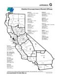
4 2015It s The Law!On January 1st, 2010, california Vehicle Code (CVC) 21809(a), took effect. It states, in part, that the driver of a motor vehicle while on a freeway approaching an Emergency Response Vehicle (CHP, Caltrans , tow truck, etc.) displaying emergency or flashing lights, shall approach with due caution and, before passing in a lane immediately adjacent to the Emergency Vehicle, make a lane change into an available lane not immediately adjacent to the Emergency Vehicle with due regard for safety and traffic conditions, if practicable and not prohited by law. If the maneuver described above would be unsafe or impracticable, slow to a reasonable and prudent speed that is safe for existing weather, road and vehicular or pedestrian traffic conditions. us onoutside quarter 1 11/24/2015 4:00:43 PMCALIFORNIA58 CALIFORNIA14 CALIFORNIA101 CALIFORNIA101 CALIFORNIA101 CALIFORNIA41 CALIFORNIA46 CALIFORNIA41 CALIFORNIA46 CALIFORNIA99 CALIFORNIA166 CALIFORNIA166 CALIFORNIA33 CALIFORNIA33 CALIFORNIA33 CALIFORNIA119 CALIFORNIA58 CALIFORNIA58 CALIFORNIA178 CALIFORNIA178 CALIFORNIA155 CALIFORNIA435555 NAlternative Routes usedto avoid the GrapevineBACKGROUNDR epresented by the bull s-eye on the map, the Grapevine is a steep portion of Interstate 5 (I-5) that winds through Tejon Pass at the southern end of the San Joaquin Valley.
5 Full closures of I-5, due to snow and icy conditions, occur during the winter months an average of 3-5 times between October and April. Typically, closures last from 4-6 hours, however some may last longer than 24 hours. In response to these emergency closures, the california department of transportation ( Caltrans ), the california Highway Patrol (CHP) and Local Partner Agencies developed Operation Snowflake. There are three major phases to Operation Snowflake, in addition to four sub-phases in Phase 3. NOTE: Motorists should be aware that Winter Weather Conditions can change quickly and that Operation Snowflake Phases will adjust as conditions require. Due to unexpected and unpredictable driving conditions, estimated times for re-opening the Grapevine (I-5) are not forecasted by the CHP or Caltrans . For more information: Quickmap: Real-time california map of current traffic conditions including lane closures, CHP incidents, changeable message signs, chain controls, and video cameras: Traffic Incident Information: Highway Conditions Report: hotline # 1-800-427-Road (7623)For an electronic copy of this brochure: 1: REPORTS OF SNOW FALLING ON THE GRAPEVINESnow is actually falling but may not be sticking to the roadway.
6 The CHP is not pacing or escorting convoys. PHASE 2: INCIDENT COMMAND POST (ICP-Lebec) FULLY OPER ATIONALSnow is falling and sticking to the roadway. The CHP is pacing or escorting groups of motorists over the pass. PHASE 3A: I-5 CLOSED - HWY 58 AND HWY 166 OPEND etours around the Grapevine are possible using Highway 58 and Highway 166. PHASE 3B: I-5 AND HWY 58 CLOSED - HWY 166 OPEND etours around the Grapevine are possible using Highway 166. PHASE 3C: I-5 AND HWY 58 AND HWY 166 CLOSEDD etours around the Grapevine are possible using Highway 46 and Highway 41 to US 101. PHASE 3D: I-5 AND HWY 58 AND HWY 166 AND US 101 CLOSEDNo detours are available around the Grapevine. inside 1 11/24/2015 3:38:13 PM