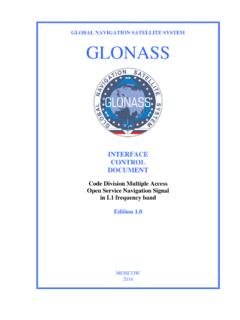
Transcription of GLOBAL NAVIGATION SATELLITE SYSTEM GLONASS
1 GLOBAL NAVIGATION SATELLITE SYSTEM GLONASS INTERFACE CONTROL DOCUMENT General Description of Code Division Multiple Access Signal SYSTEM Edition MOSCOW 2016 Edition , 2016 ICD GLONASS CDMA General Description Russian Space Systems, JSC 2 Table of contents List of figures .. 3 List of tables .. 4 Definitions and acronyms .. 5 1 Introduction .. 7 2 Scope .. 15 3 Time scales used in GLONASS .. 17 4 GLONASS geodetic reference .. 19 5 General signal properties .. 24 6 Monitoring GLONASS signal-in-space performance .. 27 Appendix A User-received signal level.
2 28 Appendix B UT1 calculation algorithm .. 29 Appendix C Transformation from GLONASS time to GPS time .. 31 Appendix D Transformation from received signal time to GLONASS time and MT using immediate NAVIGATION data .. 34 Appendix E Receiver operation during GLONASS time and MT leap second corrections .. 35 Appendix F Using number of four-year interval N4 in MT .. 41 Appendix G Using number of day NТ in a four-year interval in MT .. 42 Appendix H Transformation from UTC(SU) to TAI .. 43 Appendix J Algorithms for determination of SV center of mass position and velocity vector components using ephemeris data.
3 44 Appendix K Algorithm for calculation of the current Julian date JD0, Gregorian date, and GMST .. 59 Appendix L Algorithm for determination of the Conventional Reference Pole (Conventional International Origin) coordinates (Xp, Yp) on the surface of the PZ-90 reference ellipsoid .. 62 Appendix M Algorithm for determination of position and velocity vector components for the SV s center of mass using almanac data .. 63 Appendix N Algorithm for calculation of ranging code phase and pseudo-Doppler shift of the received carrier frequency for SV j at an arbitrary time of MT using almanac data.
4 74 Appendix P Recommendations on use of accuracy factors jEF, jTF .. 76 Appendix Q Algorithm of using ionosphere model parameters .. 77 Appendix R Algorithm for determination of SV s antenna phase center position in PZ-90 geodetic coordinate SYSTEM .. 96 Appendix S Algorithm for computing direction cosines, distance to and coordinates of true and apparent Sun .. 114 Appendix T Relativistic corrections in GLONASS .. 117 Edition , 2016 ICD GLONASS CDMA General Description Russian Space Systems, JSC 3 List of figures Figure Axes position in the geocentric spatial Cartesian reference SYSTEM (X, Y и Z).
5 20 Figure Geodetic coordinate SYSTEM (B, L, and H) .. 21 Figure Approximate location of the MT and GLONASS time scheduled leap second correction in relation to the rear boundary of the anomalous string of the message in the channel first to acquire the string .. 37 Figure SV s passing of points of largest and smallest SSE angles .. 97 Figure The typical pattern of yaw angle variation and its derivative as a function of angle for large modulo angle s ( s =45 ) .. 99 Figure The typical pattern of yaw angle variation and its derivative as a function of angle for small modulo angle s ( s=1 ).
6 100 Figure Season repeatability of small angles с for GLONASS orbital planes .. 101 Figure Rotation of axis -b during turn maneuver for small SSE angles provided angle s is positive .. 107 Figure Rotation of axis -b during turn maneuver for large SSE angles provided angle s is positive .. 107 Figure Rotation of axis -b during turn maneuver for small SSE angles provided angle s is negative .. 108 Figure Rotation of axis -b during turn maneuver for large SSE angles provided angle s is negative .. 108 Figure Change in angular rate for small angles of full turn ft.
7 109 Figure Change in angular rate for large angles of full turn ft .. 110 Edition , 2016 ICD GLONASS CDMA General Description Russian Space Systems, JSC 4 List of tables Table Fundamental geodetic constants and main parameters of the PZ-90 Earth s ellipsoid .. 22 Table Position prediction errors at various intervals (m) .. 44 Table Prediction errors for the SV s position and velocity .. 63 Edition , 2016 ICD GLONASS CDMA General Description Russian Space Systems, JSC 5 Definitions and acronyms AFS Atomic Frequency Standard CDMA Code Division Multiple Access CS Central Synchronizer ECEF Earth-Centered Earth-Fixed (coordinate SYSTEM )
8 FDMA Frequency Division Multiple Access GLONASS GLOBAL NAVIGATION SATELLITE SYSTEM GMST Greenwich Mean Sidereal Time GPS GLOBAL Positioning SYSTEM GSO Geosynchronous Orbit GST Greenwich Sidereal Time HEO Highly Elliptical Orbit ICD Interface Control Document IERS International Earth Rotation Service JD0 current Julian date at 00:00 in Moscow Time L1OC CDMA Open Service NAVIGATION Signal in L1 frequency band L1OF FDMA Open Service NAVIGATION Signal in L1 frequency band L1SC CDMA Secured Service NAVIGATION Signal in L1 frequency band L1SF FDMA Secured Service NAVIGATION Signal in L1 frequency band L2 OCp CDMA Open Service NAVIGATION Signal in L2 frequency band (pilot signal)
9 L3OC CDMA Open Service NAVIGATION Signal in L3 frequency band LDMP Long-time Dynamic Model Parameters MEO Medium Earth Orbit MT Moscow Time PS Pseudoframe Size PZ-90 SYSTEM of geodetic parameters Parametry Zemli 1990 and designation of the Earth s reference ellipsoid used in this SYSTEM of geodetic parameters RMS root mean square (error) RST Received Signal Time RT Receiver Time SSE Sun-SV-Earth (plane and angle) SV Space Vehicle TAI International Atomic Time Edition , 2016 ICD GLONASS CDMA General Description Russian Space Systems, JSC 6 TEC Total Electron Content UE User Equipment UT1 Universal Time mean solar time at 0 longitude accounted for the effect of polar motion on position of meridians UTC Coordinated Universal Time UTC(SU)
10 Coordinated Universal Time of Russia x extracting the integer part of x x computing the integer nearest to x Edition , 2016 ICD GLONASS CDMA General Description Russian Space Systems, JSC 7 1 Introduction The GLOBAL NAVIGATION SATELLITE SYSTEM ( GLONASS ) is used to provide positioning, velocity and precise time for marine, air, terrestrial, and space users, as well as to accomplish additional information functions. The GLONASS SYSTEM consists of three segments: - Space Segment; - Control Segment; - User Segment. The GLONASS Space Segment consists nominally of 24 to 30 operational Medium Earth Orbit (MEO) space vehicles (SV) in circular orbits with the nominal altitude of 19,100 km, the inclination of , and the orbital period of 11 h 15 min 44 s.