Example: barber
Current and Planned Global and Regional Navigation ...
The Global Navigation Satellite System 13 III. European Union The European Satellite Navigation System and the European Geostationary Navigation Overlay Service 19 IV. China The Compass/BeiDou Navigation Satellite System 35 V. Japan The Multi-functional Transport Satellite Satellite-based
Tags:
Information
Domain:
Source:
Link to this page:
Documents from same domain

Global Navigation Satellite Systems: Educational curriculum
www.unoosa.orgGlobal Navigation Satellite Systems (GNSS) include constellations of Earth-orbiting satellites that broadcast their locations in space and time, of networks of ground control stations, and of receivers that calculate ground positions by trilateration.

World Geodetic System 1984
www.unoosa.orgDepartment of Defense definition of a global reference system for geospatial information and is the reference system for the Global Positioning System (GPS). It is compatible with the International Terrestrial Reference System (ITRS). Definition of Frame • Origin: Earth’s center of mass being defined for the whole Earth including oceans and
World Geodetic System 1984 - UNOOSA
www.unoosa.orgWorld Geodetic System 1984 Responsible Organization: National Geospatial-Intelligence Agency Abbreviated Frame Name: WGS 84 Associated TRS: WGS 84 Coverage of Frame: Global

Overview Indian Satellite Navigation Programme - UNOOSA
www.unoosa.orgIRNSS Network Time ( IRNWT ) - 2 Nos. IRNSS CDMA Ranging Stations ( IRCDR ) - 4 Nos. IRNSS Laser Ranging Service ( ILRS ) IRNSS Range and Integrity Monitoring Stations - 16 Nos
A General Assembly
www.unoosa.orgStation implemented preventive collision avoidance control on 1 July and 21 October 2021, respectively. 1. The first collision avoidance As from 19 April 2020, the Starlink-1095 satellite had been travelling stably in orbit at an average altitude of …

UNITED NATIONS TREATIES
www.unoosa.orgUNITED NATIONS TREATIES AND PRINCIPLES ON OUTER SPACE Text of treaties and principles governing the activities of States in the exploration and use of outer space,

TRATADOS - UNOOSA
www.unoosa.orgTratados de las Naciones Unidas ... convertido en realidad y se ha comenzado a formular las reglas de conducta internacionales para facilitar las relaciones internacionales en el espacio ultraterrestre. Como corresponde a un medio cuya naturaleza es tan fuera de lo común, la
Related documents
Network Global Navigation Satellite System Surveys to ...
pubs.usgs.govThe Global Navigation Satellite System surveys were completed from April 14 to 16, 2015, at locations ranging from southern Lake Champlain near Whitehall, New York, to the northern end of the Richelieu River in Sorel, Quebec, at its confluence with the St. Lawrence River in Canada.
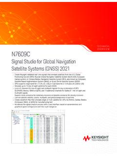
Keysight Technologies Signal Studio for Global Navigation ...
literature.cdn.keysight.comSimplify Global Navigation Satellite System (GNSS) Signal Creation Signal Studio software is a flexible suite of signal-creation tools that will reduce the time you spend on signal simulation. For GNSS, including GPS, GLONASS, Galileo,
UTILIZATION OF MODERNIZED GLOBAL NAVIGATION …
web.stanford.eduAn increased number of Global Navigation Satellite System (GNSS) space vehicles, broadcasting at multiple civilian frequencies, are expected to become oper- ational over the next decade.

NAVSTAR, the Global Positioning System: A Sampling of Its ...
history.nasa.govGlobal positioning System (GpS), the irst satellite navigation system that enabled users to determine precisely their location in three dimensions and time within billionths of a second, grew from a concept into a fully
Global Navigation Satellite Systems: Genesis, State of the ...
gps.mae.cornell.eduGlobal Navigation Satellite Systems: Genesis, State of the Art, and Future ... (Global Navigation Satellite Systems) in order o denote both systems without givingt precedence to either. ... The Global Positioning System (GPS) is being used in a variety of important and unusual applications. One example is the Joint Precision Approach and ...
Global Navigation Satellite System (GNSS)
www.princeton.eduSatellite Systems (GNSS) such as Global Positioning System (GPS), cellular network infrastructure or on the integration of the two technologies for a wide spread of applications such as Automatic Vehicle Location (AVL), tracking systems, navigation, Pedestrian Navigation
GLOBAL NAVIGATION SATELLITE SYSTEM GLONASS
russianspacesystems.ruGLONASS – Global Navigation Satellite System ICD – Interface Control Document IS – Initial State L1OC – CDMA Open Service Navigation Signal in L1 frequency band L1OCd time – time scale determined by phase of L1OCd signal at the phase center of an SV antenna
Global Navigation Satellite Systems: Educational curriculum
www.unoosa.orgGlobal Navigation Satellite Systems (GNSS) include constellations of Earth-orbiting satellites that broadcast their locations in space and time, of networks of ground control stations, and of receivers that calculate ground positions by trilateration.
Global Navigation Satellite System Implementation Team ...
mddb.apec.orgPage 1 Final Report The 22st Meeting of the APEC GNSS Implementation Team (GIT/22) 25 – 28 April 2017, Taipei, Chinese Taipei 1. GENERAL The 22nd Meeting of the Asia Pacific Economic Cooperation (APEC) Global Navigation Satellite System (GNSS) Implementation Team (GIT/22) was hosted by Chinese Taipei from
GLOBAL NAVIGATION SATELLITE SYSTEM GLONASS
russianspacesystems.ru1.1 The Global Navigation Satellite System (GLONASS) is used to provide positioning, velocity and precise time for marine, air, terrestrial, and space users, as well as to …
Related search queries
Global Navigation Satellite System, Global Navigation, UTILIZATION OF MODERNIZED GLOBAL NAVIGATION, Global positioning System, Satellite navigation system, Global Navigation Satellite Systems: Genesis, State, Global Navigation Satellite, Global, System, Global Navigation Satellite System GNSS, Satellite, Navigation, Global Navigation Satellite System Implementation Team, Global Navigation Satellite System GLONASS