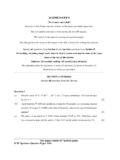
Transcription of HISTORY, CIVICS AND GEOGRAPHY (50 ) …
1 63 history , CIVICS ANDGEOGRAPHY (50) develop an understanding of terms,concepts andprinciples related to explain the cause-effect relationships of understand the use of natural resources anddevelopment of acquire knowledge of and appreciate theinterdependence of nations anddifferent regions ofthe know the availability of resources, understand,explain their uses and appreciate the problems ofdevelopment in understandand encourage human efforts made toconserve and protect thenatural practical skills related to the meaningand use of maps and theirimportancein the study IXThere will be one paper of two hours duration carrying80 marks and Internal Assessmentof question paper will consist of Part I and Part I(compulsory)will consist 1 will consist of short answer questions fromthe entire syllabus and Question 2 will consist of aquestion based II.
2 Candidates will be required to chooseany will be expected to make the fullest use ofsketches, diagrams, graphs and charts in their may require answers involving theinterpretation of photographs of geographical OF World(i)Earth as a planetShape of the as the home ofhumankind and the conditions that exist.(ii)Geographic grid-Latitudes &Longitudes(a)Concept of latitudes: main latitudes, theirlocation with degrees, parallels of latitude andtheir uses. (b) Concept of longitudes-PrimeMeridian, time(local, standard and time zones,Greenwich MeanTime(GMT)andInternational Date Line (IDL). Eastern andWestern hemisphere. (c) Using latitudes andlongitudes to find location.)
3 Calculation of time.(d)Great Circles and their use.(iii)Rotationand RevolutionRotation direction, speedand its effects(occurrence of day and night,the sun rising inthe east and setting in the west, Corioliseffect)Revolutionof the earth and its inclined axis effects: the variation in the length of the dayand night andseasonal changes withEquinoxes of the Earth(i)Earth s StructureCore, mantle, crust meaning, extent andtheircomposition.(ii) Landforms of theEarthMountains, plateaus, plains(definition, typesand their formation):Mountains fold, residual and intermont and from the world and India.(iii)Rocks-difference between minerals and rocks,types of rocks: igneous, sedimentary,metamorphic, their characteristicsandformation; rock cycle.
4 (iv)VolcanoesMeaning,Types active,dormant and constructive and volcanic zones of the world.(v)Earthquakes64 Meaning, : destructiveand zones of the World(vi)Weatheringand DenudationMeaning, types and effects of :PhysicalWeathering blockandgranulardisintegration,exfoliati on;ChemicalWeathering oxidation, carbonation,hydration and solution;BiologicalWeathering caused byhumans,plants and and agents of denudation; work ofriver and of a river courseand associated landforms V-shaped valley, waterfall, meanderand deflation hollows and Sand of their circulation pattern andeffects.(SpecificallyofGulfStream, NorthAtlantic Drift, Labrador Current, Kuro Shio andOyaShio.) (i)Composition and structure of the , Stratosphere, Ionosphere andExosphere;Ozone inthe Stratosphere, itsdepletion.
5 Global warming and itsimpact.(ii)InsolationMeaning of insolation and affecting temperature:latitude,altitude, distance from the sea,slopeofland,winds andocean currents.(iii)Atmospheric Pressureand factors that affect pressurebeltsof the affecting direction and velocity ofwind pressure gradient, Coriolis winds Trades, Westerlies andPolar winds-Land andSea breezes,Monsoons,Local winds-Loo, Chinook, Foehn andMistralVariable winds-CyclonesandAnticyclonesJet Streams-Meaning and importance(v)HumidityHumidity meaning and difference betweenrelative and absolute humidity,Condensation forms (clouds, dew, frost, fogand mist)Precipitation-forms (rain, snow, and hail).
6 Types of rainfall relief/orographic,convectional, cyclonic/ frontal with examplesfrom the different parts of the (a)Types-air, water (fresh and marine), soil,radiation and noise.(b)SourcesNoise: Traffic, factories,constructionsites, loud speakers, : vehicular, industrial, : chemical fertilizers, bio medical wasteand : X-rays; radioactive fallout fromnuclear plants.(c)Effects-ontheenvironmentandhum an health.(d)Preventive MeasuresCarpools, promotion of public transport, nosmoking zone, restricted use of fossil fuels,saving energy and encouragement of NaturalRegions of the WorldLocation, area,climate, natural vegetation andhuman region,Tropical grasslands, TropicalDeserts, Tropical Monsoon, Mediterranean,Temperategrasslands,Taiga WorkOn an outline map of the World, candidates will berequired tolocate,mark and name the majorNaturalRegionsof the world-Equatorial, Tropical Monsoon, TropicalDeserts, Mediterranean type,Tropicalgrasslands,Temperategrassla nds, Taiga ,Seas,Gulfsand Straits-allMajorOceans,Caribbean Sea, North Sea,Black Sea, CaspianSea.
7 South ChinaSea,Mediterranean Sea, Gulf ofCarpentaria,Hudson Bay,PersianGulf, Gulf of Mexico,Gulf of Guinea,BeringStrait, Strait ofGibraltar, Strait of Mississippi, Colorado, Amazon,Paraguay, Nile, Zaire, Niger,Zambezi,Orange, Rhine, Volga, Danube, Murray,Darling, Hwang Ho,Yangtse Kiang, Ob,Indus,Ganga, Mekong, Irrawaddy, Tigris, Rockies, Andes, Appalachian,Alps, Himalayas,Pyrenees, ScandinavianHighlands,Caucasus,Atlas,Dra kensburg,Khinghan, Zagros,Urals, Great Canadian Shield, TibetanPlateau,BrazilianHighlands,Patago nian Plateau,Iranian Plateau, Mongolian ASSESSMENTPRACTICAL WORK/ record file having anythreeof the followingexercises will be maintained.
8 (The file will beevaluated out of 10 marks).(a)Uses of important types of maps.(b)Directions and how to identify them-anillustrative diagram.(c)Readingand using statement of scale, graphicscale and scale shown by representativefraction method. (No drawing work, onlyexplaining their meanings).(d)Reading of one town guide map or an atlasmap. (Recognising the symbols and coloursused, identifying directions and distances).(e)Drawing and recognising forms of importantcontours viz. valleys, ridges, types of slopes,conical hill, plateau, escarpment and sea cliff.(f)Drawing at least one sketch map to organizeinformation about visiting an important place,azoo or a will be required to prepare a projectreport on anyonetopic.
9 The topics for assignmentsmay be selected from the list of suggestedassignments given below. Candidates can also takeup an assignment of their choice under anyof thefour broad areas given below. (The project will beevaluated out of 10 marks).Suggested list of Assignments:(a)Weather records:Maintaining and interpretingweather records as found in the newspaper for atleast one season.(b)Collection of data fromsecondary sources(Using Modern techniques GPS, RemoteSensing, Aerial Photography and Satelliteimageries):Preparing a PowerPoint presentationon current issueslike use of earth resources/development activities/dangers of developmentand ecological disasters like droughts, earthquakes,volcanoes, floods, landslides cyclones andtornadoes in the world.
10 (c)Physical Features:Collectionof data fromprimary and secondary sourcesor takingphotographs and preparing notional sketchesoffeaturesfoundin the vicinity or areas visitedduring the year as a part of school activity.(d)Find out the sources of pollution of water bodies inthe locality anddetermine the quality of water.(e)Collect informationonglobal environmental issuesand problems and communicate your findingsthrough appropriate modes (posters, charts,collages, cartoons, handouts, essays,street playsand PowerPoint presentation).(f)Area Studies:Choosing any aspect from Section B(World Studies) and preparing a PowerPointpresentation or a write up on it.(g)Meteorological Instruments and their uses Six s maximum and minimum thermometer,mercury barometer, aneroid barometer, wind vane,anemometer, rain gauge and XThere will beonepaper oftwohours duration carrying80 marks and Internal Assessment of 20 Paper will consist oftwoparts, PartI and Part I(compulsory) will consist 1 will be based on 2 will be based on outlineMapof : Candidateswill be expected to answer willbe expected to make the fullest use ofsketches, diagrams, graphs and charts in their set may require answers involving theinterpretation of photographs of geographical IMAP WORK1.


