Transcription of MAPS MANUAL - The Institute for Bird Populations
1 MAPS MANUAL . 2015 PROTOCOL. INSTRUCTIONS FOR THE ESTABLISHMENT AND OPERATION. OF CONSTANT-EFFORT BIRD-BANDING STATIONS AS PART OF THE. MONITORING AVIAN PRODUCTIVITY AND SURVIVORSHIP (MAPS) PROGRAM. David F. DeSante, Kenneth M. Burton, Pilar Velez, Dan Froehlich, Danielle Kaschube, and Steven Albert The Institute for Bird Populations Box 1346. Point Reyes Station, CA 94956-1346. (415) 663-1436. FAX (415) 663-9482. ACKNOWLEDGEMENTS. We thank MAPS biologists Eric Feuss, Denise Jones, Sara Martin, Eric (Zed) Ruhlen, Hillary Smith, Brett Walker, Kerry Wilcox, and Mellissa Winfield and research scientists Phil Nott and Jim Saracco for their help in the development of this MANUAL and for comments on earlier versions and revisions. We especially thank Nicole Michel and Peter Pyle for critical help with the overall development of this MANUAL and in word-crafting the more recent revisions.
2 Feedback from the many MAPS station operators also has been invaluable in refining both the MANUAL and the MAPS Program itself. Funding for the development, establishment, and operation of the MAPS Program has come from many sources. Among the most important are the Forest Service, Department of Defense/Legacy Resource Management Program, Fish and Wildlife Service/Office of Migratory Bird Management and National Park Service, Geological Survey/Biological Resources Division, and National Fish and Wildlife Foundation. We thank these and many other funding sources and private individuals for their support. Finally, we thank the many hundreds of station operators and all their assistants, interns, and volunteers who, year after year, contribute their data to the MAPS Program.
3 Without their dedication and perseverance, MAPS could not exist. This is Contribution Number 127 of The Institute for Bird Populations . Copyright 2015. 2015 MAPS MANUAL - i Contents INTRODUCTION .. 1. An Invitation .. 1. Bird 2. Proper Permitting .. 2. Background and Rationale .. 2. Design and Objectives of the MAPS Program .. 4. Analysis of MAPS Data .. 6. ESTABLISHMENT AND GENERAL OPERATION OF MAPS STATIONS .. 10. Siting a MAPS station .. 10. Establishing a MAPS station .. 12. MAPS terminology .. 12. General configuration .. 12. Mist nets (number) .. 13. Mist nets (density) .. 13. Mist nets (placement) .. 14. Mist nets (size, type, and mesh size) .. 15. Operating a MAPS 15. Station registration .. 15. Banding - dates of operation.
4 15. Effort data .. 17. Breeding Status data .. 17. Habitat Structure Assessment (HSA) data .. 17. Instructions and data forms .. 18. Recording data and making corrections .. 18. The use of MAPSPROG .. 18. MAPS data-use policy .. 19. STATION REGISTRATION .. 20. Joining the MAPS 20. Instructions for completing the MAPS Station Registration Form .. 20. MIST-NETTING EFFORT .. 24. Operation of nets .. 24. Frequency of mist-netting effort .. 24. MAPS Periods and Intended Periods .. 25. Making up missed effort .. 26. Minimum allowable effort .. 26. STANDARD NET OPENING AND CLOSING TIMES .. 27. Instructions for completing the Standard Net Opening and Closing Times form .. 27. SUMMARY OF EFFORT .. 29. Instructions for completing the Summary of Mist-Netting Effort form.
5 29. COLLECTION AND RECORDING OF BANDING DATA .. 32. General procedures for recording banding data .. 32. Primary MAPS data .. 32. Supplemental data .. 32. Optional data .. 33. ii - 2015 MAPS MANUAL Codes, scales, and forms .. 33. Multiple-station locations .. 33. Non-MAPS 33. Page headings and other notations .. 34. New bands .. 34. Lost and destroyed 34. 34. Changed bands .. 34. Added bands .. 34. Unbanded birds .. 35. Mortalities .. 35. Banding-data fields .. 35. BANDER=S INITIALS .. 36. CODE .. 36. BAND NUMBER .. 36. SPECIES NAME .. 36. SPECIES ALPHA 36. AGE .. 37. HOW AGED .. 40. SEX .. 41. HOW SEXED .. 42. SKULL .. 42. CL. PROT.. 43. BR. PATCH .. 44. FAT .. 45. BODY 46. FF 47. FF WEAR .. 47. JUV. PL.. 48. MOLT LIMITS & PLUMAGE.
6 49. WING .. 52. BODY MASS .. 52. STATUS .. 53. DATE (MO/DAY) .. 53. CAPTURE TIME .. 53. STATION .. 53. 53. DISP .. 53. NOTE 54. FTHR. PULL .. 54. SWAB .. 54. NOTE .. 54. A strategy for ageing and sexing birds .. 54. SUMMARY OF MIST-NETTING RESULTS .. 56. Instructions for completing the Summary of Mist-Netting Results form .. 56. 2015 MAPS MANUAL - iii BREEDING STATUS LIST .. 58. Instructions for completing the Breeding Status List .. 61. DATE (mm/dd) FOR INTENDED PERIOD .. 61. PERIOD STATUS .. 61. YEAR STATUS .. 62. OBSERVER=S INITIALS .. 65. DATA SUBMISSION .. 67. What data to 67. How to submit MAPS 67. Submitting data through MAPSPROG .. 67. Submitting banding data in electronic format other than through MAPSPROG 69. Submitting paper copies of banding 71.
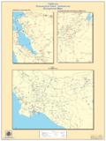
7 Due 71. Where to send data .. 72. LITERATURE CITED .. 74. iv - 2015 MAPS MANUAL Figures Figure 1. Map of the continental and Canada showing the eight MAPS regions..5. Figure 2. Diagram of an idealized MAPS station..14. Figure 3. Recommended starting periods for MAPS Figure 4. Completed MAPS Station Registration Form ..21. Figure 5. Completed MAPS Standard Net Opening and Closing Times form..28. Figure 6. Completed MAPS Summary of Mist-Netting Effort (page 1) ..30. Figure 7. Completed MAPS banding-data sheet for Band Size '0' (front)..38. Figure 8. Completed MAPS banding sheet (back)..39. Figure 9. Completed MAPS Summary of Mist-Netting Results Figure 10. Completed MAPS Breeding Status List ..60. Figure 11. Species breeding status history for a MAPS station.
8 66. Tables Table 1. Adult and young MAPS superperiods..26. Table 2. Species alpha codes for gallinaceous birds ..37. Table 3. Hierarchical categories of Period Breeding Status (upper case) and associated Daily Behavior Sub-Codes (lower case) for MAPS Breeding Status List ..61. Table 4. MAPS Banding-data file structure for 2015 data ..73. INTRODUCTION. An Invitation Welcome to the Monitoring Avian Productivity and Survivorship (MAPS) Program! MAPS is a cooperative effort among public agencies, private organizations, and the bird banders of the continental United States, Canada, and Mexico to provide critical, long-term data on population and demographic parameters for over 150 target landbird species at multiple spatial scales. As part of the MAPS family, you team with hundreds of private individuals, and workers from federal and state agencies and non-governmental organizations to gather important data for the conservation of birds and their habitat.
9 The MAPS Program utilizes standardized, constant-effort mist netting and banding during the breeding season at an extensive network of stations. The MAPS methodology provides annual indices of adult population size and post-fledging productivity from data on the numbers and proportions of young and adult birds captured; and annual estimates of adult survivorship, adult population size, proportion of resident individuals in the adult population, recruitment into the adult population, and population growth rate (lambda) from mark-recapture data on adult birds. This data is used by IBP and our collaborators to study the causes of population changes in North America's landbirds. This MANUAL (and all the forms associated with operating a MAPS station) are available for download through the MAPS web page Any public agency, private organization, or independent bird bander currently operating or able to establish one or more banding stations operated regularly through the breeding season is encouraged to participate in the MAPS Program.
10 All that is required is the standardized operation of a series of about ten nets at permanent sites on only one day during each of six to ten consecutive ten-day periods between May and August. While the operation of a MAPS station is relatively simple, it is also a substantial commitment. Standardization from year to year and continuation of the study for at least five consecutive years at each station are necessary in order to provide reliable productivity indices and survivorship estimates ( vital rates ). Continuation of the study for ten to twenty consecutive years at most stations will likely be necessary to obtain reliable trend information on these critical vital rates. This MANUAL is designed to guide you through all the steps involved in operating a MAPS station and to address any questions that may arise.