Example: bankruptcy
“Mining” Water Ice on Mars - NASA
Firn Layer. Typically found on terrestrial glaciers and ice sheets - a layer of granulated snow and ice crystals that is gradually being compressed into solid ice. Because of the granular/porous nature of this layer, any liquid water will move to lower levels until a solid interface is encountered. Due to the lack of snowfall and
Tags:
Information
Domain:
Source:
Link to this page:
Documents from same domain

Q: What do you do on the International Space …
www.nasa.govQ: What do you do on the International Space Station (ISS)? A: Astronauts and cosmonauts on the space station stay busy.There’s lots of work to operate the many science experiments on board.
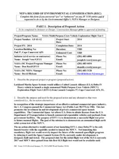
NEPA RECORD OF ENVIRONMENTAL …
www.nasa.govDec 13, 2012 · JSC Form 1119 (Revised January 25, 2011)(MS Word October 2010) NEPA RECORD OF ENVIRONMENTAL CONSIDERATION (REC) Complete this form if you answered “yes” or “unknown” on any JF 1138 entries and if
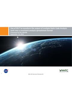
Use of XSLT to transform the output of multiple …
www.nasa.govNASA IV&V International Workshop 2014 1 Use of XSLT to transform the output of multiple Static Code Analysis tools into a consistent analysis spreadsheet format
International Space Station Activity Book
www.nasa.govNational Aeronautics and Space Administration . Grades K-5 . This activity book belongs to: International Space Station Activity Book >>> For more information, check out the web sites on page 30!
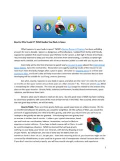
Gravity, Who Needs It
www.nasa.govGravity, Who Needs It? ... six months on the space station versus three years on a Mars mission? No. ... human, being more isolated ...
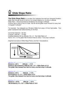
Glide Slope Ratio
www.nasa.govGlide Slope Ratio The Glide Slope Ratio is a number that indicates how well your designed shoebox glider flies through the air in terms of its forward distance vs. its drop in altitude. Glide Ratio = Horizontal Distance divided by the Change in Altitude.
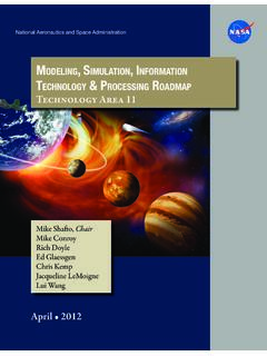
Modeling, SiMulation, inforMation technology & …
www.nasa.govTA11-1 exeCuTive Summary Figure 1 is an initial draft strategic roadmap for the Modeling, Simulation, Information Technol-ogy and Processing Technology Area.
NASA Technology Roadmaps
www.nasa.gov2015 NASA Technology Roadmaps TA 11: Modeling, Simulation, Information Technology, and Processing TA 11- 2 July 2015 Foreword NASA is leading the way with a balanced program of space exploration, aeronautics, and science research.
A Journey to Inspire, Innovate, and Discover
www.nasa.govReport of the President’s Commission on 2 Implementation of United States Space Exploration Policy Transmittal Letter June 4, 2004 The Honorable George W. Bush
National Aeronautics and Space Administration Headquarters
www.nasa.govGEMS is a Category 3 project (less than $250M) in Phase B, and was requesting transition from Formulation to Implementation (Phase C) where the official Agency baseline is established and external commitments are made
Related documents

Activity Guide for Daisies, Brownies, and Juniors
www.girlscouts.orgChoice 2: Find out about melting glaciers. In the introduction to this step, you learned what glaciers are and how they are affected by climate change. Scientists tell us that we’re seeing a rise in the temperature of the ocean’s surface that’s caused by more heat trapped in Earth’s atmosphere. As Earth’s average temperature increases,

Règlement de la Patrouille des Glaciers 2022
www.pdg.chPatrouille des Glaciers, Edition 2022 Cdmt PdG 2 2 En raison de ses caractéristiques, une demande de participation à la PdG requiert les exigences suivantes : a. une très bonne connaissance de la haute montagne, condition indispensable à la maîtrise de situations imprévues et parfois extrêmes rencontrées dans les Alpes ; b.

The Lithosphere--contains all of the cold, hard solid land ...
gml.noaa.govhot lava (lithosphere), which causes mountain glaciers (hydrosphere) to melt. Mudflows (lithosphere) and flooding may occur downstream from volcanoes and may inundate streamside communities (biosphere). Volcano >> lithosphere >> atmosphere >> biosphere >> lithosphere Volcanoes (events of the lithosphere) release a large amount of carbon

Exploring the Water Cycle Teacher’s Guide - NASA
gpm.nasa.govwater is in glaciers or underground. 6th- 8th grade: Water cycles among land, ocean, and atmosphere, and is propelled by sunlight and gravity. Density variations of sea water drive interconnected ocean currents. Water movement causes weathering and erosion, changing landscape features Background Information:

U.S. Department of the Interior / U.S. Geological Survey ...
pubs.usgs.govAge glaciers melted, permitting the melt waters to flow into the ocean. If all the glacial ice on the surface of the Earth today should melt, sea level might rise by more than 150 feet. Shoreline fluctuations are also produced through elevation or depression of the land. During times of glaciation the great weight of ...
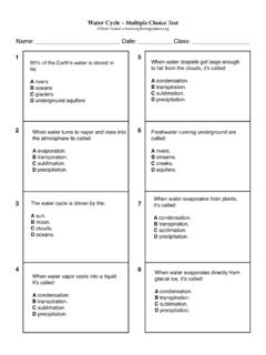
Water Cycle – Multiple Choice Test - Exploring Nature
www.exploringnature.orgC glaciers D underground aquifers When water evaporates from plants, it’s called: A condensation. B transpiration. C sublimation. D precipitation. When water droplets get large enough to fall from the clouds, it’s called: A condensation. B transpiration. C sublimation. D precipitation. The water cycle is driven by the: A sun. B moon. C ...
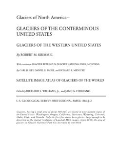
Glaciers of North America— GLACIERS OF THE …
pubs.usgs.govGlaciers are found in the following States of the Western United States: Washington, Ore-gon, California, Montana, Wyoming, Colorado, Idaho, Utah, and Nevada. According to the most recent sources, these glaciers have a total area of about 580 km 2. The earliest recorded

CLIMATE CHANGE PROFILE OF PAKISTAN - Asian …
www.adb.orgv Tables, Figures, and Boxes Tables 1 Projected Greenhouse Gas Emissions by Sector in 2020 and 2050 Under Business as Usual Scenarios 11 2 Mean Temperatures Trends in …