Example: confidence
National 5 Geography
measuring distance using scale interpreting relief and contour patterns using maps in association with photographs, field sketches, cross sections/transects Extracting, interpreting and presenting numerical and graphical information which may be: graphs tables diagrams maps Component 2: assignment
Tags:
Information
Domain:
Source:
Link to this page:
Documents from same domain
Coursework for external assessment - SQA
www.sqa.org.ukSession 2017-2018 English templates – National 5, Higher and Advanced Higher Please use the following templates for English. A flyleaf, which we will issue to centres in
Develop and maintain a healthy, safe and secure ...
www.sqa.org.ukSKAPW7 - FT4P 04 Develop and maintain a healthy, safe and secure environment for children SKAPW7 Develop and maintain a healthy, safe and secure environment for children 1
FD3H 04 (CFAMLD1) Develop Productive Working …
www.sqa.org.ukFD3H 04 (CFAMLD1) Develop Productive Working Relationships with Colleagues 3 FD3H 04 (CFAMLD1) Develop Productive Working Relationships with Colleagues
LANCS29 Identify the presence of pests, diseases …
www.sqa.org.ukLANCS29 Identify the presence of pests, diseases and disorders-(SQA Unit Code-H2RD 04) Knowledge and understanding You need to know and understand:
Assessment Arrangements Explained: Information …
www.sqa.org.ukContents Assessment Arrangements Explained: Information for centres 1 Contents 1 Introduction 1 Access to assessment: the principles 3 Assessment arrangements: contacting SQA 5
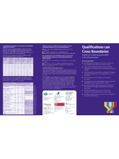
Correspondences between UK and Irish frameworks …
www.sqa.org.ukQualifications can Cross Boundaries A guide to comparing qualifications in the UK and Ireland How to use this leaflet: This leaflet provides information that allows you to look at the ways qualifications are organised in the UK and Ireland.
H5S0 04 (SCDHSC0035) Promote the Safeguarding …
www.sqa.org.ukH5S0 04 (SCDHSC0035) — Promote the Safeguarding of Individuals 3 Relationships may include those developed over a period of time or those established in a situation where immediate care or support is required.
National Quali cations SPECIMEN ONLY
www.sqa.org.ukPage three Spanky: Yeh, you have a word with him kiddo . . . I’m sure he’ll appreciate it. Now for the last time, are you going to shut that folder or . . .
H5LD 04 (SCDHSC0032) Promote Health, Safety and …
www.sqa.org.ukH5LD 04 (SCDHSC0032) — Promote Health, Safety and Security in the Work Setting 1 H5LD 04 (SCDHSC0032) — Promote Health, Safety and Security in the Work Setting Overview This standard identifies the requirements when you …
F9D7 04 (ESKWP2): Word Processing Software 2 - …
www.sqa.org.ukF9D7 04 (ESKWP2): Word Processing Software 2 2 Evidence Requirements Completion of a portfolio (manual, electronic or combination) to cover all of the Skills and
Related documents
Intact Prostate Contouring Guide
econtour.org– Link to UCSD video of how to contour intact prostate slice-by-slice (website login is free) ... use the measuring tool to check the verIcal extent of your contour. GTV (prostate) + SV = CTV Use the boolean tool to combine prostate/ GTV and Seminal Vesicle (SV) into a

Spine Examination - Veterans Affairs
www.benefits.va.govMeasuring the range of motion from a standing position (as opposed to from a sitting position) ... preserved spinal contour, and normal gait. b. Indicate whether there is muscle spasm, or guarding severe enough to result in an abnormal gait, abnormal spinal contour such as scoliosis, reversed lordosis
Topographic Maps: The basics - NRCan
www.nrcan.gc.caUse contour lines to determine elevations of mountains and flat areas. The closer together ... bar for measuring fractions of a kilometre. What is a grid? A grid is a regular pattern of parallel lines intersecting at right angles and forming squares; it is . used to identify precise positions. To help you locate your position accurately on the ...
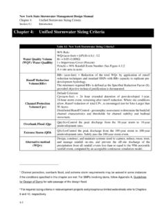
Table 4.1 New York Stormwater Sizing Criteria1
www.dec.ny.govContour lines of the 90% rainfall event are presented in Figure 4.1. The following equation can be used to determine the water quality storage volume WQ. v (in acre-feet of ... Measuring Impervious Cover: the measured area of a site plan that does not have permanent vegetative or
ORDNANCE SURVEY MAP READING
getoutside.ordnancesurvey.co.ukA contour line is drawn between points of equal height, so any single contour line will be at the same height all the way along its length. The height difference between separate contour lines is normally 10 metres, but it will be 5 metres in flatter areas. The map key will tell you the contour interval used. ˜˚ ˛˚ ˝˚ ˙˚ ˚ ˜˚ ˝˚ ˙˚