Example: stock market
Prelims Sampoorna
Sulu Sea via the straits around Palawan, the Strait of Malacca via the Strait of Singapore, and the Java Sea via the Karimata and Bangka Strait. One-third of the world’s maritime shipping passes through it. Several countries have made competing …
Tags:
Information
Domain:
Source:
Link to this page:
Documents from same domain
INDIA YEAR BOOK 2021
uploads.iasscore.inwww.iasscore.in | | INDIA YEAR BOOK - 2021 1 The Land and People 1 Physical Features" The mainland comprises four regions, namely, the great mountain zone, plains of the Ganga and the Indus, the desert region and the southern

UPSC SYLLABUS ANTHROPOLOGY OPTIONAL
uploads.iasscore.in" Autosomal aberrations- Down syndrome, Patau, Edward and Cri-du-chat syndromes." Genetic imprints in human disease, genetic screening, genetic counseling, human DNA profi ling, gene mapping and genome study. Race and racism, biological basis of morphological variation of non-metric and characters. Racial

MAP 1 RIVERS - Iasscore
uploads.iasscore.inGanga and Its Tributaries The Ganga basin is one of the largest river basins. It lies in China, Nepal, India and Bangladesh and drains an area of about 10,00,000 sq. kms. In India, its catchment lies in the states of Uttar Pradesh, Uttarakhand, Madhya Pradesh, Chhattisgarh, Bihar, Jharkhand Rajasthan, West Bengal, Haryana, Himachal Pradesh and ...

Prelims Sampoorna
uploads.iasscore.inliterature through the medium of English language alone. The government opened a few English schools and colleges instead of a large number of elementary schools, thus neglecting mass education. The British planned to educate a small section of upper and middle classes. This was called the ‘downward filtration theory’. Efforts of Thomson
UPSC Syllabus 2021 - Iasscore
uploads.iasscore.inUPSC SYLLABUS 2020-21" The Working of Government - the Ruler, Land-Revenue System, the Dahsala System, the Mansabdari System and the Army 7. Akbar’s Religious Views" Relations with the Ulama and Social Reforms" The Early Phase (1556-73) " The Second Phase (1573-80) - the Ibadat Khana" Debates - the Mahzar - Breach

GEOGRAPHY MAP BASED QUESTIONS - Iasscore
uploads.iasscore.inSulu Sea 2. Arafura Sea 3. Kara Sea 4. Laptev Sea Select the correct option from the codes given below: (a) 1 and 3 only (b) 2 and 4 only (c) 1 and 2 only (d) 3 and 4 only 4. If one is travelling from Somalia to Philippines via sea route along coastline, arrange the following islands one will encounter in sequential order: 1. Phuket Island 2 ...

MAP 4 INDIAN MOUNTAIN RANGES
uploads.iasscore.in¾ The Nilgiri hills “The Blue Mountains” in Tamil Nadu lies at the junction of the Eastern and Western Ghats. ¾ This area has the largest population of the Indian elephant. ¾ These discontinuous mountain ranges run parallel to the Bay of Bengal. Highest Peak ¾ The Shevaroy hill is the highest peak in the EasternGhats.

Prelims Sampoorna
uploads.iasscore.inJainism & Buddhism Terms Meanings Ajivika A heterodox sect closer to Jainism. It prospered at the time of the Buddha Bodhisattva An individual who attains nirvana by working for the welfare of the world Chaitya A Buddhist place of worship Dharma-Chakra-Pravartana Turning of …
Prelims Sampoorna
uploads.iasscore.inRaja Ram Mohan Roy is considered as the pioneer of modern Indian Renaissance for the remarkable reforms he brought in the 18th and 19th century India. He founded the Atmiya Sabha and in 1828, it reformed in Brahmo Sabha. This was later transformed in the Brahmo Samaj, uniting the Bhramos in Calcutta, a group of people, who had no faith in idol-
BEST PRACTICES 4 e-SERVICES
uploads.iasscore.in2020. Delhi was the fi rst state to implement it on 8th September, 2020. Later Maharashtra, Andaman & Nicobar Islands, Bihar, Chhattisgarh, Jharkhand, Gujarat, Chandigarh, Andhra Pradesh, Odisha, Uttar Pradesh, Madhya Pradesh, Punjab, Karnataka & Haryana implemented facility of e-fi lling in their respective States/UTs.
Related documents
7 Singapore: Rapid Improvement Followed by Strong ... - OECD
www.oecd.orgmalacca Straits, on the shipping lanes between Britain, india and china. during this period, it attracted large numbers of immigrants, primarily from southern china, india and the malay archipelago. at independence from Britain in 1959 and then separation from malaysia in 1965, Singapore had no assets other than its deepwater port.

THE STRAITS OF MALACCA AND SINGAPORE
www.westpandi.comTHE STRAITS OF MALACCA AND SINGAPORE SAFE PASSAGE 6 THE STRAITS OF MALACCA AND SINGAPORE 7 The SOMS are in places narrow and busy, where a large number of vessels transit daily, carrying about one-third of the world’s traded goods. These vessels include bulk carriers, container vessels, ferries, tankers, very large crude carriers …
12. International relations - INSIGHTSIAS
www.insightsonindia.comincluding the Straits of Malacca and Hormuz and the Bab-el-Mandeb 3. The Ocean’s vast drainage basin is important in its own right, home to some two billion people. This creates opportunities, especially given the high rates of economic growth around the Indian Ocean rim. 4. The Indian Ocean is rich in natural resources. Forty per cent of the
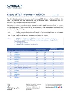
China (People’s Republic) - ADMIRALTY
www.admiralty.co.ukMS Malacca and Singapore Straits No No Yes MT Malta No No Yes MX Mexico No No Yes 3 MY Malaysia Yes Yes No NG Nigeria No No Yes NL Netherlands Yes Yes No NO Norway Yes Yes No NU Niue Yes Yes No NZ New Zealand Yes Yes No OM Oman Not known Not known Yes PA Panama Yes Yes No ...