Example: quiz answers
REVISED IMPLEMENTING (WITH AMENDMENTS)
Evaluation of Land Development and Structural Design Components of the Project 41 Section 12. ... based on the needs and financial capability of Program Beneficiaries and Appropriate Financing Schemes (RA 7279) ... Depending on the classification of roads adjacent to the subdivision and the size of the project site, road network should result ...
Tags:
Information
Domain:
Source:
Link to this page:
Documents from same domain

REPUBLIC ACT NO. 7279 - HLURB | Housing and Land Use ...
hlurb.gov.phurban areas and in resettlement areas by making available to them decent housing at affordable cost, basic services, and employment ... "Land swapping" refers to the process of land acquisition by exchanging land for another piece of land of equal value, or for shares of ... rehabilitation of blighted slum urban areas with a view of minimizing

Board of Commissioners AND REGULATIONS GOVERNING …
hlurb.gov.phPursuant to the policies and objectives embodied in Executive Order No. 648, the new charter of the Housing and Land Use Regulatory Board specifically Article IV, Section 5 to wit: "a) promulgate zoning and other land use control standards and guidelines which shall govern land use plans and zoning ordinances of local government;

REVISED IMPLEMENTING (WITH AMENDMENTS)
hlurb.gov.phREVISED IMPLEMENTING ... FOR BP 220 (WITH AMENDMENTS) HOUSING AND LAND USE REGULATORY BOARD NOVEMBER 2008 . i TABLE OF CONTENTS PAGE RULE I. General ... Section 3. Compliance with Standards and Guidelines 1 Section 4. Basis and Objectives of the Minimum Design Standards 1 Section 5. Technical Guidelines and Standards for Subdivisions …

BY-LAWS OF ARTICLE I NAME AND LOCATION - HLURB
hlurb.gov.ph(m) Petition for the creation of a separate barangay, independently or together with neighboring subdivisions: Provided, that all the requirements of the Local Government Code of 1991 are met; and, (n) Exercise any other powers conferred by the by-laws and the HLURB necessary for the governance and operation of the association. Section 4.
BY-LAWS OF ARTICLE I NAME AND LOCATION - HLURB
hlurb.gov.phHomeowners and Homeowners Associations), in Section 49 of the Implementing Rules and Regulations of RA 9904, and in its articles of incorporation and any recorded declarations or deed of restrictions encumbering the physical territory of the Association, if not inconsistent with the provisions of these by-laws.

REVISED IMPLEMENTING FOR PD 957 - HLURB
hlurb.gov.phnecessary access road/right-of-way. Said access road right-of-way may be constructed either by the developer or the local government unit. B. Planning Considerations 1. Area Planning Planning and designing of subdivision projects shall take into account the following: a. safety and general welfare of the future occupants: b.
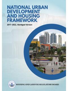
NATIONAL URBAN DEVELOPMENT AND HOUSING …
hlurb.gov.phNATIONAL URBAN DEVELOPMENT AND HOUSING FRAMEWORK 2017–2022 5 THE FRAMEWORK vision and principles the framework The vision reflects the aspirations of millions of Filipinos for the future of Philippine cities. Better urban systems are globally competitive, economically vibrant, and livable. Greener urban systems are environmentally
REVISED IMPLEMENTING FOR PD 957 - HLURB
hlurb.gov.phnecessary access road/right-of-way. Said access road right-of-way may be constructed either by the developer or the local government unit. B. Planning Considerations 1. Area Planning Planning and designing of subdivision projects shall take into account the following: a. safety and general welfare of the future occupants: b.
REPUBLIC ACT NO. 4726 AN ACT TO DEFINE CONDOMINIM ...
hlurb.gov.phREPUBLIC ACT NO. 4726 AN ACT TO DEFINE CONDOMINIM, ESTABLISH REQURIEMENTS FOR ITS CREATION, AND GOVERN ITS INCIDNETS SECTION 1. The short title of this Act shall be The Condominium Act. SECTION 2. A condominium is an interest in real property consisting of a separate interest in a unit in a
Related documents
2022 Agricultural Assessment Guide for Wisconsin Property ...
www.revenue.wi.govNote: The classification of land capable of being tilled but used as pasture is a function of capability use . (ex: grade 2 tillable land may be used for growing corn, beans, potatoes . Nevertheless, it remains grade 2 tillable based on its capability to grow corn) .
Basics of Synthetic Aperture Radar - NASA
appliedsciences.nasa.gov• Describe the interaction of SAR with the land surface ... • Nearly all weather capability • Day or night capability • Penetration through the vegetation canopy ... Example: Land Cover Classification • Brazil • JERS-1 L-band • 100 meter resolution .

Geography Optional Syllabus for UPSC 2021-22
www.aspireias.com2. Institutional factors; land holdings, land tenure and land reforms; 3. Cropping pattern, agricultural productivity, agricultural intensity, crop combination, land capability; 4. Agro and social-forestry; 5. Green revolution and its socio-economic and ecological implications; 6. Significance of dry farming; 7.

FLORIDA LAND USE, COVER AND FORMS CLASSIFICATION …
www.pinellas.wateratlas.usf.educlassification of land use, cover and forms and a flexible means of capturing not only image data but also auxiliary non-image data in a comprehensive land use/cover/forms data base. As a result of these increased capabilities, the mission of the Thematic Mapping Section has expanded greatly, necessitating a

Air Force Doctrine Publication 3-60, - AF
www.doctrine.af.milFor example, the land component may want a bridge destroyed at a specific time to create a trap. This is a preplanned target, which is also time sensitive. If the enemy ground forces moved more quickly than anticipated and were about to use the bridge …

US Topo—Topographic Maps for the Nation - USGS
pubs.usgs.govGeoreferencing provides the capability to display the ground coordinate location as the user moves the cursor around the map. US Topo maps are designed to be used like the traditional 7.5 minute quadrangle paper topographic maps for which the USGS is so well known. However, in contrast to paper-based maps, US Topo maps provide modern

[TO BE PUBLISHED IN THE GAZETTE OF INDIA, …
www.civilaviation.gov.inPage 2 of 15 Draft Rules PART I PRELIMINARY 1. Short title, commencement and application.— (1) These rules may be called the Drone Rules, 2021. (2) They shall come into force on the date of their publication in the Official Gazette. (3) They shall apply to, – (a) All persons owning or possessing or engaged in exporting, importing, manufacturing, trading, leasing, operating, …
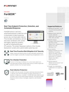
DATA SHEET FortiEDR
www.fortinet.comDATA SHEET FortiEDR opri 2021 orine, nc. ll ris reserved. Forine ®, Foriae , Foriare and Foriuard ®, and cerain oer ars are reisered radears o orine, nc., and oer orine naes erein a also e reisered and/or coon law radears o orine. ll oer produc or copan naes a e radears o eir respecive owners. Perforance and oer erics conained erein were aained in inernal la tess under ideal condiions, …