Example: confidence
Soil Survey Bulletin No.
the Geological Survey of Ireland. The scale of 1 : 30,000 compared very favourably with the map scale 1 : 25,000 used by the National Soil Survey (base maps only). Peatland distribution for Northern Ireland was derived from the Peat Bog Survey of Northern Ireland (1956), Land Use Survey Maps (1939), the 1920 Peat Map, and from
Tags:
Information
Domain:
Source:
Link to this page:
Documents from same domain
Improving Farm Sustainability - Teagasc
www.teagasc.iepre-heating of water) • Variable speed drives on the vacuum pump and milk pump as appropriate • Micro-generator level Solar PV system (solar panels that generate on-site electricity). A newly announced TAMS grant is available Energy ef˜ ciency and energy generation on dairy farms can reduce emissions and cost DAIRY ENERGY
The Winter Wheat Guide - Teagasc
www.teagasc.ieThe average yields of winter wheat achieved by Irish growers are amongst the highest globally. This is facilitated by the mild, wet climate and long summer days which results in slow crop development, and a long grain filling period rarely affected by drought. The crops development through its growth stages
A Step by Step Guide to Setting up a New Dairy Farm
www.teagasc.ie15 Dead A Collection € Allow for higher cow and calf mortality in the initial years Dairy 16 Supplies € 17 Milking Machine costs € 18 Milk Rec € Feed 19 Dairy cow € Cow numbers * target conc. / cow * conc. Price/tonne
y Grass Silage fo r Dai ry and Beef P rodu ct io n Syste ms
www.teagasc.ieDry matter yield is the most important factor affecting cost per tonne of silage fed. First cut silage tends to be Cless expensive than subsequent cuts. The relative cost of baled silage depends on DM yield -lighter crops make bales a more viable option. On a feed cost per ha basis, well-managed grass-plus-silage systems compare favourably with
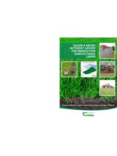
MAJOR & MICRO NUTRIENT ADVICE FOR PRODUCTIVE …
www.teagasc.ieaccording to the professional judgement of the advisor depending on soil conditions, weather, the appearance of the crop and the economic response to application of fertilizer. 7 Teagasc fertilizer advice is not static but is reviewed constantly in the light of new national and international research findings, changes in farm practices ...
Key Environment Issues for Dairy Farmers
www.teagasc.ienitrogen fertiliser type right for the prevailing conditions can significantly reduce losses and improve the effectiveness of N fertiliser Improved liveweight gain improves GHG efficiency by reducing finishing age and/or increasing carcass weight and thereby reducing the emissions per unit of output. Land Use – sequestration.
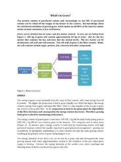
What s in Grass? - Teagasc
www.teagasc.ieDairy cows need a minimum of 30% fibre (NDF) to maintain a healthy rumen. Beef cattle can thrive with much lower levels of fibre in the diet. The fibre content of grass is defined by the neutral detergent fibre content (NDF %). The NDF content of grazed grass varies from 35% for leafy fresh spring grass to 50% for stemmy grass. ...
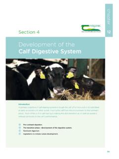
Development of the Calf Digestive System
www.teagasc.iedigestive system. The transition phase (period covering the move from the pre-ruminant to the ruminant phase) occurs between four and eight weeks of age, when the rumen begins to take over the main digestion of feed. When a calf consumes water and starter concentrates, bacterial fermentation is initiated in the rumen. This generates large amounts
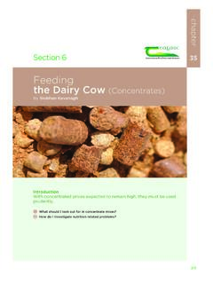
Feeding the Dairy Cow (Concentrates) - Teagasc
www.teagasc.ie4.vary with type of animal, stage of lactation and the base protein, minerals, fibre) is more important than the forage being offered. Always balance the protein content individual ingredient composition. Always buy of the concentrate with the protein content of the forage. 3. Unless feeding minerals separately, check that minerals
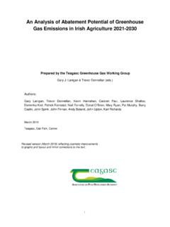
An Analysis of Abatement Potential of Greenhouse Gas ...
www.teagasc.ie• This is the second iteration of the Greenhouse Gas Marginal Abatement Cost Curve (GHG MACC) for Irish Agriculture to be published by Teagasc. This GHG MACC quantifies the opportunities for abatement of agricultural greenhouse gases, as well as the associated costs/benefits and visualises the abatement
Related documents

Geography programmes of study: key stages 1 and 2
assets.publishing.service.gov.ukuse maps, atlases, globes and digital/computer mapping to locate countries and describe features studied use the eight points of a compass, four and six-figure grid references, symbols and key (including the use of Ordnance Survey maps) to build their knowledge of the United Kingdom and the wider world
ORDNANCE SURVEY MAP READING
getoutside.ordnancesurvey.co.ukOrdnance Survey maps are covered in a series of faint blue lines that make up a grid. The lines have numbers accompanying them that allow you to accurately pinpoint your location on a map. Once you have located where you are, the grid system makes it simple to give others (such as Mountain Rescue) an accurate description of your location.

OS Landranger (1:50 000 scale) Map symbols
www.geographypods.comway are not shown on maps of Scotland. The representation on this map of any other road, track or path is no evidence of the existence of a right of way Firing and Test Ranges in the area. Danger! ... Made, printed and published by Ordnance Survey, Southampton, United Kingdom. For educational use only.

BEST PRACTICE GUIDANCE FOR HABITAT SURVEY AND …
www.heritagecouncil.ieTO HABITAT SURVEY AND MAPPING 1 INTRODUCTION 2 1.1 Scope 2 1.2 Need for Best Practice Guidance 3 1.3 Habitat Survey Methodology 4 2 HABITAT CLASSIFICATION 6 2.1 Past Approaches to Classification 6 2.2 Habitats Directive 8 2.3 Current and Future Irish Systems 9 3 MAPS AND GIS 12 3.1 Overview 12 3.2 Introduction to Mapping 12
N5 - SQA
www.sqa.org.ukStudy the Ordnance Survey Map Extract (Item A) of the Brecon Beacons area and find the cross-section X–Y shown on Diagram Q3 above. Use the information in the OS map to match the letters A to C with the correct features, choosing from the features below. • Afon Mellte (river) • A4059 • Minor road • Coniferous woodland 3
Explorer Explorer Map symbols - GEOGRAPHY FOR 2020 & …
www.geographypods.comGround survey height Air survey height 52 284 Surface heights are to the nearest metre above mean sea level. Heights shown close to a triangulation pillar refer to the ground level height at the pillar and not necessarily at the summit HEIGHTS AND NATURAL FEATURES Mud 60 75 50 Loose rock Outcrop Vertical face/cliff Boulders Scree TOURIST AND ...

Maps, Plans & Planning Applications: What to Submit - A ...
ecab.planningportal.co.ukMaps, Plans & Planning Applications: What to Submit . Most planning applications require a location plan and a site plan (also known as a block plan), to be submitted as supporting documents. A location plan shows the proposal in its surrounding context and a site plan shows the development in more detail. 1