Transcription of What is Remote Sensing?
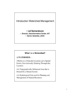
1 11 Introduction to Remote SensingLal SamarakoonDirector, Geoinformatics Center, AITS enior Scientist, JAXAC ontents Overview of Remote sensing Current & Future satellite Systems Overview of GIS GIS & Remote sensing Applications DiscussionWhat is Remote Sensing? 22 What is Remote sensing ? Remote sensing is defined as the science and technology by which characteristicsof objects of interest can be identified without direct contact Concept of Remote SensingEarth observation from space and airRemote Sensingis a technology to observe objects' size, shape and character without direct contact with them. The reflected or radiated electromagnetic(EM) waves are received by sensorsaboard platform. The characteristics of reflected or radiated EM waves depend on the type or conditionof the objects. By understanding characteristics of EM response and comparing observed information, we can know the size, shape and character of the of satellite Observation Enables to observe a broad area at a time Enables to observe the area for a long period Repeat pass observation (Time series data, Change detection) Enables to know the condition without visiting the area Enables to know invisible information Sensors for various electromagnetic spectrum (Infrared, microwave)33 Brief History of Remote sensing (1)1826 The invention of photography1850 sPhotography from balloons1873 Theory of electromagnetic energy by J.
2 C. Maxwell1909 Photography from airplanes1910 sWorld War I: aerial reconnaissance1920 sDevelopment and applications of aerial photography and photogrammetry1930 sDevelopment of radar in Germany, USA, and UK1940 sWorld War II: application of Infrared and microwave regions1950 sMilitary Research and DevelopmentBrief History of Remote sensing (2)1960 sThe satellite era: Space race between USA and first meteorological satellite (TIROS-1)1960 sFirst use of term Remote sensing 1960 s Skylab Remote sensing observations from the space1972 Launch of the first earth resource satellite (Landsat-1)1970 sRapid advances in digital image processing1980 s Landsat-4: new generation of Landsat sensors1986 Launch of French earth observation satellite (SPOT-1)1980 sDevelopment of hyperspectral sensors1990 sLaunch of earth resource satellites by national space agenciesand commercial companiesSatelliteoptical sensor/SAR High-flying AircraftAir SAR Light PlaneAerial ShuttlePlatforms44 SensorsOptical VisibleReflectance Near InfraredReflectance Thermal InfraredThermal RadiationMicrowave Passive (Scatterometer)Microwave Radiation Active(SAR, Altimeter)BackscatterLaser ActiveIntensity, TimeSensorsStrength of reflection and radiation of EM waves from plants, earth and water in each materialon earth shows its own strength of reflectionin each wavelength when it is exposed to the EM wavesSensorsaboard a platform are capable to acquire the strength of reflection and radiation in each wavelength.
3 Landsat TM/5 Manila, Phillipines 2000/01/26 Bands: 7,5,1 (RGB) 180 x 170km55 Process of Remote sensing (1)Energy Source or Illumination (A)- the first requirement for Remote sensing is to have an energy sourcewhich illuminates or provides electromagnetic energy to the target of interest. Radiation and the Atmosphere (B)- as the energy travels from its source to the target, it will come in contact with and interact with the atmosphereit passes through. This interaction may take place a second time as the energy travels from the target to the of Remote sensing (2)Interaction with the Target (C)- once the energy makes its way to the target through the atmosphere, it interacts with the targetdepending on the properties of both the target and the radiation. Recording of Energy by the Sensor (D)- after the energy has been scattered by, or emitted from the target, we require a sensor( Remote -not in contact with the target) to collect and recordthe electromagnetic radiation.
4 Process of Remote sensing (3)Transmission, Reception, and Processing (E)- the energy recorded by the sensor has to be transmitted, often in electronic form, to a receiving and processing stationwhere the data are processed into an image (hardcopy and/or digital). Interpretation and Analysis (F)- the processed image is interpreted, visually and/or digitally or electronically, to extract information about the target which was illuminated. 66 Process of Remote sensing (4)Application (G)- the final element of the Remote sensing process is achieved when we apply the informationthat we have been able to extract from the imagery about the target, in order to better understand it, reveal some new information, or assist in solving a particular of Electromagnetic EnergyRadiation:Transmission of electromagnetic energythrough a medium or by Remote SensingConduction: Atomic or molecular : The physical movement of bodies of energetic Sources Visible Lightis only one formof electromagnetic energy.
5 Radio waves, heat, ultra-violet rays and X-rays are other familiar forms. All of this energy is inherently similar, and radiates in accordance with basic wave SpectrumVisible Spectrum (1)The light which our eyes- our " Remote sensors" - can detect is part of the visible spectrum. It is important to recognize how small the visible portionis relative to the rest of the spectrum. There is a lot of radiation around us which is invisibleto our eyes, but can be detected by other Remote sensing instrumentsand used to our advantage. Visible SpectrumIt is important to note that this is the only portion of the EM spectrum we can associate with the concept of - m - m - m - - - mVisible SpectrumPrismVisible Spectrum (2)Blue, green, and redare the primary colorsor wavelengths of the visible spectrum. They are defined as such because no single primary color can be created from the other two, but all other colorscan be formed by combining blue, green, and redin various proportions.
6 Although we see sunlight as a uniform or homogeneous color, it is actually composed of various wavelengthsof radiation in primarily the ultraviolet, visibleand infrared portions of the spectrum. The visibleportion of this radiation can be shown in its component colorswhen sunlight is passed through a (IR) RegionThe IR Regioncovers the wavelength range from approximately m to 100 m- more than 100 times as wide as the visible portion!The IR regioncan be divided into twocategories based on their radiation properties - the reflected IR, and the emittedor thermal and Thermal IRRadiation in the reflected IR regionis used for Remote sensingpurposes in ways very similarto radiation in the visible portion. The reflected IR covers wavelengths from approximately m to m. The thermal IR regionis quite differentthan the visible and reflected IR portions, as this energy is essentially the radiation that is emitted from the Earth's surface in the form of heat.
7 The thermal IR covers wavelengths from approximately m to 100 m. Microwave RegionThe portion of the spectrum of more recent interest to Remote sensingis the microwave region from about 1 mm to 1 covers the longest wavelengthsused for Remote sensing . The shorter wavelengthshave properties similar to the thermal infraredregion while the longer wavelengthsapproach the wavelengths used for radio broadcasts. Microwave Region1010 Reflectance Theproportionsof energy reflected, absorbed, and transmitted will depend on the wavelength of the energyand the material and condition of the feature. These features permit us to distinguish different featureson an image. Even with a given feature type, the proportion of reflected, absorbed and transmitted energy will vary at different wavelengths. Different features may be distinguished using more than one spectral Reflectance of Earth-Surface MaterialsTypical Spectral Reflectance Curves0%10%20%30%40%50%60%70%80% (m m)ReflectanceWater (clear)Vegetation (green)Dry bare soil (gray-brown)BlueGreenRedNear IRMid IRMid IR1 2 3 4 5 7 TM band( m)ReflectanceSoilVegetationWaterBands of Landsat TMPassive and Active Remote sensingPassive Sensors: measure energy that is naturally available( Optical sensors)Active Sensors: provide their own energy source for illumination ( Synthetic Aperture Radar (SAR),Laser Scanner (LIDAR) )1111 Passive Remote sensing The sunprovides a very convenient source of energyfor Remote sensing .
8 The sun's energy is reflected for visible wavelengths, or absorbedand then re-emitted for thermal IRwavelengths For all reflected energy, this can only take place during the time when the sun is illuminating the Earth Energy that is naturally emitted(such as thermal infrared) can be detected day or night, as long as the amount of energy is large enough to be recorded. Active Remote sensing An activesensor emits radiationwhich is directed toward the target to be investigated. The radiation reflectedfrom that target is detected and measured by the sensor. Advantages for active sensors: the ability to obtain measurements anytime, regardless of the time of day, season or (weather), examine wavelengthsthat are not sufficiently provided by the sun( , microwaves), to better controlthe way that a target is illuminated. However, active systems require the generation of a fairly large amount of energyto adequately illuminate targets.
9 1212 Spatial Resolution and PixelMost Remote sensing images are composed of a matrix of picture elements, or pixels, which are the smallest units of an image. Pixels are normally square and represent a certain area on an image. It is important to distinguishbetween pixel sizeand spatial resolution. If a sensor has a spatial resolution of 20 m and an image from that sensor is displayed at full resolution, each pixel represents an area of 20m x 20m on the ground. In this case the pixel size and resolution are the same. However, it is possible to displayan image with a pixel size different than the resolution. Many posters of satellite images have their pixels averaged to represent larger areas, although the original spatial resolution of the sensor remains the same. Spatial Resolution of SatellitesImages where only large features are visible are said to have coarse or low resolution.
10 In fine or high resolutionimages, small objects can be detected. Military sensors for example, are designed to view as much detail as possible, and therefore have very fine resolution. Commercial satellites provide imagery with resolutions varyingfrom a few metres to several kilometres. Generally speaking, the finer the resolution, the less total ground areacan be seen. Scale of Image/MapThe ratio of distance on an image or map, to actual ground distanceis referred to as scale. If you had a map with a scale of 1:100,000, an object of 1cm length on the map would actually be an object 100,000cm (1km) long on the ground. Maps or images with small"map-to-ground ratios" are referred to as small scale( 1:100,000), and those with larger ratios( 1:5,000) are called large scale. 1313 Spectral Resolution (1)Different classes of features and details in an image can often be distinguished by comparing their responses over distinct wavelength ranges.