Arc Hydro Tools 2.0 - Tutorial
Getting Started Software Requirements .Net Framework 3.5 for ArcGIS 10 ArcGIS 10 (Note: Arc Hydro is fully functional for ArcInfo and ArcEditor only – limited functionality is available with ArcView – see note below). Spatial Analyst extension
Download Arc Hydro Tools 2.0 - Tutorial

Information
Domain:
Source:
Link to this page:
Documents from same domain
ArcGIS 10.4 Issues Addressed List - Esri
downloads.esri.comEnterprise Geodatabase . Support Files ArcGIS Desktop Top BUG-000081094 Enable parcel division equal area to use 1 for the number of parts. BUG-000081260

ArcGIS Data Models: Water Utilities - Esri Support …
downloads.esri.comWater Utilities ArcGIS ™ Data Models Water Utilities $50.00 88053 DOME2M12/01sp Printed in USA ArcGIS ™ Water Utilities Data Model ESRI • 380 New York Street • Redlands, CA 92373-8100 • USA

D.A.R.T. (Customer Segmentation) Introduction - Esri
downloads.esri.comD.A.R.T. (Customer Segmentation) Introduction . DART is a marketing platform created by OPENmate. The life style of urban and suburb are different.

ArcGIS Secure Mobile Implementation Patterns - Esri
downloads.esri.comArcGIS Secure Mobile Implementation Patterns 3 | Page 2.2 ArcGIS Enterprise ArcGIS Enterprise is the software offering from Esri …
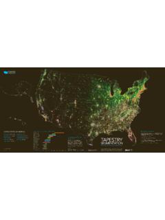
G60263 Tapestry Poster 141079 R24 dl - Esri
downloads.esri.comPrincipal Urban Centers: Young, mobile, diverse in metros of 2.5 + million people LIFEMODE SUMMARY GROUPS 1. Affl uent Estates: Established wealth —educated,
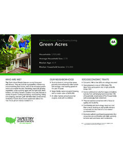
LifeMode Group: Cozy Country Living 6A Green Acres
downloads.esri.comOwn 86.1% Rent 13.9% Chart Title Own Rent Home Ownership US Percentage: 62.7% Own 37.3% Rent Population Population Growth (Annual %) Population Density (Persons per sq. mile) 350 350 350 0 0
Tutorial 9: Advanced shape grammar - Esri Support …
downloads.esri.comAttributes, variables, and assets Attributes are defined at the beginning of the rule file. These attributes are used through the entire rule set and can be modified via
Arc Hydro GP Tools 2.0 - Tutorial - Esri Support Home
downloads.esri.comBurn Stream Slope 27 ... How to create your own model 55 ... The purpose of this tutorial is to illustrate, step-by-step, how to access and use the Arc Hydro Geoprocessing (GP) tools that are installed by the standard Arc Hydro setup. The installation process
Template for Creating a Project Vision Statement
downloads.esri.comTemplate for Creating a Project Vision Statement An ESRI ... Problem Statement This section summarizes the problem being solved by this project. The following issues should be addressed: Describe the problem. Describe the stakeholders affected by the problem.
Tips and Tricks for using ArcGIS 8 - downloads.esri.com
downloads.esri.comTips and Tricks for using ArcGIS 8.3 This resource was developed from ideas gathered from ESRI software training instructors in Redlands, California and at ESRI regional offices.
Related documents

Getting Started with ArcGIS - University of Pennsylvania ...
web-facstaff.sas.upenn.eduWelcome to Getting Started with ArcGIS. This book is intended to help you get started using ESRIfi ArcGISŽ software and to illustrate the methods and procedures involved in conducting a geographic information system (GIS) project. If you are new to GIS, this book is a great place to startŠyou

ArcGIS Pro General Training Guide - Harvard University
cga-download.hmdc.harvard.eduGetting Started with ArcGIS Pro – To complete exercises, you will need ArcGIS Pro 1.2 – 2.1 (Basic, Standard & Advanced) & ArcGIS Online User Privileges. Some optional exercise steps may require the 3D Analyst, the Geostatistical Analyst, or the Spatial Analyst extension.
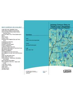
Joining Census Data to TIGER/Line Shapefiles
www2.census.govGETTING STARTED . The instructions are for the 10.x versions of ArcGIS. The data from American FactFinder should be downloaded and saved in a Microsoft Excel Workbook format. See the brochure “Downloading Data from American FactFinder to use with TIGER/Line

Content Management Strategies for your ArcGIS Enterprise ...
www.esri.comNotes: This whitepaper takes a more “getting started” perspective, though you may find this information useful if you have been working with your Enterprise portal for some time and need to revisit your approach to content management. Many …

Arc Hydro in ArcGIS Pro: The Next Generation of Tools for ...
www.esri.comDefitions: Hydro Analysis in ArcGIS •Hydro Analysis in ArcGIS is used to model the flow of water across a surface. •What are the primary objectivesof hydrologic analysis in a GIS?-Extract hydro information and drainage system characteristics from a digital elevation model.-To know where the water comes from, and where it is flowing to.

Hydrologic Modeling using HEC-HMS
web.ics.purdue.edu2 Getting Started Start HEC-HMS by clicking on the HEC-HMS icon by going to Start Programs HEC-HMS HEC-HMS 3.1.0 (Purdue students doing this tutorial in an ITap Lab may have to first run the set-up file by going to Start Programs Course Software Engineering HEC-HMS HEC-HMS 3.1.0) After a few seconds, the following should appear: