
Cooloola Conditions Report
Neighbourhood Police Beat (Reviewed 16 August 2016) Everything is protected – plants, animals, natural and cultural features Updated 19 January 2022 Visit: www.des.qld.gov.au Track and beach conditions (Updated 19 January 2022) 2021) Cooloola conditions report
Download Cooloola Conditions Report

Information
Domain:
Source:
Link to this page:
Documents from same domain

Moreton Island National Park and Recreation Area map
parks.des.qld.gov.auTitle: Moreton Island National Park and Recreation Area map Author: Queensland Department of Environment and Science Subject: Moreton Island National Park and Recreation Area map, indicating access, facilities, features, tracks and vehicle access and speed zones.
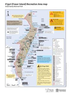
K’gari (Fraser Island) Recreation Area map
parks.des.qld.gov.auTitle: K'gari (Fraser Island) Recreation Area map Great Sandy National Park Author: Queensland Department of Environment and Science Subject: Map of K'gari (Fraser Island), Great Sandy National Park indicating locality, access, walking tracks and facilities.

Noosa National Park walking tracks map Headland Section
parks.des.qld.gov.auGranite Bay Alexandria Bay Lion Rock Noosa Heads Surf Life Saving Club Sunshine Beach Surf Life Saving Club Boiling Day-use area Pot Dolphin Point Hell’s Gates Laguna Lookout Sunshine Beach e Sunshine D a v i d L o w W a y Surf St Emergency radio Sunshine Beach edge Rd ong e Bicentennial Dr 3 1 2 4 4 5 4 2 Park Rd St Seaview Tce
Cape York Peninsula - Department of Environment and ...
parks.des.qld.gov.auYork Peninsula. From May to July, maximum temperatures are around 30°C. As the season progresses, the days become hotter and more humid. The peninsula is busiest between June and September, during the ‘cooler’ weather. School holiday periods (July and September) are best avoided if you seek solitude. Parks on the peninsula are closed during

Teewah Beach camping zones map Cooloola Recreation Area
parks.des.qld.gov.auBring your own portable toilet. Portable toilets are mandatory for all campers in the Teewah Beach camping zones. All Qld road rules apply on Teewah Beach. Legend Recreation Area Water 4WD camping zone No camping area 4WD camping only 4WD camper trailer 4WD caravan Toilets Bring your own portable toilet Portable toilet waste disposal Shower ...
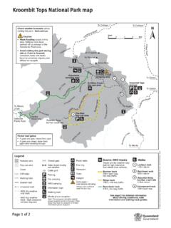
Kroombit Tops National Park map - Parks and forests
parks.des.qld.gov.auTitle: Kroombit Tops National Park map Author: Queensland Government; Queensland Parks and Wildlife Service Subject: Map of Kroombit Tops National Park indicating access, facilities, features, tracks and camping.

K'gari (Fraser Island) conditions report
parks.des.qld.gov.auK’gari (Fraser Island) conditions report Everything is protected – plants, animals, natural and cultural features www.des.qld.gov.au General alerts Reviewed 06 January 2022 The Department of Environment and Science (DES) continues to monitor and receive guidance from the Government in relation to COVID-19 health and safety
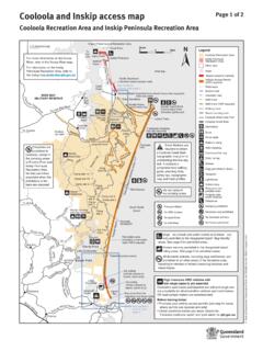
Cooloola and Inskip access map - Parks and forests
parks.des.qld.gov.au(Northern beach access road) See northern access map page 2 Bullock Inskip Point Inskip Peninsula ... including in vehicles or trailers traversing beaches and inland tracks. High clearance 4WD vehicles with ... Horses are permitted on the council horse trail and on the beach indicated on the map. (no public facilities) Noosa River estuary

Moreton Bay Marine Park
parks.des.qld.gov.auEntry and use guide Gene r a l se zone Ha b i t a t protection zone C o n se r v ation park zone M arine n atio nal park zone Boating Yes Line fishing Yes Yes Yesa Nob Crabbing Yes Yes Yesc Nob Trolling Yes Yes Yes No Bait gathering Yes Yes Yes Nob ait netting Yes No Netting (other than bait netting) Yes Yes Nob Nob Limited spearfishing Yes ...
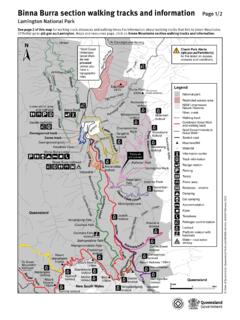
Lamington Binna Burra Map - Parks and forests
parks.des.qld.gov.auLamington National Park map: Binna Burra walking tracks and information Author: Queensland Department of Environment and Science Subject: Map of the Binna Burra section of Lamington National Park showing access, facilities and recreational opportunities and safety messages. Legend provided. Keywords
Related documents
Application to determine if prior approval is required for ...
ecab.planningportal.co.ukPlanning Portal - Application Guidance V2019 . Application to determine if prior approval is required for a proposed: Larger Home Extension. The Town and Country Planning (General Permitted Development) (England) Order 2015
Magna Carta (1215)
d1lexza0zk46za.cloudfront.netshall be imposed except by the assessment on oath of reputable men of the neighbourhood. (38) In future no official shall place a man on trial upon his own unsupported statement, without producing credible witnesses to the truth of it.
Category 7: Employee Commuting
ghgprotocol.orgTechnical Guidance for Calculating Scope 3 Emissions [89] CATEGO Employee Commuting Emission factors needed Companies should collect: •, CHEmission factors for each mode of transport (usually expressed in units of greenhouse gas (CO 2 4, N 2 O, or CO 2 e) emitted per passenger-kilometers travelled).
IMPORTANT CANDIDATES ARE REQUESTED TO GO …
edumedias.s3.ap-south-1.amazonaws.comwould need to look for vacancy announcements by the Army Public School of their choice/neighbourhood. For this, they may contact the school/check the website of the schools concerned or look for advertisement on the newspapers. Stage 2

Table of Contents
library.bjp.org01 02 03 04 06 07 14 03 11 13 17 20 23 24 27 29 31 33 36 38 Table of Contents 05 07 08 09 10 11 12 13 15 2 40 09 05 16 17 Ÿ Road Connectivity Ÿ Energy Ÿ Jal Shakti ...

Calstock Neighbourhood Development Plan 2019-2030
www.cornwall.gov.ukNeighbourhood plans and orders should not promote less development than set out in the Local Plan or undermine its strategic policies. The legal basis of the NDP is from: the Localism Act 2011, Neighbourhood Planning Regulations 2 012, the