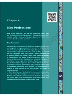
Map Projections - NCERT
The need for a map projection mainly arises to have a detailed study of a region, which is not possible to do from a globe. Similarly, it is not easy to compare two natural regions on a globe. Therefore, drawing accurate large-scale maps on a flat paper is required. Now, the problem is how to transfer these lines of latitude and longitude on a ...
Download Map Projections - NCERT

Information
Domain:
Source:
Link to this page:
Documents from same domain
ntse exam notification - National Council Of …
ncert.nic.inExamination: The tentative pattern of written examination will be as follows: Stage-I & Il : examination at the State/UT level will comprise of three papers i.e.
14 Effects Electric Current and Its - National …
ncert.nic.in76 EXEMPLAR PROBLEMS 3. Three bulbs A, B, C are connected in a circuit as shown in Figure 14.2. When the switch is ‘ON’ (a) bulb C will glow first. (b) bulb B and C will glow simulaneously and bulb A will
SEMICONDUCTOR AND SIMPLE CIRCUITSnot to be …
ncert.nic.in469 Semiconductor Electronics: Materials, Devices and Simple Circuits semiconductors. However , after 1990, a few semiconductor devices using organic semiconductors and semiconducting polymers have been
ENVIRONMENTAL CHEMISTRY - National Council …
ncert.nic.in400 CHEMISTRY (c) Hydrocarbons: Hydrocarbons are composed of hydrogen and carbon only and are formed by incomplete combustion of fuel …
LAWS OF MOTION
ncert.nic.inLAWS OF MOTION 91 In practice, the ball does come to a stop after moving a finite distance on the horizontal plane, because of the opposing force of friction which
DESIGN OF THE QUESTION PAPER Mathematics …
ncert.nic.inDESIGN OF THE QUESTION PAPER, SET-I 207 (A) 18 5 (B) 17 5 (C) 17 8 (D) 1 7. In the adjoining figure, PA and PB are tangents from a point P to a circle with centre O.
CHAPTER 10
ncert.nic.in(A) Main Concepts and Results Circle, radius, diameter , chord, segment, cyclic quadrilateral. • Equal chords of a circle (or of congruent circles) subtend equal angles at the
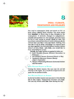
INDIA : CLIMATE, VEGETATION AND WILDLIFE
ncert.nic.inINDIA : CLIMATE, VEGETATION AND WILDLIFE 59 year. Therefore, they always appear gr een and are called evergreen forest as you may notice in Figure
Objectives Polymers - National Council of …
ncert.nic.in427 Polymers C:\Chemistry-12\Unit-15.pmd 28.02.07 Polymers can also be classified on the basis of mode of polymerisation into two sub groups.
TEXTBOOK IN GEOGRAPHY FOR CLASS IX
ncert.nic.inFOREWORD The National Curriculum Framework, (NCF) 2005, recommends that children’s life at school must be linked to their life outside the school. This principle
Related documents
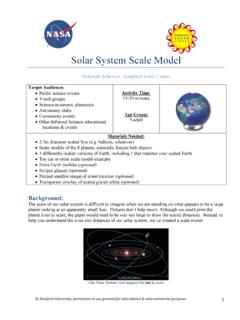
Solar System Scale Model - Stanford University
solar-center.stanford.eduOur Solar System, real imagery but not to scale . Stanford Solar Center Scale Model 2 Process: 1. Ask your audience if they know what a scale model is. A scale model is a representation or ... If you have one, show participants the satellite map of the area and the orbit overlays. Encourage discussion and questions. 8. If participants are still ...

Maps and Cartography - Ball State University
lib.bsu.eduScale, continued… A map displaying the entire surface of the earth with all the continents and oceans would be drawn at a larger scale. A scale on this type of map would be drawn in thousands of miles and kilometers. A map of the White House, however, may have a scale with distance determined in feet. The two maps described above may
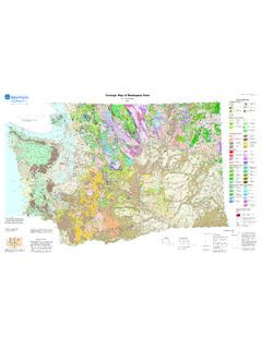
Geologic Map of Washington State - USGS
ngmdb.usgs.govGeologic Map of Washington State by J. Eric Schuster 2005 WASHINGTON DIVISION OF GEOLOGY AND EARTH RESOURCES GEOLOGIC MAP GM-53 10 0 10 20 30 40 50 KILOMETERS SCALE 1:500 000 10 0 10 20 30 40 MILES 1 inch on the map represents approximately 8 miles on the ground. 1 centimeter on the map represents 5 kilometers on the …
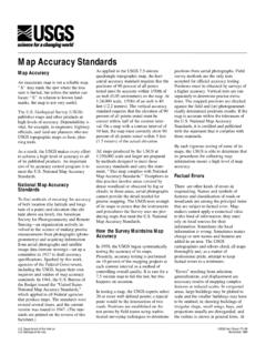
Map Accuracy Standards - USGS
pubs.usgs.govmap scale, it may not be possible to show each of several closely spaced linear features in its correct position. In such cases, one feature, such as a railroad, is positioned in its true location and others, such as parallel roads or rivers, are displaced the minimum amount necessary to make each symbol legible or are omitted to make the

OS Landranger (1:50 000 scale) Map symbols
www.geographypods.comas the scale of mapping will allow. Rights of way are not shown on maps of Scotland. The representation on this map of any other road, track or path is no evidence of the existence of a right of way Firing and Test Ranges in the area. Danger! Observe warning notices. Footpath Road used as a public path Bridleway Byway open to all traffic ...

FM 3-25.26 MAP READING AND LAND NAVIGATION - Radford
www.radford.edumove quickly and effectively on the battlefield. This chapter includes the definition and purpose of a map and describes map security, types, categories, and scales. 2-1. DEFINITION A map is a graphic representation of a portion of the earth's surface drawn to scale, as seen from above. It …

Student MAP Scores - Rochester City School District
www.rcsdk12.orghe or she has grown from one year to the next. MAP assessments do the same sort of thing, except they measure your student’s growth in mathe-matics, reading, and language usage. The RIT scale is an equal-interval scale much like feet and inches on a yardstick. It is used to chart your child’s academic growth from year to year.
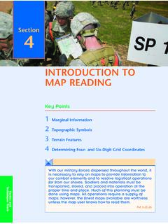
INTRODUCTION TO MAP READING - University of Akron
www.uakron.eduThe contour interval for each map will be listed in the lower center of the map margin. Make sure you note whether the interval is in meters or feet. 182 SECTION 4 scale the ratio of the map distance to the corresponding distance on the earth’s surface Figure 4.5 The Three Norths Figure 4.4 Map Scale, Contour Interval, and Grid Reference Box