
owner’s manual - Garmin
Unit 5, The Quadrangle, Abbey Park Industrial Estate, Romsey, SO51 9DL, U.K. Tel. 44/1794.519944 ... names and saves a location (as an electronic waypoint) in its memory, allowing you to navigate back to ... • Zoom in and out on Map Page • Cycle through trip data on NavigationPage
Download owner’s manual - Garmin
Information
Domain:
Source:
Link to this page:
Documents from same domain
EDGE® 1030 Owner’s Manual - Garmin International
static.garmin.comCharging the Device NOTICE To prevent corrosion, thoroughly dry the USB port, the weather cap, and the surrounding area before charging or connecting to
Owner’s Manual - Garmin International
static.garmin.comIntroduction WARNING See the Important Safety and Product Information guide in the product box for product warnings and other important information.
Lidar Lite v3 Operation Manual 2 and Technical …
static.garmin.com1 Lidar Lite v3 Operation Manual and Technical Specifications Laser Safety WARNING This device requires no regular maintenance. In the event that the device
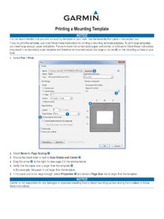
Printing a Mounting Template - Garmin
static.garmin.comPrinting a Mounting Template Notice It is not recommended that you print a mounting template on your own. Use the template that came in the product box.
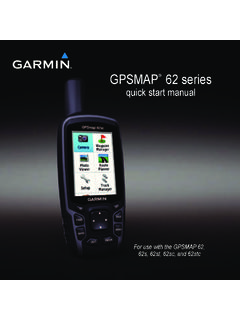
GPSMAP 62 series - Garmin
static.garmin.comGPSMAP 62 Series Quick Start Manual 3 3. Replace the battery cover. For best results, after you install new batteries, update the battery type in the

Important Safety and Product Information 2 …
static.garmin.comIMPORTANT SAFETY AND PRODUCT INFORMATION WARNING Failure to heed the following warnings could result in an accident or collision resulting in death or
Important Safety and Product Information 2 …
static.garmin.comImportant Safety and Product Information 2 Informations importantes sur le produit et la sécurité 3 guida Informazioni importanti sulla sicurezza e sul
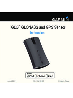
Instructions - Garmin
static.garmin.com1 GLO™ GLONASS and GPS Sensor Instructions August 2012 190-01492-00_0B Printed in Taiwan

GNS 430(A) - Garmin International
static.garmin.com190-00140-00 Rev. P GNS 430(A) Pilot’s Guide and Reference i RECORD OF REVISIONS Revision Date of Revision Description A 12/98 Initial Release B 4/99 Update to conform to recent SW changes
GNS 530(A) - Garmin International
static.garmin.com190-00181-00 Rev. H GNS 530(A) Pilot’s Guide and Reference i RECORD OF REVISIONS Revision Date of Revision Description A 5/00 Initial Release B 5/01 Update to reflect software changes through 2.06
Related documents
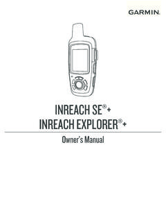
INREACH SE+ / Owner’s Manual INREACH EXPLORER
static.garmin.comSelect > View on Map to view the location on the map from which the message was sent. Navigating to a Message Location. You can navigate to the location from which a message was sent by another inReach device. 1. Select Messages . 2. Select a conversation. 3. Select a message that includes . 4. Select Navigate. Including Location Coordinates in ...

FEATURES SHOWN ON TOPOGRAPHIC MAPS
pubs.usgs.govThe amount of information shown on a topographic map depends on the map scale, the purpose of the map, and the cost of obtain ing the information. This chapter describes the three main categories of map information and the methods by which they are shown. Reference lists of published maps and a chart illustrating standard map symbols are
Map Accuracy Standards - USGS
pubs.usgs.govquadrangle topographic map, the hori-zontal accuracy standard requires that the positions of 90 percent of all points tested must be accurate within 1/50th of ... Sometimes names change or new names and features are added in an area. The USGS cartographers and editors check all maps

Chapter 2 Reading Topographic Maps and Making Calculations
www.honolulu.hawaii.eduAdjoining Quadrangle Legend (corners of map) Names of adjoining quadrangles are frequently indicated in the corner margins of USGS topographical maps; Mayfield is the joining quadrangle in Figure 2-3. Figure 2-3. Road classification, revision date, quadrangle location and …
Campus Map - Purdue University
www.purdue.eduWest Lafayette Campus BUILDING NAMES AND ABBREVIATIONS MODIFICATION DATE: AUGUST, 2020 AACC Asian American and Asian Resource and Cultural Center F6 ACPF Ag Alumni Seed Controlled Environmental Pheotyping Facility F8 ABE Agricultural and Biological Engineering F9 ADDL Animal Disease Diagnostic Laboratory G10 ADMADM Agricultural …