U.S. Chart No. 1
and NGA charts. Col 1 — Symbol number. The number together with the section letter which . DSSHDUV DW WKH WRS RI HDFK SDJH FRQVWLWXWHV D XQLTXH LGHQWL¿HU IRU HDFK symbol, such as C1 for the “Coastline, surveyed” symbol. Col 2 — INT symbol example. Col 3 — Description of the feature or real world phenomenon being portrayed.
Download U.S. Chart No. 1

Information
Domain:
Source:
Link to this page:
Documents from same domain
Distances Between United States Ports
nauticalcharts.noaa.govDistances Between United States Ports is published by the Office of Coast Survey, National Ocean Service (NOS), National Oceanic and Atmospheric Administration (NOAA), pursuant to the Act of 6 August 1947 (33 U.S.C. 883a and b), and the Act of 22 October
Co UNITEDas STATESt Pilot
nauticalcharts.noaa.govsafe navigation. (7) Chapter 2 contains selected extracts from the Code of Federal Regulations (CFR) that affect mariners. (8) Chapter 3 contains general information that is peculiar to the region covered by a particular Coast Pilot volume. For example, practical information regarding offshore currents and dangers, coastal aids to navigation,

Gulf of Mexico, Puerto Rico and Virgin Islands
nauticalcharts.noaa.govGulf of Mexico, Puerto Rico and Virgin Islands Co ... the gulf coast, clockwise around each of the Great Lakes and south to north on the west coast and Alaskan coast. Features are described as they appear on the largest scale chart, with that chart number prominently shown in blue.
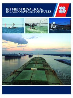
INTERNATIONAL U.S. INLAND NAVIGATION RULES
nauticalcharts.noaa.govFollowing the signing of the Convention on the International Regulations for Preventing Collisions at Sea, 1972, a new effort was made to unify and update the various inland navigation rules. This effort culminated in the enactment of the Inland Navigational Rules Act of 1980. This legislation sets out Rules 1 through 38—

Co UNITED asSTATESt Pilot
nauticalcharts.noaa.govWeekly updates to this edition are available at: ... waters of the Great Lakes. The Coast Pilot is intended to be used as a supplement to NOAA nautical charts. Much ... planned by the U.S. Army Corps of Engineers (USACE) and may be deeper than current conditions. For this reason,
Co UNITED asSTATESt Pilot - National Oceanic and ...
nauticalcharts.noaa.govNotices to Mariners and other information pertinent to safe navigation. (7) Chapter 2 contains selected extracts from the Code of Federal Regulations (CFR) that affect mariners. (8) Chapter 3 contains general information that is peculiar to the region covered by a particular Coast Pilot volume. For example, practical information regarding
Co UNITED asSTATESt Pilot - Office of Coast Survey
nauticalcharts.noaa.govsequence, north to south on the east coast, east to west on the gulf coast, clockwise around each of the Great Lakes and south to north on the west coast and Alaskan coast. Features are described as they appear on the largest scale chart, with that chart number prominently shown in blue. (10) Appendix A contains contact information regarding
Related documents
C0 Controls and Basic Latin - Unicode
www.unicode.orgThese charts are provided as the online reference to the character contents of the Unicode Standard, Version 14.0 but do ... The particular fonts used in these charts were provided to the Unicode Consortium by a number of different font designers, who own the rights to the fonts. ... ° 2422 blank symbol
Chapter 16 - Gantt Charts
www2.westsussex.gov.ukcharts that depict activities in a project, their ... number followed by w for weeks, d for days, h for hours, or m for minutes (for example, 3d for 3 days). A task with a duration value of zero is a milestone (see task 8 Go to Airport above). ... Right-click on a blank area of the page and 2 .
Formulas, Functions and Charts
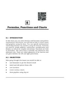
nios.ac.inFormulas, Functions and Charts :: 177 8.4 CHARTS Charts allow you to present data entered into the worksheet in a visual format using a variety of graph types. Before you can make a chart, you must first enter data into a worksheet. This section explains how you can create simple charts from the data.
Supplemental Aids for STAAR: What's Allowed and What's Not?
tea.texas.govMathematics: Number Charts v. Calculation Aids A number chart with a sequence of numbers is allowable as a supplemental aid. However, number charts that identify and/or illustrate a calculation function (e.g., +, x) are . NOT. allowable as supplemental aids. A student . MUST. meet eligibility for the Calculation Aids policy to use these types ...
1870 FEDERAL CENSUS - Archives
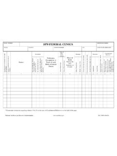
www.archives.govPAGE NUMBER 1870 FEDERAL CENSUS MICROFILM SERIES STATE COUNTY TOWN/TOWNSHIP P.O. DATE OF ENUMERATION g-n n Country n Names Description Profession, Occupation, or Trade of each Male or Female Person Value of Real Estate Owned Place of Birth Naming the state, Territory, or Parentage .. h r Education i e t Constitutional …
National Archives genealogy forms and charts
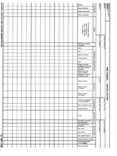
www.archives.govNumber of months not em 10 ed Attended school (months) Can read Can write Can speak English Home owned or rented Home owned free or mortgaged Farm or house . Title: National Archives genealogy forms and charts Subject: 1900 Census Created Date:
RIT Reference Charts - NWEA
www.nwea.orgMolly stared out the bus window with blank eyes. Next to her, a woman pulled herself up. She got oˇ at the next stop. Molly looked over and saw that she had left something on the seat. (passage continues) What was Molly’s fi rst reaction when she picked up the wallet? 1. to turn it in to the bus driver ˜. to look at the pictures
Control Charts in the Analytical Laboratory
www.philadelphia.edu.joShewhart control charts based on the standard deviation of the mean • In some cases the number of replicates appears in the standard deviation of the mean (= σ/ √n), are used to set the acceptable limits of the graph • The chart is made according to the following steps: 1. Plot the daily mean (xi) for each of the daily results against ...