Transcription of Geologic Map of the Great Smoky Mountains National Park ...
1 Department of the Geological SurveyPrepared in cooperation with the National park ServiceGeologic Map of the Great Smoky Mountains National park Region, Tennessee and North CarolinaBy Scott Southworth, Art Schultz, John N. Aleinikoff, and Arthur J. MerschatPamphlet to accompanyScientific Investigations Map 2997 Supersedes USGS Open-File Reports 03 381, 2004 1410, and 2005 Department of the InteriorKEN SALAZAR, Geological SurveyMarcia K. McNutt, Geological Survey, Reston, Virginia: 2012 For more information on the USGS the Federal source for science about the Earth, its natural and living resources, natural hazards, and the environment, visit or call 1 888 ASK an overview of USGS information products, including maps, imagery, and publications, visit order this and other USGS information products, visit use of trade, product, or firm names is for descriptive purposes only and does not imply endorsement by the this report is in the public domain, permission must be secured from the individual copyright owners to reproduce any copyrighted materials contained within this citation:Southworth, Scott, Schultz, Art, Aleinikoff, , and Merschat, , 2012, Geologic map of the Great Smoky Moun-tains National park region, Tennessee and North Carolina: Geological Survey Scientific Investigations Map 2997, one sheet, scale 1:100,000, and 54-p.
2 Pamphlet. (Supersedes USGS Open-File Reports 03 381, 2004 1410, and 2005 1225.)ISBN 978-1-4113-2403-9 Cover: Looking northeast toward Mount Le Conte, Tenn., from Clingmans Dome, ..1 Previous ..3 Field Mapping ..3 Digitization and Base Map ..3 General Geologic Setting and Physiography .. Blue Ridge Province ..3 Highlands of the Western Blue Ridge Province ..3 Foothills of the Western Blue Ridge Province ..4 Northern Foothills ..4 Central Foothills ..5 Tennessee Valley of the Valley and Ridge Province ..5 Rocks of the Central Blue Ridge Province ..5 Rocks of the Highlands of the Western Blue Ridge Province ..5 Mesoproterozoic Basement Complex ..5 Paragneisses ..7 Ultramafic Rocks ..8 Amphibolite ..9 Hornblende-Biotite Gneiss .. Biotite Gneiss ..10 Spring Creek Metagranitoid ..10 Metamonzogranite ..11 Mylonitic Monzogranite ..11 Megacrystic Metagranite ..11 Metagranodiorite ..11 Biotitic Porphyritic Metagranitoid ..11 Neoproterozoic Ocoee Supergroup.
3 Group ..12 Introduction ..12 Wading Branch Formation ..12 Longarm Quartzite ..12 Roaring Fork Sandstone ..12 Pigeon Siltstone ..13 Metcalf Phyllite ..13 Rich Butt Sandstone ..13 Great Smoky Group ..14 Introduction ..14 Elkmont Sandstone ..14ivThunderhead Sandstone ..14 Cades Sandstone ..15 Anakeesta Formation ..15 Copperhill Formation ..16 Wehutty Formation ..17 Grassy Branch Formation ..17 Ammons Formation ..17 Dean Formation ..17 Rocks of the Murphy Belt ..17 Tusquitee Quartzite and Nantahala Formation ..17 Intrusive Rocks ..18 Metadiorite, Metadiabase, and Altered Rocks ..18 Pegmatite ..18 Trondhjemite ..19 Vein Quartz ..19 Rocks of the Foothills of the Western Blue Ridge Province ..19 Neoproterozoic Walden Creek Group .. Formation ..19 Shields Formation ..19 Wilhite Formation ..20 Sandsuck Formation ..20 Paleozoic Rocks .. Cambrian Chilhowee Group ..21 Cochran Formation ..21 Nichols Shale ..21 Nebo Quartzite ..21 Murray Shale ..21 Hesse Quartzite.
4 22 Helenmode Formation ..22 Shady Dolomite ..22 Rome Formation ..22 Paleozoic Rocks within the Tectonic Windows of the Foothills of the Western Blue Ridge Province ..22 Slices of Jonesboro Limestone along the Great Smoky Fault ..23 Paleozoic Rocks of the Tennessee Valley of the Valley and Ridge Province .. Group ..23 Knox Ordovician Shale ..24 Grainger and Greasy Cove Formations ..24 Interpretation of Sedimentary Environments ..25 Ocoee Supergroup ..25 Snowbird Group ..25vGreat Smoky Group ..25 Walden Creek Group ..26 Chilhowee , Ordovician, Devonian, and Mississippian Rocks .. Minerals ..26 Pegmatite ..27 Secondary Minerals ..27 Structure .. Foliation ..28 Cleavage ..28 Mylonitic ..29 Folds .. Folds ..29 Neoproterozoic Soft-Sediment Folds ..29 Paleozoic Folds in the Highlands ..29 Alum Cave Synclinorium ..29 Murphy Synclinorium ..29 Basement Domes and Anticlinoria ..30 Paleozoic Folds in the Southern Foothills ..30 Cartertown, Copeland Creek, and Chestnut mountain Anticlines.
5 30 Paleozoic Folds in the Northern Foothills ..30 Paleozoic Folds in the Tennessee Valley of the Valley and Ridge Province ..30 Faults .. Faults in the Highlands ..31 Early Paleozoic Faults in the Highlands ..31 Greenbrier Fault ..31 Fault Slices Beneath the Greenbrier Fault ..32 Windows Through the Greenbrier Fault and Related Faults ..32 Late Paleozoic Faults and Shear Zones in the Highlands ..32 Introduction ..32 Eagle Creek Shear Zone ..32 Little River Shear Zone ..32 Cold Spring and Caldwell Fork Faults ..32 Gatlinburg Fault ..33 Faults of the Foothills ..33 Dunn Creek Fault ..33 Rabbit Creek Fault ..33 Capshaw Branch Fault ..33viWebb mountain and Big Ridge Faults ..33 Great Smoky and Related Faults ..34 Tectonic Windows of the Great Smoky Thrust Sheet ..34 English mountain , Green mountain , and the English mountain Fault ..35 Pigeon Forge Fault ..35 Other Faults ..35 Paleozoic Faults in the Tennessee Valley ..35 Metamorphism ..35 Mesoproterozoic.
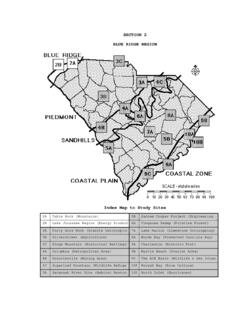
6 35 Paleozoic ..35 Metamorphic Grades and Minerals ..36 Isotopic Summary ..37 Surficial Deposits and Landforms ..37 Fluvial Deposits and Landforms ..37 Terraces ..38 Landforms and Deposits Formed by Physiochemical Weathering ..38 Karst ..38 Residuum ..39 Slope Flows ..39 Colluvium ..40 Debris Fans ..40 Isotopic Ages of Debris Fans ..42 Isotopic Ages of Terraces ..43 Relative Ages of Debris Fans and Terraces ..43 References of Map Units ..50 Surficial Deposits ..50 Tennessee Valley and Tectonic Windows ..50 Paleozoic Rocks ..50 Foothills of the Western Blue Ridge Province ..51 Paleozoic Rocks ..51 Neoproterozoic Rocks ..52 Highlands of the Western Blue Ridge Province ..52 Paleozoic Intrusive Rocks ..52 Paleozoic and Neoproterozoic Intrusive Rocks ..52 Neoproterozoic Rocks ..52 Mesoproterozoic Rocks ..53 Central Blue Ridge Province ..54 Paleozoic to Neoproterozoic Rocks ..54viiFigures 1. Index map of the Great Smoky Mountains National park region showing 1:24,000-scale quadrangle names and a list of published Geologic maps.
7 2 2. Physiographic provinces in the study area ..4 3. Structure map showing faults ..6 4. Structure map showing folds and other features ..8viiiConversion FactorsInch/Pound to SIMultiplyByTo obtainLengthinch (in.) (cm)inch (in.) (mm)foot (ft) (m)foot (ft) (cm)mile (mi) (km)SI to Inch/Pound MultiplyByTo obtainLengthcentimeter (cm) (in.)millimeter (mm) (in.)meter (m) (ft) centimeter (cm) (ft)kilometer (km) (mi)Temperature in degrees Celsius ( C) may be converted to degrees Fahrenheit ( F) as follows: F=( C)+32 Temperature in degrees Fahrenheit ( F) may be converted to degrees Celsius ( C) as follows: C=( F-32) Map of the Great Smoky Mountains National park Region, Tennessee and North Carolina By Scott Southworth, Art Schultz, John N. Aleinikoff, and Arthur J. MerschatIntroduction The geology of the Great Smoky Mountains National park region of Tennessee and North Carolina was studied from 1993 to 2003 as part of a cooperative investigation by the Geological Survey (USGS) with the National park Service (NPS).
8 This work resulted in a 1:100,000-scale Geologic map derived from mapping that was conducted at scales of 1:24,000 and 1:62,500. The Geologic data are intended to support cooperative investigations with the NPS, the development of a new soil map by the Natural Resources Conservation Service ( Department of Agriculture, 2009), and the All Taxa Biodiversity Inventory ( ) (Southworth, 2001). In response to a request by the NPS, we mapped previously unstudied areas, revised the geology where problems existed, and developed a map database for use in interdisciplinary research, land management, and interpretive programs for park visitors. This map and report supersede USGS Open-File Reports 03 381, 2004 1410, and 2005 1225 (Southworth and others, 2003, 2005b, and 2005c, respectively). Southworth and others (2005b) provides abundant photographs of the bedrock and surficial InvestigationsAt the request of the NPS, USGS geologists studied the rocks of the region from 1946 to 1954 and established the regional stratigraphic and structural framework (King and others, 1958) based on earlier work by Keith (1895, 1907).
9 As indicated in figure 1, detailed mapping was done by Hamilton (1961) at 1:24,000 scale (north-central area), by Hadley and Goldsmith (1963) at 1:24,000 and 1:62,500 scale (eastern area), by King (1964) at 1:24,000 scale (central area), and by Neuman and Nelson (1965) at 1:24,000 and 1:62,500 scale (western area). These four studies were published as chapters A, B, C, and D, respectively, of USGS Professional Paper 349, which includes Geologic maps at scales of 1:24,000 and 1:62,500, and they should be consulted for the extensive data on the petrology and petrography of the rocks. A general report and a Geologic map compiled at 1:125,000 scale summarized the earlier work (King and others, 1968). Subsequent Geologic maps of the region were published at 1:250,000 scale (Hadley and Nelson, 1971; Wiener and Merschat, 1992; and Robinson and others, 1992). Some of the Mesoproterozoic rocks were studied by Cameron (1951) and Merschat and Wiener (1988), and Carter and Wiener (1999) studied similar rocks to the east of the park .
10 The Neoproterozoic rocks were studied by Stose and Stose (1949), King (1949), Rodgers (1953), King and others (1958), Espenshade (1963), and Lesure and others (1977). The surficial geology was studied locally by Hadley and Goldsmith (1963), King (1964), Neuman and Nelson (1965), Southworth (1995), Southworth and others (1999), Schultz (1998, 1999), and Schultz and others (2000) and was summarized by Southworth and others (2003). Studies of the surficial geology by Hamilton (1961), Hadley and Goldsmith (1963), King (1964), and Neuman and Nelson (1965) were incidental to the detailed investigations of the bedrock, although surficial geologists (James Gilluly, Denny, Richmond, Hack, and Malde) observed such deposits in the field and contributed comments in their reports. These workers recognized that the three dom-inant types of surficial deposits in the region are residuum, colluvium, and alluvium and that many units were deposited during climatic conditions very different from those of today.