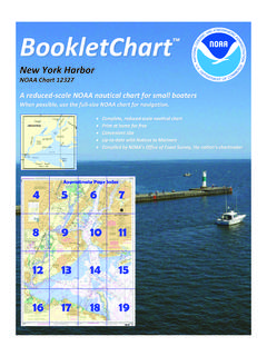
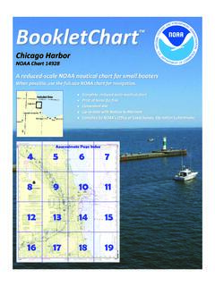
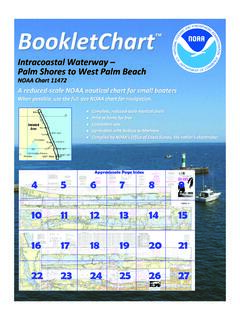
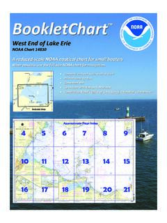
Transcription of A reduced -scale NOAA nautical chart for small …
1 BookletChart Hudson and East Rivers Governors Island to 67th Street noaa chart 12335 A reduced -scale noaa nautical chart for small boaters When possible, use the full-size noaa chart for navigation. 2 Published by the National Oceanic and Atmospheric Administration National Ocean Service Office of Coast Survey 888-990- noaa What are nautical Charts? nautical charts are a fundamental tool of marine navigation. They show water depths, obstructions, buoys, other aids to navigation, and much more. The information is shown in a way that promotes safe and efficient navigation.
2 chart carriage is mandatory on the commercial ships that carry America s commerce. They are also used on every Navy and Coast Guard ship, fishing and passenger vessels, and are widely carried by recreational boaters. What is a BookletChart ? This BookletChart is made to help recreational boaters locate themselves on the water. It has been reduced in scale for convenience, but otherwise contains all the information of the full -scale nautical chart . The bar scales have also been reduced , and are accurate when used to measure distances in this BookletChart.
3 See the Note at the bottom of page 5 for the reduction in scale applied to this chart . Whenever possible, use the official, full scale noaa nautical chart for navigation. nautical chart sales agents are listed on the Internet at This BookletChart does NOT fulfill chart carriage requirements for regulated commercial vessels under Titles 33 and 44 of the Code of Federal Regulations. Notice to Mariners Correction Status This BookletChart has been updated for chart corrections published in the Coast Guard Local Notice to Mariners, the National Geospatial Intelligence Agency Weekly Notice to Mariners, and, where applicable, the Canadian Coast Guard Notice to Mariners.
4 Additional chart corrections have been made by noaa in advance of their publication in a Notice to Mariners. The last Notices to Mariners applied to this chart are listed in the Note at the bottom of page 7. Coast Pilot excerpts are not being corrected. For latest Coast Pilot excerpt visit the Office of Coast Survey website at (Selected Excerpts from Coast Pilot) Hudson River, sometimes called North River in New York City, has its source in the Adirondack Mountains, about 275 miles along its course from a junction with East River at The Battery, NY, and flows in a general southerly direction into New York Upper Bay.
5 Troy Lock and Dam, 134 miles above The Battery, permits vessels to pass from tidewater to the upper river and the New York State Canal System. The river water is usually fresh as far south as Poughkeepsie, halfway from Troy Lock and Dam to The Battery. New York City extends along the eastern bank of Hudson River for a distance of about 14 miles above The Battery. For about 5 miles northward from The Battery, the New York waterfront is an almost continuous line of wharves and piers, some of which can accommodate the largest transatlantic liners. Anchorages.
6 General anchorages begin 5 miles above The Battery and extend upriver for about 10 miles. (See and , chapter 2, for limits and regulations.) Dangers. Numerous fishtraps are planted each spring, usually from about mid-March to mid-May, during the seasonal run of shad to the spawning grounds in the upper Hudson. The charts show the fishtrap areas in the 30-mile stretch beginning about 5 miles above The Battery and extending upriver to Stony Point; Corps of Engineers permits are required for the placing of shad nets and poles in the charted areas. Outer limits of the nets usually are marked by flags during the day and by lights during the night.
7 Caution is advised when navigating a fishtrap area because broken-off poles from previous traps may remain under the surface. East River is a 14-mile-long tidal strait that connects Long Island Sound with New York Upper Bay and separates the western end of Long Island from the New York mainland. The Sound entrance is between Throgs Neck and Willets Point; the Upper Bay entrance is between The Battery and Governors Island. Hell Gate, about halfway between Throgs Neck and The Battery, is noted for its strong tidal currents. Harlem River extends northward from Hell Gate to the Hudson River.
8 Both sides of the East River, from The Battery to Port Morris, a distance of 9 miles, present an almost continuous line of wharves except where shoals or currents prevent access. Caution. Mariners transiting East River in the vicinity of Rikers Island and/or South Brother Island Channel are advised of the following: East River Main Channel Lighted Buoy 5 has been established northeast of Rikers Island in 40 47'47"N., 73 51'59"W. to assure that no vessel penetration of air space exists over that portion of the East River which coincides with the glide path of the northeast-southwest runway of La Guardia Airport.
9 Vessels with mast heights in excess of 125 feet shall pass 100 yards to the north of this buoy so as to avoid interference with the glide path. Anchorages. Several general and special anchorages are in East River. (See , , and ,chapter 2, for limits and regulations.) Roosevelt Island Reef (Welfare Island Reef), with bare islets, rocks awash, and submerged rocks, extends mile southwestward from the island. Belmont Island, near southwest end of reef, is marked by a light. From abreast the entrance to Newtown Creek, the 35-foot-project main channel of the East River crosses from the west side of the river to the east side.
10 Poorhouse Flats Lighted Range (Front Light; 40 43'28"N., 73 57'46"W.), bearing 161 , is on the Brooklyn side of the river and marks the best water in the crossover. East River Deepwater Lighted Range (Front Light; 40 41'58"N., 73 59'59"W.), bearing 078 , is on the Brooklyn side of the river and marks the best water in the 40-foot-project main channel which leads from deep water in New York Upper Bay to the East River. The range line passes about midway between The Battery and Governors Island, mile to the southward. Caution. Eelgrass is found in most of the waters described in this chapter.