Example: bachelor of science
GPS—Measuring Plate Motion - IRIS Consortium
The Global Positioning System (GPS) has been the most useful for studying the Earth’s crustal movements. By repeatedly measuring distances between specific points, geologists can determine the movement along faults or between plates. The separations between GPS
Tags:
Information
Domain:
Source:
Link to this page:
Documents from same domain

Refraction - IRIS
www.iris.edurich in both subtlety and complexity, two processes, reflection and refraction are common (and common to many other wave-systems such as light, sound, etc) Page 3/3
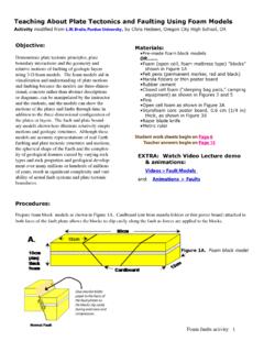
Teaching About Plate Tectonics and Faulting Using ... - IRIS
www.iris.eduTeaching About Plate Tectonics and Faulting Using Foam Models Activity modified from L.W. Braile, Purdue University, by Chris Hedeen, Oregon City High School, OR Objective: Demonstrate plate tectonic principles, plate boundary interactions and the geometry and ... Flip Book” in which continental drift during the past

Plate Boundaries N T P. IRIS Animations
www.iris.eduVocabulary (from USGS Visual Glossary and Photo Glossary of Volcanic words) Accretionary wedge—Sediments, the top layer of material on a tectonic plate, that accumulate and deform where oceanic and continental plates collide. These sediments are scraped off the top of …
Related documents

Social Impact of the Global Positioning System (GPS)
www.writing.ucsb.eduThis technology is Global Positioning System (GPS). With a click on a screen, an ordinary person can find his or her way via a complex system involving satellite technology. Essentially, the GPS satellites transmit a signal to receivers on Earth; the GPS receivers then compare the time the signal was transmitted to
BEYOND DISCOVERY - National Academy of Sciences
www.nasonline.orgthe Global Positioning System has spawned many commercial applications in an industry that some predict will reach $30 billion in annual revenues in the next decade: here, a built-in
The Global Positioning System - cdn.ymaws.com
cdn.ymaws.comThe Global Positioning System 1. System Overview 2. Biases and Errors 3. Signal Structure and Observables 4. Absolute v. Relative Positioning 5. GPS Field Procedures 6. Ellipsoids, Datums and Coordinate Systems 7. Mission Planning . I. System Overview ! GPS is a passive navigation and positioning ...
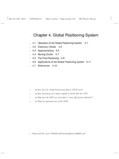
Chapter 4. Global Positioning System - Edwin F. Taylor
www.eftaylor.com4-4 Chapter 4 Global Positioning System r tower t A t t B t C t D r Earth r Identical slopes of worldlines (identical radial map speed of light) at every r-coordinate. FIGURE 2 Schematic plot in Schwarzschild global coordinates (t;r) of worldlines of two sequential flashes moving downward from the top to the bottom of a tower. According
Law Enforcement Use of Global Positioning (GPS) …
fas.orgLaw Enforcement Use of GPS Devices to Monitor Motor Vehicles Congressional Research Service 1 Global Positioning System (GPS) Technology GPS “is a satellite-based technology that reveals information about the location, speed, and

Global Positioning System - UMass Amherst
www.ecs.umass.edu1 Lecture 8–Global Positioning System ECE 197SA – Systems Appreciation Global Positioning System ! Many systems require location information

Global Positioning Systems and Geographic Information …
extension.missouri.eduGeographic Information Systems Applications in Plant Biosecurity Management ... Examples of GPS and GIS: Global Positioning System (GPS): An agricultural producer may use a handheld GPS receiver to determine the ... Global Positioning System (GPS). Publication Number WQ452. University of Missouri-Columbia.
Global Positioning System - Brian Arnall
npk.okstate.eduGlobal Positioning System Wesley M. Porter . GPS •Three Segments: –Space –Control –User . Space Segment ... • Global system • Gives the user the ability to measure position anywhere in the world with accuracy better than 10 cm (4 inches).

Global Positioning System (GPS) - cdn.ymaws.com
cdn.ymaws.comGlobal Positioning System (GPS) GPS is a navigational system made up of a network of 24 satellites, placed into orbit by the U.S. Department of Defense.
Global Positioning System - Edwin F. Taylor
www.eftaylor.comA-2 P ROJECT A Global Positioning System As a result, measurement of the relative position of control tower and air-plane is accurate to 1 or 2 meters.
Related search queries
The Global Positioning System, Global Positioning System, System, BEYOND DISCOVERY, Positioning, Chapter 4. Global Positioning System, Chapter 4 Global Positioning System, Global, Enforcement Use of Global Positioning, Global Positioning, Geographic Information, Geographic Information Systems, The ... Global Positioning System, University of Missouri, Global system