Transcription of GPSMAP 78 series - Garmin
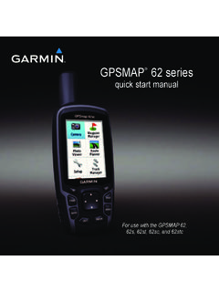
1 GPSMAP 78 series . quick start manual for use with the GPSMAP 78, GPSMAP . 78s, and GPSMAP 78sc Getting Started More Information You can go to to warning download the latest manuals. See the Important Safety and Product Information guide in the product box for product warnings and other Safe Compass Distance important information Make sure you install the GPSMAP 78. at least 8 inches ( cm) from any When using your device the first time, compass. Test your compass to verify you should complete the following that it operates correctly when the tasks to set up the device and get to device is operating. know the basic features. 1. Install the batteries (page 2). Battery Information 2. Turn on the device (page 3). The device operates on two AA. 3. Acquire satellites (page 3). batteries. Use alkaline, NiMH, or lithium batteries.
2 Use precharged 4. Mark a waypoint (page 5). NiMH or lithium batteries for best 5. Calibrate the compass (page 7). results. 6. Navigate with the search menu (page 8). Installing the Batteries 7. Navigate a route (page 9). 1. Slide the latch on the back of the device, and remove the battery cover. GPSMAP 78 Quick Start Manual 2. Insert the batteries, observing Acquiring Satellite polarity. Signals It may take 30 to 60 seconds to acquire signals. 1. Go outdoors to an open area. 2. If necessary, turn on the device. 3. Replace the battery cover. 3. Wait while the device searches for satellites. For best results, after you install new batteries, update the battery type in the A question mark flashes while the system settings (page 10). device determines your location. 4. Quickly press to open the Turning the Device On or backlight status page.
3 Off The GPS bars indicate satellite Press and hold . strength. When the bars are green, the device has acquired satellite Setting Your Language signals. 1. Turn on the unit. 2. Use the Rocker to select a language. GPSMAP 78 Quick Start Manual . Buttons PAGE Press PAGE to scroll through the main pages (page 5). MENU Press MENU to open the options menu for the page that is currently open. Press MENU twice to open the main menu (from any page). ENTER/ Press ENTER to select MARK options and acknowledge FIND/MOB Press FIND to open the messages. search menu. Press and hold MARK to Press and hold MOB save your current location (man overboard function) as a waypoint. to store your current Rocker Press up, down, right, and location as a waypoint left to select menu options and begin navigation to and to move the map that point.
4 Cursor. Press and hold to turn + Press + to zoom in on the device on and off. the map. Quickly press to open the backlight status page. - Press - to zoom out on the map. QUIT Press QUIT to cancel or return to the previous menu or page. GPSMAP 78 Quick Start Manual Waypoints 2. Select a waypoint. Waypoints are locations you record and 3. Press Menu. store in the device. 4. Select Delete. Creating Waypoints Main Pages 1. From any page, press and hold MARK. The information needed to operate this device is found on the following pages: 2. Select Done. map, compass, main menu, and trip Editing a Waypoint computer. Before you can edit a waypoint, you must create a waypoint. Map 1. From the main menu, select The position icon represents your Waypoint Manager. location on the map. As you travel, the position icon moves and leaves a 2.
5 Select a waypoint. track log (trail). Waypoint names and 3. Select an attribute (such as the symbols also appear on the map. name or location). 4. Enter the new information. 5. Select Done. Deleting a Waypoint 1. From the main menu, select Waypoint Manager. GPSMAP 78 Quick Start Manual . Changing the Map Orientation 3. Move the cursor to a point you 1. From the map, press MENU. want to measure to. 2. Select Setup Map > Orientation. The distance appears at the top of 3. Select an orientation: the page. Select North Up to show north 4. Press quit to stop measuring. at the top of the page. Compass Select Track Up to show your current direction of travel at the When navigating to a destination, top of the page. the bearing pointer points to your destination, regardless of the direction Select Automotive Mode to you are moving.
6 When the bearing show a perspective view. pointer points toward the top of the Measuring Distance electronic compass, you are traveling You can move the cursor around the directly toward your destination. If map to measure distance from the it points any other direction, turn current location. toward that direction until the arrow is pointing toward the top of the compass. 1. From the map, press MENU. 2. Select Measure Distance. The device automatically begins measuring from your current location. GPSMAP 78 Quick Start Manual Calibrating the Compass Calibrating the Barometric Altimeter notice note: The elevation plot page is Calibrate the electronic compass available only with the GPSMAP 78s outdoors. Do not stand near objects that and GPSMAP 78sc. influence magnetic fields, such as cars, buildings, or overhead power lines.
7 You can manually calibrate the barometric altimeter if you know note: The three-axis compass is the correct elevation or the correct available only with the GPSMAP 78s pressure. and GPSMAP 78sc. 1. From the elevation plot, press You should calibrate the compass after menu. moving long distances, experiencing temperature changes, or changing the 2. Select Calibrate Altimeter. batteries. 3. Follow the on-screen instructions. 1. From the compass, press MENU. Trip Computer 2. Select Calibrate Compass > Start. The trip computer displays your current 3. Follow the on-screen instructions. speed, average speed, maximum speed, trip odometer, and other helpful statistics. GPSMAP 78 Quick Start Manual . Customizing Data Fields Navigating to a Waypoint You can customize the data fields Using the Search Menu displayed on each main page.
8 You can use the search menu to quickly For data field descriptions, see the find waypoints, tracks, routes, and GPSMAP 78 Owner's Manual. coordinates that you have saved. 1. From a main page, press meNu. 1. From any page, press FIND. 2. Select Change Data Fields. 2. Select Waypoints. 3. Select a data field. 3. Select a waypoint. 4. Press enter. 4. Select Go. 5. Follow the on-screen instructions. Change Your Guidance About Tracks Method You can select a guidance method that Your Garmin device records a track log while you are moving. You can save is for off-road use, that follows the roads, or that prompts you each time these tracks and navigate to them later. you begin navigating. 1. From the main menu, select Setup > Routing > Guidance Method. 2. Select an option. GPSMAP 78 Quick Start Manual Creating a Route Using Sight N Go 1.
9 From the main menu, select Route NOTE: Sight N Go is available only Planner > Create Route > Select with the GPSMAP 78s and GPSMAP . First Point. 78sc. 2. Select a category. You can point the device at an object in 3. Select the first point in the route. the distance, such as a lighthouse, lock 4. Select Use. in the direction, and then navigate to the object. 5. Select Select Next Point. 6. Repeat steps 2 5 until the route is 1. From the main menu, select Sight complete. N Go. A route must contain at least two 2. Point the device at an object. points. 3. Select Lock Direction > Set 7. Press quit to save the route. Course. 4. Use the compass to navigate to the Navigating a Route object. 1. Press FIND. 2. Select Routes. 3. Select a route. 4. Select Go. GPSMAP 78 Quick Start Manual . Attaching the Wrist Strap and decrease the backlight timeout to 1.
10 Place maximize battery power. the 1. Quickly press to open the loop of backlight status page. the wrist 2. Use the Rocker to adjust the strap through brightness. the slot opening at the bottom of the Adjusting the Backlight device. Timeout 2. Route the strap through the loop From the main menu, select Setup and pull it tight. > Display > Backlight Timeout. Selecting the Battery Type Maximizing Battery Life 1. From the main menu, select Setup Using the Battery Save Option > System > Battery Type. Use the battery save option to save 2. Select Alkaline, Lithium, or battery power and prolong battery life. Rechargeable NiMH. From the main menu, select Setup Long-Term Storage > Display > Battery Save > On. When you do not plan to use the Decreasing the Backlight device for several months, remove the Extensive use of screen backlighting batteries.