Transcription of Hurricane Genevieve - nhc.noaa.gov
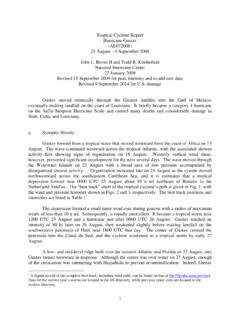
1 NATIONAL Hurricane CENTER TROPICAL CYCLONE REPORT1 Hurricane Genevieve (EP072014) 25 July 13 August 2014 John L. Beven II and Thomas Birchard National Hurricane Center and Central Pacific Hurricane Center 19 August 20162 VIIRS VSISIBLE IMAGE OF Genevieve AT 2250 UTC 25 JULY. IMAGE COURTESY OF NRL MONTEREY. Genevieve was a short-lived tropical storm that crossed 140 W into the central Pacific as a depression. It later became a major Hurricane in the central Pacific and a super typhoon in the western Pacific.
2 1 This report focuses on Genevieve s history in the western hemisphere. Additional information may be available from the Joint Typhoon Warning Center. 2 Original report date 25 February 2015. Updated 2 May 2016 to include analyses from CPHC and JTWC. Updated 19 August 2016 to include additional data from CPHC. Hurricane Genevieve 2 Hurricane Genevieve 25 JULY 13 AUGUST 2014 SYNOPTIC HISTORY Genevieve was the first of a sequence of four tropical cyclones that formed in the eastern Pacific over an 11-day period in late July and early August.
3 The cyclone was spawned by a disturbance in the Intertropical Convergence Zone that developed south of Panama on 15 July. Moving westward, the associated convection first showed signs of organization on 20 July. This was followed by the formation of a broad low pressure area on 22 July about 1000 n mi southwest of Cabo San Lucas, Mexico, but the subsequent development was slow during the next few days while a general westward motion continued. On 24 July, the convection and circulation associated with the low became better organized, and this led to the formation of a tropical depression early the next day about 1475 n mi west-southwest of Cabo San Lucas.
4 The best track chart of the tropical cyclone s path is given in Fig. 1, with the wind and pressure histories shown in Figs. 2 and 3, respectively. The best track positions and intensities are listed in Table 13. The depression strengthened into a tropical storm a few hours after genesis, and the estimated maximum winds reached a peak (in the eastern Pacific basin) of 40 kt later on 25 July. The storm slowed its forward motion later on 25 July as the subtropical ridge to the north weakened temporarily.
5 When the ridge re-built on 26 July, Genevieve resumed a faster forward motion. Increasing westerly vertical shear caused Genevieve to weaken to a tropical depression on 26 July, and it remained a depression when it moved into the Central Pacific Hurricane Center area of responsibility (140 W to the International Dateline) on 27 July. Genevieve had the most interesting parts of its life cycle after it left the eastern Pacific. The cyclone degenerated to a remnant low on 28 July, but then regenerated to a tropical depression on 29 July and a tropical storm on 39 July.
6 A similar degeneration to a disturbance occurred on 1 August southeast of the Hawaiian Islands, followed by a second regeneration into a tropical cyclone the next day. Aside from a brief intensification to tropical storm strength on 2 August, the cyclone persisted as a tropical depression through 5 August while passing well south and southwest of the Hawaiian Islands. Rapid intensification started later on 5 August, with Genevieve becoming a Hurricane on 6 August and a major Hurricane on 7 August (Figure 4).
7 The estimated maximum sustained winds reached 140 kt just after Genevieve crossed the International Dateline to become a supertyphoon in the western Pacific. After reaching peak intensity, the cyclone weakened as it moved generally northward to northwestward. Genevieve 3 A digital record of the complete best track, including wind radii, can be found on line at Data for the current year s storms are located in the btk directory, while previous years data are located in the archive directory.
8 Hurricane Genevieve 3 finally dissipated on 13 August well to the east of Japan. METEOROLOGICAL STATISTICS Observations in Genevieve (Figs. 2 and 3) include subjective satellite-based Dvorak technique intensity estimates from the Tropical Analysis and Forecast Branch (TAFB) and the Satellite Analysis Branch (SAB), the Central Pacific Hurricane Center (PHFO), and the Joint Typhoon Warning Center (JTWC). The figures also include objective Advanced Dvorak Technique (ADT) estimates from the Cooperative Institute for Meteorological Satellite Studies/University of Wisconsin-Madison.
9 Data and imagery from noaa polar-orbiting satellites including the Advanced Microwave Sounding Unit (AMSU), the NASA Tropical Rainfall Measuring Mission (TRMM), the European Space Agency s Advanced Scatterometer (ASCAT), and Defense Meteorological Satellite Program (DMSP) satellites, among others, were also useful in constructing the best track of Genevieve . There were no observations of tropical-storm-force winds or other impacts from Genevieve . CASUALTY AND DAMAGE STATISTICS There were no reports of damage or casualties associated with Genevieve .
10 FORECAST AND WARNING CRITIQUE The genesis of Genevieve was generally well forecast. The precursor disturbance was first mentioned in the Tropical Weather Outlook (TWO) on 20 July about 114 h before genesis (Table 2). At that time, it was given a low (<30%) chance of development in both the 48-h and five-day time frames. The genesis probability was raised to medium (30-50%) for the five-day time frame 102 h prior to genesis, but subsequently decreased back to a low chance. The five-day genesis probably was again raised to medium 66 h before genesis.