Example: marketing
Introduction to Remote Sensing - NASA
•Remote sensing data comes in multiple images, each representing a different range, or band, of wavelengths •The pixel values of the images represent the intensity of the energy from the source •Multiple band images can be stacked and viewed at once ... Introduction to Remote Sensing
Tags:
Information
Domain:
Source:
Link to this page:
Documents from same domain

Fundamentals of Remote Sensing - NASA
appliedsciences.nasa.govRemote sensing is obtaining information about an object from a distance. Photography is a very common form of remote sensing. There are different ways to collect data, and different sensors …
Basics of Synthetic Aperture Radar - NASA
appliedsciences.nasa.govNational Aeronautics and Space Administration Applied Remote Sensing Training Program 7 . Active and Passive Remote Sensing . Passive Sensors: • The source of radiant energy arises from natural sources • e.g. the sun, Earth, other “hot” bodies . Active Sensors • Provide their own artificial radiant energy source for illumination • e.g.

Fundamentals of Remote Sensing - NASA
appliedsciences.nasa.govRemote sensing is obtaining information about an object from a distance. There are different ways to collect data, and different sensors are used depending on the application. Some methods …

Introduction to SAR Interferometry - NASA
appliedsciences.nasa.govNational Aeronautics and Space Administration Applied Remote Sensing Training Program SAR Phase - A Measure of the Range and Surface Complexity ... satellite synthetic aperture radar interferometric correlation, J. Geophys. Res., 110(B3), B03302, ...
SAR Processing and Data Analysis - NASA
appliedsciences.nasa.govSAR Processing and Data Analysis Erika Podest . National Aeronautics and Space Administration Applied Remote Sensing Training Program 2 ... – Metadata: parameters related to orbit and data – Tie Point Grids: interpolation of latitude/longitude, incidence angle, etc.
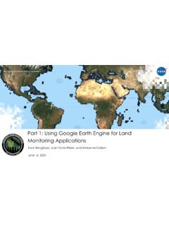
Part 1: Using Google Earth Engine for Land Monitoring ...
appliedsciences.nasa.govThresholding rates the severity of wildfire burning to complete a full burn severity assessment. • Refer to the step-by-step UN-SPIDER burn severity in GEE training. Example of burn severity mapping using Sentinel- 2 data in Empedrado, Chile in February 2017. This map was produced using the UN-SPIDER Burn Severity with GEE script. Credit: UN ...

Part 3: Using Google Earth Engine for Land Monitoring ...
appliedsciences.nasa.gov– For example, drought years vs. non -drought years Aug 1999. Aug 2000. Aug 2001. Aug 2002. Aug 2003. ... – Healthy vegetation has high ... – The same spatial resolution – Data from the exact same or similar times of day, days of the year, and/or seasons
NASA Applied Science | Applied Sciences Website
appliedsciences.nasa.govNASA Applied Science | Applied Sciences Website
Monitoring Applications Part 2: Using Google Earth Engine ...
appliedsciences.nasa.govspectral bands and attempts to classify each individual pixel based on this spectral information. • Spectral Signature: – Objects on the ground reflect electromagnetic radiation differently in different wavelengths. • Example: Green vegetation absorbs red wavelengths but reflects near-infrared (NIR) wavelengths. Landsat Bands Percent ...
Related documents

Applications of Remote Sensing in Agriculture - A Review
www.ijcmas.comAug 01, 2019 · Introduction Remote sensing is the art and science of gathering information about the objects or area of the real world at a distance without coming into direct physical contact with the object under study. Remote sensing is a tool …
Chapter 5. Introduction to Remote Sensing
hillagric.ac.inChapter 5. Introduction to Remote Sensing 5.1 What is Remote Sensing Remote sensing is the science (and to some extent, art) of acquiring information about the Earth's surface without actually being in contact with it. This is done by sensing and recording reflected or emitted energy and processing, analyzing, and applying that information.
Chapter 7 84 Introduction To Remote Sensing
ncert.nic.inIntroduction To Remote Sensing e. Detection of Reflected/Emitted Energy by the Sensor: The sensors recording the energy that they receive are placed in a near– polar sun synchronous orbit at an altitude of 700 – 900 km. These satellites are known as remote sensing satellites (e.g. Indian Remote Sensing Series).
Remote Sensing Image Analysis with R
rspatial.org•A Review of Modern Approaches to Classification of Remote Sensing Data •Online remote sensing course 1.4R packages Here is a list of some R packages for analyzing remote sensing data •RStoolbox •landsat •hsdar •rasterVisfor visualization 4 Chapter 1. Introduction
PRINCIPLES OF REMOTE SENSING
www.wamis.orgIndian Institute of Remote Sensing, Dehra Dun Abstract : Remote sensing is a technique to observe the earth surface or the atmosphere from out of space using satellites (space borne) or from the air using aircrafts (airborne). Remote sensing uses a part or several parts of the electromagnetic spectrum.