Example: bankruptcy
Introduction to Remote Sensing - NASA
Landsat bands Spectral signatures. 22 4. Energy Recording by Sensor The sun emits radiation + Some of that radiation interacts with the atmosphere. When a satellite detects this radiation, it can evaluate what might have ... • Using near real-time data for tracking global change
Tags:
Information
Domain:
Source:
Link to this page:
Documents from same domain

Part 3: Using Google Earth Engine for Land Monitoring ...
appliedsciences.nasa.gov– For example, drought years vs. non -drought years Aug 1999. Aug 2000. Aug 2001. Aug 2002. Aug 2003. ... – Healthy vegetation has high ... – The same spatial resolution – Data from the exact same or similar times of day, days of the year, and/or seasons
Monitoring Applications Part 2: Using Google Earth Engine ...
appliedsciences.nasa.govspectral bands and attempts to classify each individual pixel based on this spectral information. • Spectral Signature: – Objects on the ground reflect electromagnetic radiation differently in different wavelengths. • Example: Green vegetation absorbs red wavelengths but reflects near-infrared (NIR) wavelengths. Landsat Bands Percent ...
Part 1: Using Google Earth Engine for Land Monitoring ...
appliedsciences.nasa.govThresholding rates the severity of wildfire burning to complete a full burn severity assessment. • Refer to the step-by-step UN-SPIDER burn severity in GEE training. Example of burn severity mapping using Sentinel- 2 data in Empedrado, Chile in February 2017. This map was produced using the UN-SPIDER Burn Severity with GEE script. Credit: UN ...
SAR Processing and Data Analysis - NASA
appliedsciences.nasa.govSAR Processing and Data Analysis Erika Podest . National Aeronautics and Space Administration Applied Remote Sensing Training Program 2 ... – Metadata: parameters related to orbit and data – Tie Point Grids: interpolation of latitude/longitude, incidence angle, etc.
Basics of Synthetic Aperture Radar - NASA
appliedsciences.nasa.govNational Aeronautics and Space Administration Applied Remote Sensing Training Program 7 . Active and Passive Remote Sensing . Passive Sensors: • The source of radiant energy arises from natural sources • e.g. the sun, Earth, other “hot” bodies . Active Sensors • Provide their own artificial radiant energy source for illumination • e.g.
NASA Applied Science | Applied Sciences Website
appliedsciences.nasa.govNASA Applied Science | Applied Sciences Website

Introduction to SAR Interferometry - NASA
appliedsciences.nasa.govNational Aeronautics and Space Administration Applied Remote Sensing Training Program SAR Phase - A Measure of the Range and Surface Complexity ... satellite synthetic aperture radar interferometric correlation, J. Geophys. Res., 110(B3), B03302, ...

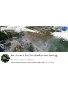
Fundamentals of Remote Sensing - NASA
appliedsciences.nasa.govRemote sensing is obtaining information about an object from a distance. Photography is a very common form of remote sensing. There are different ways to collect data, and different sensors …

Fundamentals of Remote Sensing - NASA
appliedsciences.nasa.govRemote sensing is obtaining information about an object from a distance. There are different ways to collect data, and different sensors are used depending on the application. Some methods …
Related documents
Part 3: Using Google Earth Engine for Land Monitoring ...
appliedsciences.nasa.gov– Common time series and change detection methods – Techniques for time series analysis and change detection in GEE • GEE Code Editor Activity – Landsat data retrieval and imagery preparation – Vegetation index time series analysis and data visualization – Change detection using visual inspection and image differencing
3: RADIOMETRIC CORRECTION OF SATELLITE IMAGES: …
www.ncl.ac.ukas Excel or using a calculator. Image data The first image was acquired by Landsat 5 TM on 22nd November 1990 at 14.55 hours Universal Time (expressed as a decimal time and thus equivalent to 14:33 GMT). The Turks & Caicos are on GMT – 5 hours so the overpass would have been at 09:33 local time. You are provided with bands 1 (blue), 2

CHANGE DETECTION IN LAND USE AND LAND COVER …
www.geospatialworld.netUSING REMOTE SENSING DATA AND GIS (A case study of Ilorin and its environs in Kwara State.) BY ZUBAIR, AYODEJI OPEYEMI ... provision free Landsat data which was used for this project. Finally, deep gratitude goes to the entire students of GIS, University of Ibadan ... pattern in the land use/land cover over time.
Resolutions of Remote Sensing - University of Rhode Island
www.edc.uri.eduFor example, we often speak of Landsat as having “30-meter" resolution, which means that two objects, thirty meters long or wide, sitting side by side, can be separated (resolved) on a Landsat image. Other sensors have lower or higher spatial resolutions. Comparison of Landsat Sensors Thematic Mapper (TM) Landsat 4 and 5 Enhanced Thematic

“GIS APPLICATION IN AGRICULTURAL DEVELOPMENT”
kilimotrust.orgusing spatial data for assessment, planning and monitoring. The concept of using the computers for making maps and analysing them was initiated with the SYMAP –Synagraphic mapping system, developed by Harvard School of computer graphics in the early 1970. Since then, there has been wide range of automated methods for handling maps using ...
Landsat 8 (L8) Data Users Handbook
d9-wret.s3.us-west-2.amazonaws.comeight-day offset with Landsat 7, which was launched in 1999. Landsat 8’s space-borne data acquisition combines with the USGS archival and distribution systems, which includes the data processing techniques required to render Landsat 8 data into a scientifically usable format. With Landsat 8, special emphasis has been placed on

Landsat Collection 2 Help
d9-wret.s3.us-west-2.amazonaws.comLandsat Collection 2 EarthExplorer Help . Landsat Collection 2 (Level-1 and Level-2) products on EarthExplorer are available as a .tar.gz bundle download that includes all files associated with a scene. Users can also select individual bands and files to …

HISTORY OF REMOTE SENSING - Department of Geography
ibis.geog.ubc.ca• The beginning: photography and flight (1858-1918) • Rapid developments in photogrammetry (1918-1939) • Military imperatives (1939-1945) • Cold …