Example: barber
Iowa Transportation Map
North Fork South Fork River Racc oo n English D eep R. Riv er W . Fork G ran d R. E. Fork Grand R. North Fork Maquoketa R. W. E. R. North Des Skunk B oyer River River River River Iowa North E. MISSISSIPPI RIVER M I S S I S S I P P I ER RI V Little Spirit Lake Platte River Wisconsin River MISSOURI RIVER MISSOURI R. DAM NO. 18 Crystal Lake A.A ...
Tags:
Information
Domain:
Source:
Link to this page:
Documents from same domain
Commercial Driver License Manual
iowadot.govare the eyes and the ears of our nation’s highways. If you see a minor working any of those areas or suspect pimp control, call the National Hotline and report your tip: 1-888-3737-888 (US) 1-800-222-TIPS (Canada) For law enforcement to open an investigation on your tip, they need “actionable information.” Specific tips

DS-12062 (New) DEVELOPMENTAL SPECIFICATIONS FOR ...
iowadot.govApr 21, 2015 · CONSTRUCTION OR MAINTENANCE WORK ON RAILROAD RIGHT-OF-WAY (CHICAGO, CENTRAL, & PACIFIC RAILROAD COMPANY AND CEDAR RIVER RAILROAD COMPANY) Effective Date April 21, 2015 THE STANDARD SPECIFICATIONS, SERIES 2012, ARE AMENDED BY THE FOLLOWING ... ROW, or may impact current or future CCP …

LICENSE CDL
iowadot.govIntrastate commerce Moving goods or passengers solely within the state of Iowa provided those goods and passengers ... • Remove a restriction that only permits a CDL holder to operate CMVs without full air brakes (i.e. driver may operate CMV with air over hydraulic brake system)
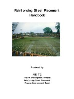
Reinforcing Steel Placement Handbook
iowadot.govreinforcing steel can reduce the strength of the structure by preventing the necessary interaction between the concrete and the reinforcing steel. Proper bonding between the reinforcing steel and the concrete can also be prevented by debris on the bar such as dirt, mud, oil, or corrosion when the concrete is poured around it. ...

LRFD Pile Design Examples
iowadot.govThis design example is basically the same as Track 1, Example 1, with additional construction control involving a pile driving analyzer® (PDA) and CAPWAP analyses. The purpose of this design example is to demonstrate that when more strict construction control is applied, fewer uncertainties are involved, since the pile resistance can be field-

Design Manual Vertical Alignment - Iowa Department of ...
iowadot.govCombination of Horizontal and Vertical Alignment . Horizontal and vertical alignments should be designed together to provide stopping and decision sight distance. Poor coordination between superelevation transition and a vertical alignment may result in a flat

Design Manual Using the Rational Method to Chapter 4 ...
iowadot.govFor stormwater system design, a drainage area (A) is the combined area of all surfaces that drain to a given location such as a swale, intake or culvert inlet, pond, stream, etc. Following are some questions to investigate when evaluating a drainage area. Local maintenance authorities may be able to provide information.
Conceptual Engineering Cost Estimate Detailed Cost ...
iowadot.gov70.08 Vehicle refurbishment: Electric locomotive $ rr $ r$ 70.09 Vehicle refurbishment: Non relectric locomotive $ rr $ r$ 70.1 Vehicle refurbishment: Electric multiple unit $ rr $ r$ 70.11 Vehicle refurbishment: Diesel multiple unit $ rr $ r$ 70.12 Veh refurb: Loco rhauled passenger cars w/ ticketed space $ rr $ r$

Single Precast Reinforced Concrete Box Culvert Standards
iowadot.govTransverse Reinforcement Bottom of Form Reinforcement Longitudinal maximum of 48 inches. of nylon boots when spaced at a Plastic spacers may be utilized in lieu Nylon boots on every fourth wire. Bottom of Form Reinforcement Longitudinal Steel Form or Equal or Bevel Optional Small Radius As1, As7 or As8 As5

Design Manual Horizontal Alignment Chapter 2 Alignments ...
iowadot.gov• Design considerations, and • ... Y = Perpendicular distance of a compound horizontal curve from the backward tangent to the PT. L = Total length in feet of the circular curve from PC to PT measured along its arc. E = External distance (radial distance) in feet from PI to the mid-point of the circular curve. ...
Related documents
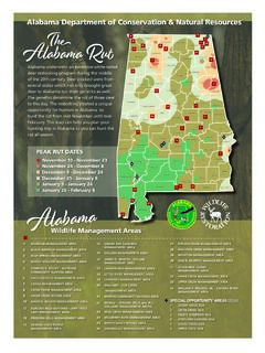
Alabama Department of Conservation & Natural Resources …
www.outdooralabama.com25 north sauty refuge area 26 oakmulgee management area 27 perdido river management area 28 raccoon creek management area 29 riverton management area 30 sam r. murphy management area 31 seven mile island management area 32 swan creek management area 33 upper delta management area 34 william r. ireland, sr.

VANCOUVER ISLAND REGION 1 www.gov.bc.ca/hunting for in ...
www2.gov.bc.ca(situated in MU 1-4). See Map A11. 4Cowichan River No Shooting Area (MU 1-4). The discharge of firearms is Prohibited within 100 metres of the high water mark of the Cowichan River from a point starting on the River immediately north of the Holt Creek Trailhead upstream along the Cowichan River to the Municipality of Lake Cowichan.

State Game Lands 095 Map - Pennsylvania Game Commission
www.pgc.pa.govwetlands. Mink, raccoon, opossum, red and gray fox and coyote can be found and provide hunting and trapping opportunities. The Glades Lake and Harbor Acres Lake have become popular fishing areas in both summer and winter. The North Country Trail runs

REGULAR & BOWHUNTING 21 MUZZLELOADING DEER …
www.dec.ny.govRIVER OTTER TRAPPING. There are no bag limits. Nov. 1 –Apr. 7. Nov. 10 – Feb. 28. Closed. Season Dates 2021/22. REMINDER. If you take a fisher, marten, bobcat, or river otter, YOU MUST: •Complete a furbearer possession tag, AND •Get the pelt or unskinned animal sealed. FISHER & MARTEN TRAPPING. Nov. 1 –Nov. 30 Fisher & Marten
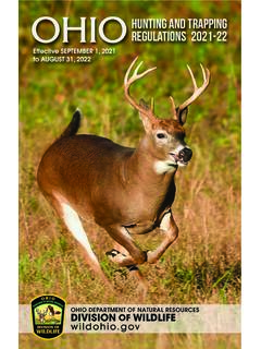
OHIOHUNTING AND TRAPPING REGULATIONS 202122
ohiodnr.govRiver Otter Dec. 26, 2021 Feb. 28, 2022 28 2021-22 OHIO HUNTING & TRAPPING REGULATIONS SEASONS & DATES The primary source of funding for the Ohio Division of Wildlife comes from the sale of hunting and fishing licenses,
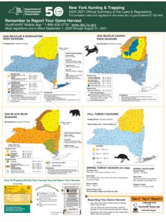
New York State Hunting & Trapping Season Maps 2020-21
www.dec.ny.govHuntFishNY Mobile App * 1-866-426-3778 * www.dec.ny.gov Most regulations are in effect September 1, 2020 through August 31, 2021 SPRING TURKEY SEASON (no map) Hunting Hours One half – hour before sunrise to noon Area Open All of upstate New York north of the Bronx-Westchester County boundary Season Dates May 1 – May 31 Season Bag Limits
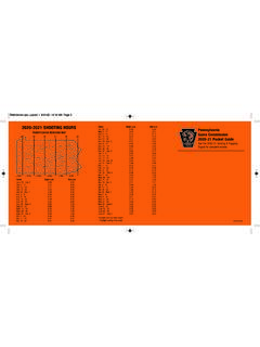
2020-2021 SHOOTING HOURS Dates Begin a.m. End p.m ...
www.pasenategop.comNov. 27 and Dec. 26 - Jan. 23, 2021. Limit of 1 antlered deer per year, and 1 antlerless deer with each valid antlerless license or permit. DEER, ARCHERY (Antlered and Antlerless) Statewide: Oct. 3 - Sun., Nov. 15 and Nov. 16 - Nov. 20 and Dec. 26 - Jan. 18, 2021. Limit of 1 antlered deer per year, and 1 antlerless deer with each valid antlerless

REGION 2
www2.gov.bc.ca1 H See Map B9. H2-6 Sept 10 - Sept 30 t See Maps B17, B19 t 2-12 to 2-15 Sept 10 - Oct 31 Compulsory Inspection required. BLACK BEAR 2-2 to 2-19 Sept 10 - Nov 30 Q2 2-2 to 2-19 Apr 1 - June 15 Bow Only 2-2 to 2-19 Sept 1 - Sept 9 Q The bag limit for black bears is two per license year (Apr 1-Mar 31)