Transcription of Owner’s Manual - Garmin International
1 GPSMAP 500/700 Series and echoMAP 50/70 SeriesOwner s ManualMarch 2016190-01556-10_0 EAll rights reserved. Under the copyright laws, this Manual may not be copied, in whole or in part, without the written consent of Garmin . Garmin reserves the right to change or improve its products and to make changes in the content of this Manual without obligation to notify any person or organization of such changes or improvements. Go to for current updates and supplemental information concerning the use of this , the Garmin logo, BlueChart , g2 Vision , GPSMAP , MapSource , and Ultrascroll are trademarks of Garmin Ltd. or its subsidiaries, registered in the USA and other countries. echoMAP , Garmin Helm , GMR , GSD , GXM , HomePort , and Meteor are trademarks of Garmin Ltd. or its subsidiaries. These trademarks may not be used without the express permission of is a trademark of Google Inc.
2 The Bluetooth word mark and logos are owned by the Bluetooth SIG, Inc. and any use of such marks by Garmin is under license. FUSION-Link is a trademark of Fusion Electronics Ltd. iOS is a registered trademark of Cisco Systems, Inc. used under license by Apple Inc. iPod is a trademark of Apple Inc., registered in the and other countries. microSD and the microSDHC logo are trademarks of SD-3C, LLC. NMEA , NMEA 2000 , and the NMEA 2000 logo are registered trademarks of the National Marine Electronics Association. SiriusXM is a registered trademark of SiriusXM Radio Inc. Wi Fi is a registered trademark of W-Fi Alliance. Windows is a registered trademark of Microsoft Corporation in the United States and other countries. Other trademarks and trade names are those of their respective of 70 Series and GPSMAP 700 the 50 Series and GPSMAP 500 the More Memory the New Software on a Memory the New Software on a Memory the Device Satellite the GPS the the Home the Vessel the the Color and Showing the Menu with Wireless Up the Wi Fi Wireless a Wireless Device to the the Wireless the Garmin Helm App with the a Bluetooth Wireless a Bluetooth Wireless and 3D Chart Chart and Offshore Fishing In and Out of the the an Item on the Map Using the Device a Distance on the to a Point on the Location and Object Information on a Details about a Line and Angle Tide Station Satellite Imagery on the Navigation Aerial Photos of Quickdraw Contours a Body of
3 Water Using the Garmin Quickdraw Contours a Label to a Garmin Quickdraw Contours Quickdraw Contours Identification Targeting and Projected Course of Activated AIS AIS Vessels on a Chart or 3D Chart a Target for an AIS a List of AIS the Safe-Zone Collision Distress Off AIS and 3D Chart View and Fishing Chart and Tracks Settings on the Charts and Chart Numbers a Navigation Appearance the Heading and Course Over Ground Vessels Settings on the Charts and Chart Eye 3D with a Navigation for a Destination by a Destination Using the Navigation for a Marine Services Your Present Location as a a Waypoint at a Different and Starting Navigation to an MOB a List of all a Saved a Saved for and Navigating to a Saved a Waypoint or an All and Following a Direct Course Using Go and Navigating a Route From Your Present and Saving a a List of Routes and Auto Guidance a Saved for and Navigating a Saved for and Navigating Parallel to a Saved a Saved All Saved and Following an Auto Guidance and Saving an Auto Guidance an Auto Guidance an Auto Guidance Calculation in a Timed Guidance Path the Color of the Active the Active a List of Saved a Saved a Track as a for and Navigating a Recorded a Saved All Saved the Active the Active the Track Log Memory During the Recording Interval of the Track a a Route to a a Track to a a a Boundary a User Data Across the Garmin Marine All Saved Waypoints, Routes.
4 And of a a Combination a Custom Combination Sonar Sonar Sonar Sonar Sonar Sonar the Sonar the Transducer a Waypoint on the Sonar Screen Using the a Waypoint on the Sonar Screen Using the Device Distance on the Sonar the Sonar Sonar a Sonar a Sonar the Overlay the Level of the Color the Range of the Depth or Width the Zoom Level on the Sonar the Scroll a Frequency the Panoptix Sonar the the Appearance of the LiveV Sonar the LiveV Transducer Transmit the RealV Viewing Angle and Zoom the Appearance of the RealV Sonar the RealV Sweep On the Sonar Sonar Appearance Sonar Alarm Installation the Sonar the Sonar a Sonar Sonar and Water Temperature the Depth and Water Temperature Graph Range and Time Display Radar the Radar for Selecting a Radar the Zoom Scale on the Radar a Waypoint on the Radar Timed the Standby and Transmit a Guard a Circular Guard a Partial Guard a List of AIS AIS Vessels on the Radar and the VRM and the the VRM and the the Range and Bearing to a Target Overlay and Chart Data the Radar a Custom Park and Adjusting a Radar No Transmit the Transmission of Radar the Radar Gain and Display Appearance and Almanac the Trip Trip Engine and Fuel Engine Gauge and Fuel Gauge Status Alarms for Engine Some Engine Gauge Status the Number of Engines Shown in the Engines Shown in the Fuel Gauges the Fuel Capacity of the the Fuel Data with the Actual Vessel the Fuel the Wind the Sailing Wind the Speed the
5 Heading Source of the Wind the Close-Hauled Wind the Environment the Alignment of the Wind the Heading Source of the Environment the Barometer Reference , Current, and Celestial Station Station Tide Station, Current Station, or Celestial Information for a Different Information for a Different Tide or Current Almanac Information from the Navigation Selective Chartplotter and VHF Radio On the DSC a DSC Distress to a Vessel in Distress Calls Initiated from a VHF of ContentsMan-Overboard and SOS Distress Calls Initiated from the a Position to a Tracked a Waypoint at the Position of a Tracked Information in a Position a Position-Report Vessel Trails on the Routine a DSC an Individual Routine an Individual Routine Call to an AIS the Media the Media a Bluetooth Wireless Device to the Media for a Song to All Songs to Songs to to the the MTP the and Disabling the Media VHF the VHF the Device Satellite a SiriusXM Radio a SiriusXM the Channel a SiriusXM
6 Channel to the Presets SiriusXM Parental the Video Equipment and Subscription Data Precipitation Cell and Lightning Warnings and Weather Forecast Information for Another Time a Marine Forecast or an Offshore Fronts and Pressure Sea Height, Wave Period, and Wave Forecast Sea Conditions Information for Another Time Fishing Pressure and Water Temperature Fish the Sea Surface Temperature Color Forecast Visibility Information for Another Time Buoy Local Weather Information near a a Waypoint on a Weather On the Weather Overlay on a Overlay Settings on the Navigation Overlay Settings on the Fishing Weather Subscription On the Chartplotter the Event System Software Vessel the Keel a Water Speed the Water Temperature 2000 the Fuel Weather Guidance Path the Distance from Vessel the Original Chartplotter Factory Data Waypoints, Routes, and Tracks from HomePort to a a File Type for Third-Party Waypoints and Data from a Memory Waypoints, Routes.
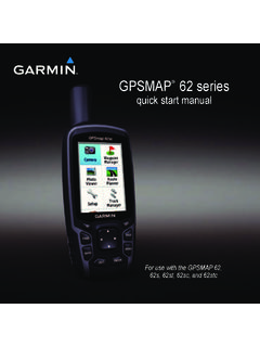
7 And Tracks to a Memory Built-In Maps to a Memory Up Data to a Backup Data to a System Information to a Memory Your the the Screenshots to a device will not acquire GPS device will not turn on or keeps turning device is not creating waypoints in the correct touchscreen is not responding to my 0183 2000 PGN License of ContentsiiiIntroduction WARNINGSee the Important Safety and Product Information guide in the product box for product warnings and other important 70 Series and GPSMAP 700 Series Power key Automatic backlight sensor Touchscreen microSD memory card slotsUsing the Touchscreen Tap the screen to select an item. Drag or swipe your finger across the screen to pan or scroll. Pinch two fingers together to zoom out. Spread two fingers apart to zoom the TouchscreenYou can lock the touchscreen to prevent inadvertent screen.
8 2 Select Lock 50 Series and GPSMAP 500 Series Automatic backlight sensor Power key Device keys microSD memory card slotsDevice KeysTurns on and off the device when the backlight and color mode when quickly pressed and out of a chart or in to a chart or view. Scrolls, highlights options, and moves the messages and selects to the previous the present location as a to the Home a menu of options for the page, when a menu, when the ManualsYou can get the latest owner 's Manual and translations of manuals from the to the on-screen instructions to download the Manual for your ConventionsIn this Manual , the term select is used to describe these actions. Touching an item on the screen (for touchscreen devices only). Using the arrow keys to highlight a menu item, and then pressing SELECT (for hard key devices only).
9 Pressing a key, such as SELECT or you are instructed to select multiple items in a series, small arrows appear in the text. For example, "select Menu > Add," indicates that you need to select the Menu item or hard key and then select the Add images in this Manual are for reference only and may not match your device More InformationIf you have any questions about your device, you can contact Garmin Product website, , offers many different troubleshooting tips to help resolve most issues and answer most questions. Frequently-asked questions (FAQs) Software updates owner 's and installation manuals Service alerts Video Contact numbers and addressesInserting Memory CardsYou can use optional memory cards in the chartplotter. Map cards allow you to view high-resolution satellite imagery and aerial reference photos of ports, harbors, marinas, and other points of interest.
10 You can use blank memory cards to record sonar data and transfer data such as waypoints, routes, and tracks to another compatible Garmin chartplotter or a the access flap or door on the front of the the memory the card in until it the UpdateYou may need to update the device software when you install the device or add an accessory to the the New Software on a Memory CardYou must copy the software update to a memory card using a computer that is running Windows : You can contact Garmin customer support to order a preloaded software update card if you do not have a computer with Windows a memory card into the card slot on the to Download next to the software bundle that corresponds with your and agree to the necessary, select necessary, select the drive associated with the memory card, and select Next > the New Software on a Memory Card1 Insert a memory card into the card slot on the to Download next to echoMAP Series with SD and agree to the the drive associated with the memory card, and select Next > the Device SoftwareBefore you can update the software, you must obtain a software-update memory card or load the latest software onto a memory on the the home screen appears, insert the memory card into the card.