Transcription of Table of Contents for Chapter 3 - TVA - Home
1 Chapter 3 Affected Environment SMI Final Environmental Impact Statement3-1 Table of Contents for Chapter .. Area Boundaries .. of Shoreline Development Data .. Shoreline Conditions .. Shoreline by Land Use or Allocation .. Shoreline by Land Use or Allocation .. Shoreline by Ownership Category .. Shoreline by Reservoir .. Subdivisions .. Shoreline Alterations .. Depth of Reservoir Shoreland .. Vegetation .. Vegetation Types .. Area and Tract Size .. Wildlife Populations .. Waterfowl Populations .. Wildlife Communities .. and Threatened Species .. of the Blue Ridge .. of the Valley and Ridge .. of the Cumberland Plateau .. of the Highland Rim .. of the Nashville Basin .. of the Coastal Plain .. Soil Erosion .. Bank Stability .. Mapping and Interpretation .. Analysis Zones and Acreage Calculations .. Functions and Values .. Trends .. Control .. Habitat .. Macroinvertebrates .. Communities.
2 And Existing Conditions .. Quality .. Enrichment .. Contamination .. Use of Shoreline ..3-37 Click on page number to go to that page. Use Find from the Tools menu to search for ContentsChapter 3 Affected Environment SMI Final Environmental Impact Visitation .. Activities Occurring Along the Shoreline .. Recreation .. Resources .. of the Gallup Poll, TVA Land Management and Use Study,January 1993 .. Public Scoping .. of the TVA Questionnaire, Viewing TennesseeValley Shoreline .. Conditions .. Resources .. Resources .. Structures .. and Employment .. Values .. Justice .. Navigation .. Aids (Including Safety Harbors and Landings) .. Navigation .. Navigation Aids ..3-53 Reminders:In each numbered section of the Chapter , the first mention of an alternative will be in bold A - Limited TVA Role Along Open Shoreline and Additional AreasAlternative B1 - Existing Guidelines Along Open Shoreline and Additional Areas (No Change/NoAction)
3 Alternative B2 - Existing Guidelines Along Open Shoreline OnlyAlternative C1 - Managed Development Along Open Shoreline and Additional AreasAlternative C2 - Managed Development Along Open Shoreline OnlyAlternative D - Minimum Disturbance Along Open Shoreline OnlyBlended Alternative - Maintain and Gain Public ShorelinePlease see the Glossary in Chapter 5 for the meaning of unfamiliar Categories on 10,995 Miles of TVA Reservoir Shoreline Flowage easement shoreland TVA-owned residential access shoreland TVA-owned-and-jointly-managed shoreland TVA-owned-and-managed shorelandChapter 3 Affected Environment SMI Final Environmental Impact Statement3-3 AFFECTED ENVIRONMENTCHAPTER 3 provides baseline information for understanding environmental and socioeconomic impactsassociated with SMI alternatives analyzed in Chapter 4, Environmental Consequences. More specifi-cally, this Chapter describes the setting and existing conditions of natural, social, and economicresources that would be affected by the SMI alternatives.
4 Resource issues to be discussed in detail are: Shoreline Vegetation Wildlife Endangered and Threatened Species Soils Wetlands Floodplains/Flood Control Aquatic Habitat Water Quality Recreational Use of Shoreline Aesthetic Resources Cultural Resources Socioeconomics NavigationChapter 3 also includes a description of the study area boundaries, an explanation on compilation ofshoreline mileage data, and a discussion of existing shoreline Area BoundariesThe study area boundaries used in Chapter 4, Environmental Consequences, are shown inFigure The boundary for direct effects is the area between winter pool elevation and themaximum shoreline contour or TVA backlying property line (whichever is farther from the shoreline).Indirect effects are measured on (1) adjacent private lands one-fourth mile from the maximum shorelinecontour or TVA backlying property line (approximately equal to the average depth of a subdivision),(2) the remainder of the reservoir area (both above and below the lake surface), and (3) countiesimmediately adjacent to the reservoirs.
5 However, the study area boundaries of some resources willvary, especially the boundaries associated with consideration of cumulative of Shoreline Development DataIn 1994 TVA s Land Management Offices conducted boat surveys of TVA reservoir shorelines anddelineated developed and undeveloped shoreline segments on topographic maps. Segments wereidentified as developed if shoreline structures such as docks and retaining walls were present. Ifvegetation disturbance also occurred, then the total extent of the disturbed area was marked asdeveloped. These field data maps were digitized using TVA s GIS, and miles of developed, undevel-oped, and total shoreline were computed for each Shoreline Shoreline by Land Use or AllocationAs the population and economy of the Tennessee Valley have grown, so have the pressures for theuse and development of land surrounding TVA reservoirs. As of 1994, development from all uses hadChapter 3 Affected Environment SMI Final Environmental Impact Statement3-4 Figure Study Area Boundaries of a Typical Impact AreaWinter Pool to MSC (Maximum ShorelineContour) or TVA Backlying Property LineOther FeaturesCounty BoundariesDamIndirect Impact Areas1/4 Mile from MSC or TVA BacklyingProperty LineCounties Adjacent to ReservoirWaterChapter 3 Affected Environment SMI Final Environmental Impact Statement3-5impacted about 17 percent (1,833 miles) of the 10,995 miles of reservoir shoreline ( Table ).
6 Residential access and associated development (including private docks, boathouses, retaining walls,and other related uses) is the dominant use (13 percent) along the shoreline. Developed recreation( , public facilities and commercial marinas) is a distant second (3 percent), followed by a very smallamount of industrial development and natural resource management (both less than 1 percent).Developed shoreline areas are subjected to various levels of vegetation management. These rangefrom little or no vegetation removal to extensive removal of native vegetation and, in some places,replacement with grass and nonnative plant species. In many instances, developed shorelines aremowed and maintained as an extension of adjoining residential Shoreline by Land Use or AllocationMost (83 percent) of the shoreline was undeveloped as of 1994 ( Table ). Anticipated use of themajority of this undeveloped land is for natural resource protection/management; it is notable, however,that 1 out of every 4 shoreline miles is designated as residential access ( , has outstanding landrights).
7 Table Miles of Developed and Undeveloped Shoreline by Land Use ofTotal , , , ofTotal , , Use and/orAllocationResidential AccessRecreationIndustrialNatural ResourceManagement/ProtectionTotalUndeve loped shoreline varies in land use/land cover from open grassland ( , pasture) to matureforest. With the exception of agricultural activities, these shorelands are relatively undisturbed. TVAhas designated some of these lands for natural area protection. In other cases, land has beentransferred to state and federal agencies for use as wildlife refuges/management Shoreline by Ownership CategoryThe number of miles of developed shoreline is listed by ownership category in Table (SeeChapter 1 for a detailed explanation of TVA landrights and shoreline ownership patterns.) Thesecategories are briefly defined as: Flowage easement shoreland: privately owned lakeshore properties where TVA has the right toflood the land as part of its reservoir operations.
8 TVA-owned residential access shoreland: TVA-owned land where adjoining private propertyowners have access rights across TVA land. TVA-owned-and-jointly-managed shoreland: TVA-owned property that adjoins lands sold, trans-ferred, or otherwise conveyed to developers, entrepreneurs, or local, state, or federal agencies forcommercial recreation, public recreation, industrial development, or resource management. TVA-owned-and-managed shoreland: TVA-owned land where there are no outstanding accessrights potentially affecting its future 3 Affected Environment SMI Final Environmental Impact Statement3-6% of TotalShoreline , , , , , , Miles of Developed and Total Shoreline by Ownership of OwnershipCategory CategoryFlowage EasementShorelandTVA-OwnedResidential AccessShorelandTVA-Owned-and-Jointly-Man agedShorelandTVA-Owned-and-Managed ShorelandTotal (or Percent)The proportion of total shoreline currently developed under flowage easement is only slightly lessthan that of residential access shoreland (6 percent and 7 percent, respectively).
9 However, becausethere are fewer miles of residential access shoreland, this category shows a higher rate of develop-ment (40 percent) than for flowage easement (28 percent). Most of the undeveloped shoreline isjointly managed or owned and managed by TVA. These two ownership categories are primarily underpublic ownership and control and/or have no outstanding access rights and, therefore, are not ashighly developed. See tables in Appendix I for the number of developed and undeveloped miles byreservoir and Shoreline by ReservoirThe amount of total development varies greatly between reservoirs. Three reservoirs (Boone, FortLoudoun, and Wilson) are more than 50 percent developed ( Table ). Conversely, eight reservoirs(Apalachia, Bear Creek Project, Hiwassee, Kentucky, Normandy, Ocoee Project, Tellico, and Wheeler)are less than 10 percent developed. Fort Loudoun has the greatest number of developed shorelinemiles (199), followed by Guntersville (171), Kentucky (168), and Watts Bar (159).
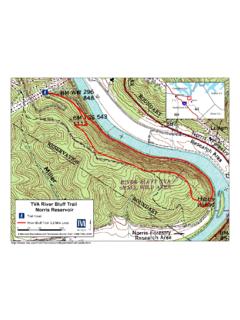
10 With a few excep-tions, the proportion of residential shoreline development tracks closely with total has occurred on approximately one-third of shoreland currently available for residentialaccess ( , flowage easement and TVA-owned residential access). More than 75 percent of shore-land with residential access rights has been developed on two reservoirs (Guntersville and TimsFord). Eight other reservoirs (Blue Ridge, Boone, Chatuge, Fort Loudoun, Fort Patrick Henry,Hiwassee, Pickwick, and Wilson) exceed 50 SubdivisionsIn 1995, subdivisions with lakefront property were randomly sampled to further characterize existingshoreline development. Data on the frequency, types, and dimensions of subdivision lots werecollected from 684 subdivision plats. These data were then expanded to give estimates for all 1,443reservoir subdivisions (Tables and ). Shoreline AlterationsDevelopment can also be characterized by the number, density, and kinds of residential shorelinealterations along the shoreline ( Table ).


![MISSISSIPPI [TABLE OF CONTENTS FOR CHAPTER 1: GENERAL]](/cache/preview/8/6/7/c/2/3/f/c/thumb-867c23fc8844610ce92dcaf0d67646c3.jpg)